5mm here overnight, making 20.5mm for the system and 55mm mtd. Well short of our June average of 81mm so we're unlikely to get there, but still a long way ahead of ytd average.
Great to see those SE Tas totals!

Welcome New Members! We want to hear from you. Register, stop lurking and start posting!
Winter Solstice being marked with a BANG
- Dane
- Supercell
- Reactions:
- Posts: 1661
- Joined: Thu Nov 26, 2009 9:51 am
- Location: Sebastopol 420m ASL
- Contact:
Re: Winter Solstice being marked with a BANG
9mm's up to 9am here - system total now 28.5mm's MTD 61.9mm's.
Ballarat Airport had 6mm's overnight - system total 17.6mm's MTD 38.6mm's
Long Term Average at BAP is 62.5mm's
Ballarat Airport had 6mm's overnight - system total 17.6mm's MTD 38.6mm's
Long Term Average at BAP is 62.5mm's
-
hillybilly

- Site Admin/Moderator
- Reactions:
- Posts: 5007
- Joined: Thu Nov 26, 2009 7:26 am
- Location: Howden Tasmania, 25m above sea level
- Contact:
Re: Winter Solstice being marked with a BANG
A cold, foggy spitty day up here in the Nongs with another 0.6mm of rain.
Good to see Gippsland getting showers tonight as part of the final act for this low. Seriously dry month out there so far, so they need it.
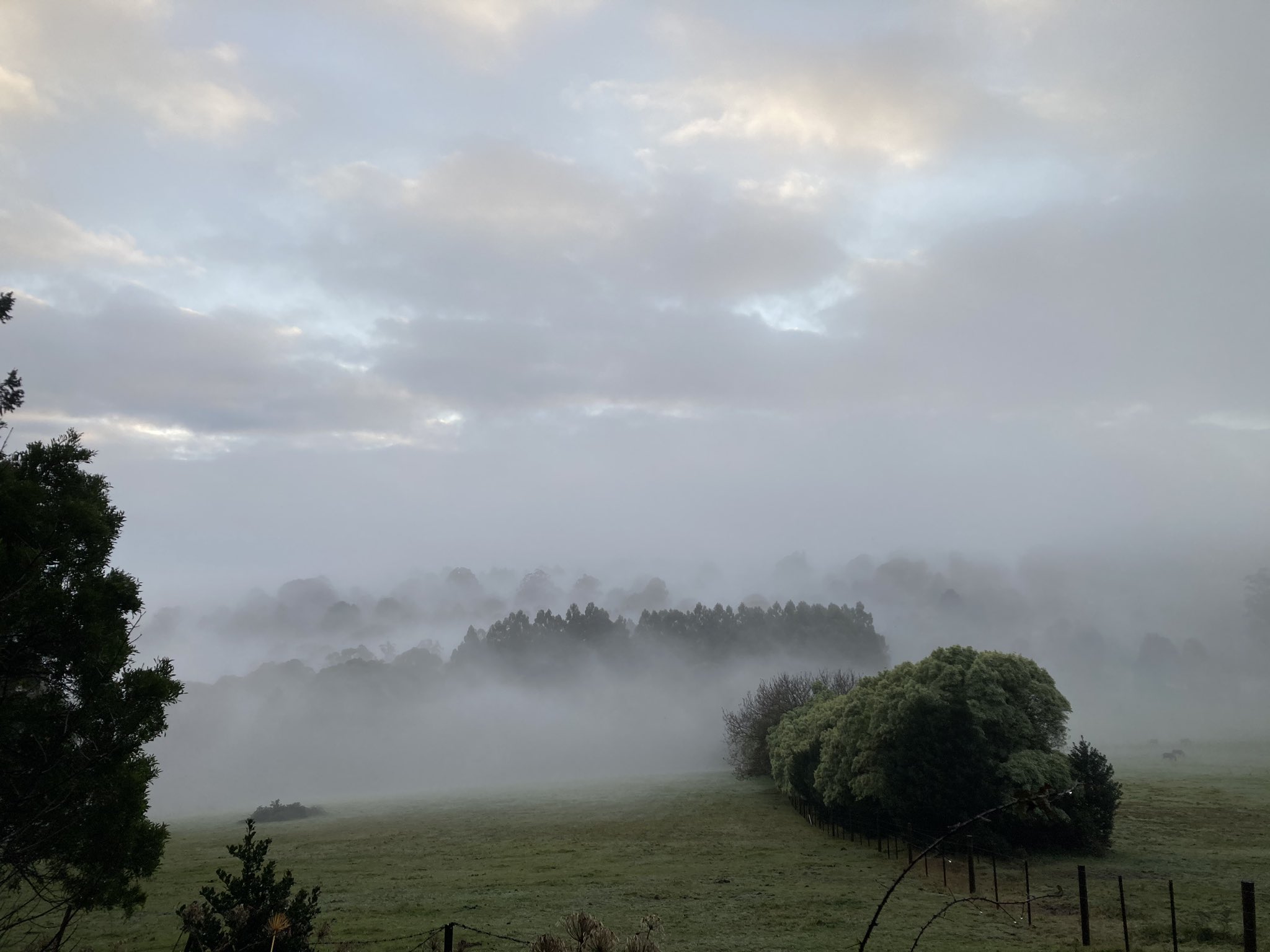
BTW here’s a photo from walking the dog this morning. Got myself a new iPhone which takes cracking photos and the weather has obliged this past week
Good to see Gippsland getting showers tonight as part of the final act for this low. Seriously dry month out there so far, so they need it.
BTW here’s a photo from walking the dog this morning. Got myself a new iPhone which takes cracking photos and the weather has obliged this past week
- StratoBendigo
- Supercell
- Reactions:
- Posts: 2818
- Joined: Fri Jan 02, 2015 2:18 pm
- Location: Kangaroo Flat
Re: Winter Solstice being marked with a BANG
Rather warm here yesterday and today. What happened to winter?
- Tassiedave
- Supercell
- Reactions:
- Posts: 1101
- Joined: Thu Nov 11, 2010 11:09 am
- Location: Grindelwald Tasmania
Re: Winter Solstice being marked with a BANG
Tas rain since 9am: Lewis Hill 40mm, Mt Victoria 37mm, Gray 35mm, Deddington 28mm, Fingal 24mm, Hobart 3.2 mm, Launceston 0.4mm. Kunanyi/Mt Wellington. Another 96.6mm for Kunanyi/Mt Wellington. Three day total is 316mm!!
-
hillybilly
- Site Admin/Moderator
- Reactions:
- Posts: 5007
- Joined: Thu Nov 26, 2009 7:26 am
- Location: Howden Tasmania, 25m above sea level
- Contact:
Re: Winter Solstice being marked with a BANG
Same in the Nongs. This is not a particularly cold system, and the cold air is now being replaced by mild Tasman Sea air. There is a bit of a front for Thursday which will usher in a bit cooler air, but our "non-winter" continues. With such a warm globe and warm Indian Ocean we shouldn't be too surprised.StratoBendigo wrote: ↑Wed Jun 24, 2020 7:24 am Rather warm here yesterday and today. What happened to winter?
We scored 2.2mm to 9am. MTD about 110mm so comfortably ahead of the average. We've done well in the Nongs with a couple of healthy drizzle events which didn't really deliver on the flats.
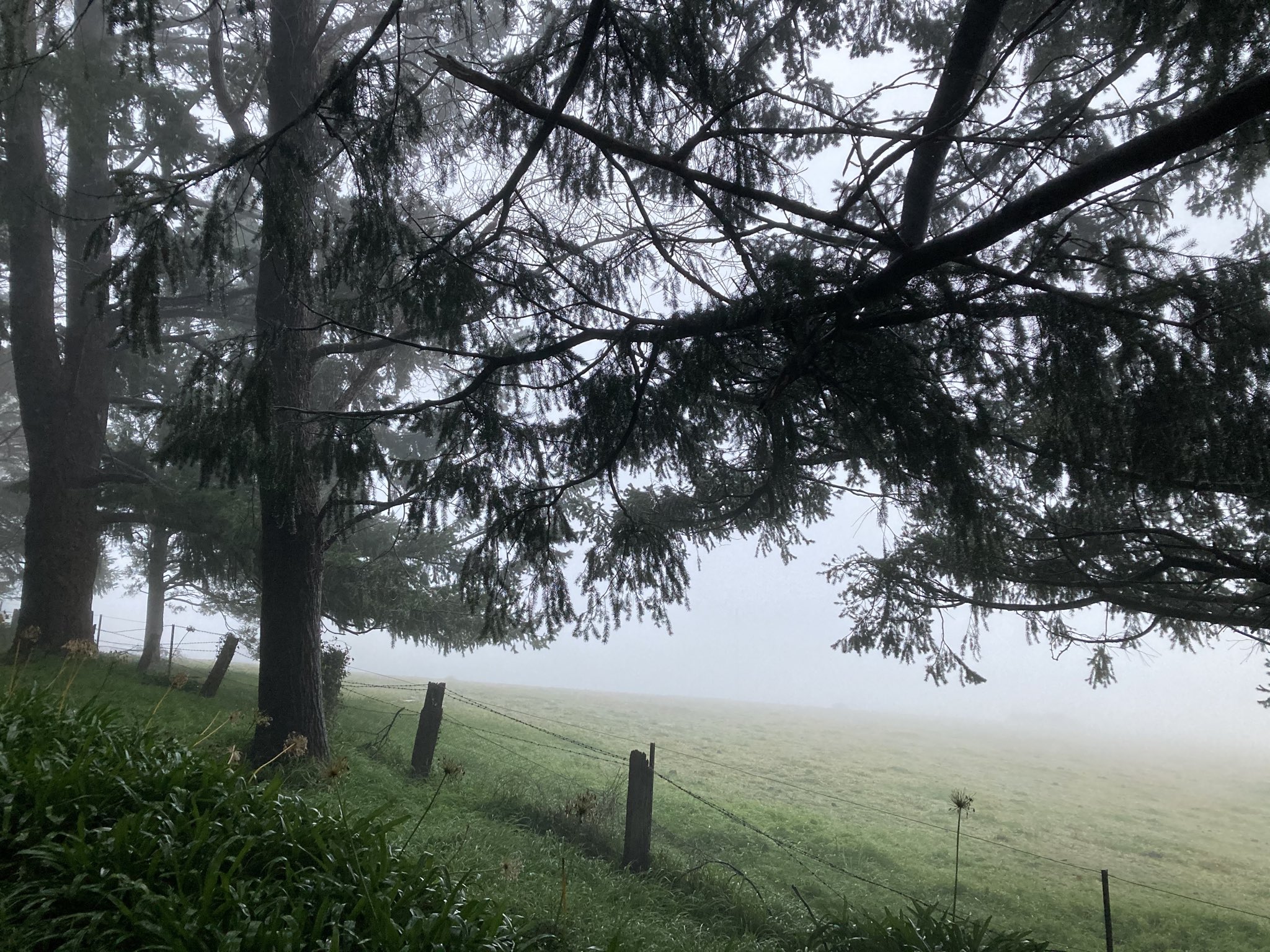
Here's a photo from today's dog walk. Got quite wet with drizzle and fog.
Still one more sneaky part to this system with a front squeezing in ahead of the approaching high as the low gets absorbed back into the westerlies.
- QldTwister
- Cumulonimbus
- Reactions:
- Posts: 434
- Joined: Tue May 22, 2012 7:56 pm
- Location: Ashwood Vic
Re: Winter Solstice being marked with a BANG
Only 6mm here for the whole event and many missing out with only local good falls across much of the state and a dryish week to 10 days ahead
Amazing falls in Tas over 300mm at Mount Wellington very welcome and needed im sure and much of E Tas did well
After great rains in April Much of the inland hasnt dont to well in May or June with well below avg rainfall and July could follow that same story lets hope not
Amazing falls in Tas over 300mm at Mount Wellington very welcome and needed im sure and much of E Tas did well
After great rains in April Much of the inland hasnt dont to well in May or June with well below avg rainfall and July could follow that same story lets hope not
Bring on the heat and stroms
- Tassiedave
- Supercell
- Reactions:
- Posts: 1101
- Joined: Thu Nov 11, 2010 11:09 am
- Location: Grindelwald Tasmania
Re: Winter Solstice being marked with a BANG
Tas temps today: Devonport 17.4, Wynyard 17.1, Cape Sorell 17.1, Strahan 16.5, Launceston 16.4, Scottsdale 16.3, Hobart 12.4
- Tassiedave
- Supercell
- Reactions:
- Posts: 1101
- Joined: Thu Nov 11, 2010 11:09 am
- Location: Grindelwald Tasmania
Re: Winter Solstice being marked with a BANG
Rain in Tas since 9am: Gray 36mm, Mt Victoria 14mm, Triabunna 7.6mm, St Helens 6.2mm, Wynyard 3.2mm, Hobart 2mm
- flyfisher
- Cumulonimbus
- Reactions:
- Posts: 250
- Joined: Wed Jul 18, 2012 1:39 pm
- Location: Belgrave
- Contact:
Re: Winter Solstice being marked with a BANG
Looks like the SAM is going negative. Not reflected in the charts yet but hope that changes. Of course even with a negative SAM we can still get unlucky on where the LWT positions it'self.
- Sean
- Supercell
- Reactions:
- Posts: 1000
- Joined: Mon Feb 27, 2012 6:35 pm
- Location: Patterson Lakes - SE Melb
Re: Winter Solstice being marked with a BANG
Yes, which will hopefully mean we get some interesting weather towards mid July and into August.
Been a boring old month, but June often is.
-
hillybilly
- Site Admin/Moderator
- Reactions:
- Posts: 5007
- Joined: Thu Nov 26, 2009 7:26 am
- Location: Howden Tasmania, 25m above sea level
- Contact:
Re: Winter Solstice being marked with a BANG
Apparently the 3 day rainfall at Mt Wellington is a new all months record. At least that is what I've seen reported  Amazing warm rain system for them.
We've turned on another 24 hours of fog and showers up here. 0.4mm in the gauge this morning and closing in on 2mm for today. Some of the showers today have been surprisingly heavy. There is a decent shot of cold air coming with this front, but it turns anticyclonic quickly so will not be much of a rain or snow producer.
We've turned on another 24 hours of fog and showers up here. 0.4mm in the gauge this morning and closing in on 2mm for today. Some of the showers today have been surprisingly heavy. There is a decent shot of cold air coming with this front, but it turns anticyclonic quickly so will not be much of a rain or snow producer.
- Sean
- Supercell
- Reactions:
- Posts: 1000
- Joined: Mon Feb 27, 2012 6:35 pm
- Location: Patterson Lakes - SE Melb
Re: Winter Solstice being marked with a BANG
This narrow little band pushing through now is bearing some heavy rainfall rates. Seemed to come out of nowhere
-
hillybilly
- Site Admin/Moderator
- Reactions:
- Posts: 5007
- Joined: Thu Nov 26, 2009 7:26 am
- Location: Howden Tasmania, 25m above sea level
- Contact:
Re: Winter Solstice being marked with a BANG
3.6mm in the gauge this morning. Was clear and cold when I got up, but drizzle has pushed in the last 30 minutes. This event is nearly done, and the next high will be overhead tonight. Should make for cold mornings on Saturday and Sunday.
Guess new thread time. Next week is throwing up a more classical frontal sequence from about Wednesday or Thursday. Not overly cold (again ) but reasonably wintery. The ski resorts are starting to look pretty ordinary as we approach July
Guess new thread time. Next week is throwing up a more classical frontal sequence from about Wednesday or Thursday. Not overly cold (again
- StratoBendigo
- Supercell
- Reactions:
- Posts: 2818
- Joined: Fri Jan 02, 2015 2:18 pm
- Location: Kangaroo Flat
Re: Winter Solstice being marked with a BANG
0 degC and a frost here this morning. Back to winter!
While it's been a lean June for our ski resorts, Chile in South America has been having huge snowfalls. Tends to happen with MJO stalled in phase 1&2.
While it's been a lean June for our ski resorts, Chile in South America has been having huge snowfalls. Tends to happen with MJO stalled in phase 1&2.
-
Didjman

- Supercell
- Reactions:
- Posts: 2100
- Joined: Fri Sep 03, 2010 2:52 pm
- Location: Wallan, Vic 328m ASL
- Contact:
Re: Winter Solstice being marked with a BANG
What causes the MJO to stall??
- Sean
- Supercell
- Reactions:
- Posts: 1000
- Joined: Mon Feb 27, 2012 6:35 pm
- Location: Patterson Lakes - SE Melb
Re: Winter Solstice being marked with a BANG
7-day synoptics looking far more dynamic than what we've seen so far this winter. Expect more activity if this is, indeed, a breakdown in the current pattern given the relatively warm waters
- stevco123
- Supercell
- Reactions:
- Posts: 2937
- Joined: Sat Aug 07, 2010 7:42 pm
- Location: Cranbourne 78m asl
Re: Winter Solstice being marked with a BANG
I've been saying it all along... June is a boring month
All the main winter action is late july to late September. Nearly nothing happens before the solstice
https://www.weatherlink.com/bulletin/53 ... 76dd68e8bc: for current weather updated every 2 minutes
-
hillybilly
- Site Admin/Moderator
- Reactions:
- Posts: 5007
- Joined: Thu Nov 26, 2009 7:26 am
- Location: Howden Tasmania, 25m above sea level
- Contact:
Re: Winter Solstice being marked with a BANG
Nice winters day here. Morning fog and drizzle and afternoon sun. 3.9 to 7.6C so cold but sun was very nice.
Next week looks half decent.
Next week looks half decent.
- Tassiedave
- Supercell
- Reactions:
- Posts: 1101
- Joined: Thu Nov 11, 2010 11:09 am
- Location: Grindelwald Tasmania
Re: Winter Solstice being marked with a BANG
Cressy in northern Tasmania had a record low maximum today with 3.4 degrees with records going back to 1960. Launceston 30 minutes drive away was 12 degrees. Cressy was shrouded in fog all day after a frosty night.