
Welcome New Members! We want to hear from you. Register, stop lurking and start posting!
Meso's Photo's and chase reports

Re: Meso's Photo's
#5 and #7 are single image HDR's and #11 is a 3 image (2 stops each way) HDR. The rest are just photoshop editing jobs (levels, curves, sharpness, etc.). I've been trying to avoid the fake cartoony look whenever I use HDR now and just use it more as a post processing tool to add some life to the photo.
- Hamlan
- Storm Chaser
- Reactions:
- Posts: 449
- Joined: Tue Dec 22, 2009 11:05 pm
- Location: Northern suburbs
Re: Meso's Photo's
hehe, I have a keen eye for HDR work and totally agree on avoiding the fake cartoon look so well done. Yours have the effect of gaining attention because they look great - not fake and thats how I like HDR.Meso wrote:#5 and #7 are single image HDR's and #11 is a 3 image (2 stops each way) HDR. The rest are just photoshop editing jobs (levels, curves, sharpness, etc.). I've been trying to avoid the fake cartoony look whenever I use HDR now and just use it more as a post processing tool to add some life to the photo.
- GregSorenson2
- Cumulus
- Reactions:
- Posts: 68
- Joined: Thu Sep 16, 2010 11:08 pm
Re: Meso's Photo's
greta shots Meso, and lovely locations too:) I'm not a super fan of HDR's, but they do have their place.
Re: Meso's Photo's
North Central Vic Thunderstorms - October 12th 2010
First cell I caught was near Maryborough, had a massive rain/hail curtain on it and I didn't follow the cell too long. You can see a tinge of green in the first photo so I suspect their may have been some hail in there somewhere. As you can see from the photos it was really dumping!
After taking a few photos of the Maryborough cell, I quickly checked the radar and decided to head towards a cell coming down past Birchip. After driving for 10 mins or so I realised the GPS was taking me through St Arnaud way, which is a terrible area for chasing with all the trees. So, I thought better of it and turned around and headed back towards Bendigo, basically with the attitude of "Whatever happens, happens, if I see something, great, otherwise, oh well..." I think I should take this attitude more often as I spotted a nice cell as I was coming through Bridgewater heading SE to Bendigo.
Managed to stay in front of it from Bridgewater to Marong, whilst periodically stopping to take a few shots...
Somewhere near Marong after darting around trying to get a better view I was smashed by the core and basically had to drive 40-50km/h back to Eaglehawk due to whiteout conditions and strong winds sending branches all over the road.
Emerged from the core between Eaglehawk and Golden Square in Bendigo and managed to get another view on it before following it to my front door step...
Some nice low scud getting sucked in to the storm in this first shot...
Gave up on it after that and went and had some dinner. All in all a most enjoyable chase, with no long trip home afterwards, which was a bonus
Re: Meso's Photo's and chase reports
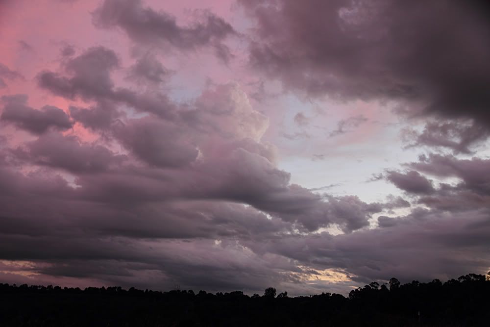
Got bored and went for a drive on sunset tonight to see if I could find anything interesting to photograph as the sun was going down.
This old shapely tree was about the best I could do...
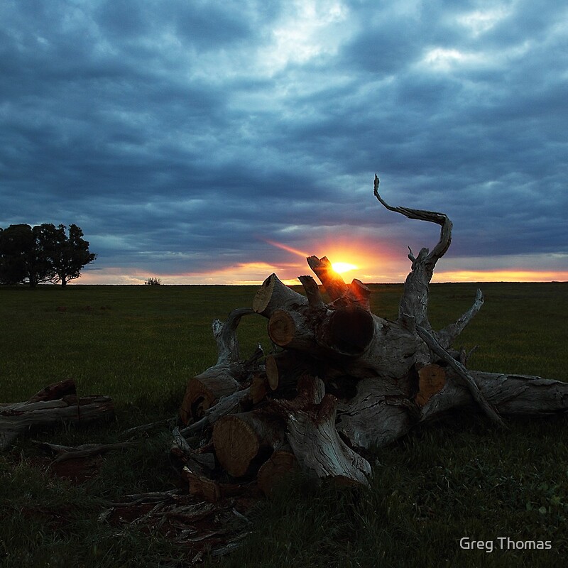
This old shapely tree was about the best I could do...
- Hamlan
- Storm Chaser
- Reactions:
- Posts: 449
- Joined: Tue Dec 22, 2009 11:05 pm
- Location: Northern suburbs
Re: Meso's Photo's and chase reports
Gee Greg if that was all you could muster on sunset you've done well! nice colours and flares and the tree reminds of a bulls horn.
Re: Meso's Photo's and chase reports
North Central Vic Thunderstorms - November 25th 2010
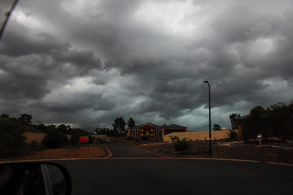
Pics from a quick chase around the industrial areas of Bendigo (Strathdale area)...
First couple from the backyard of some nice towers...
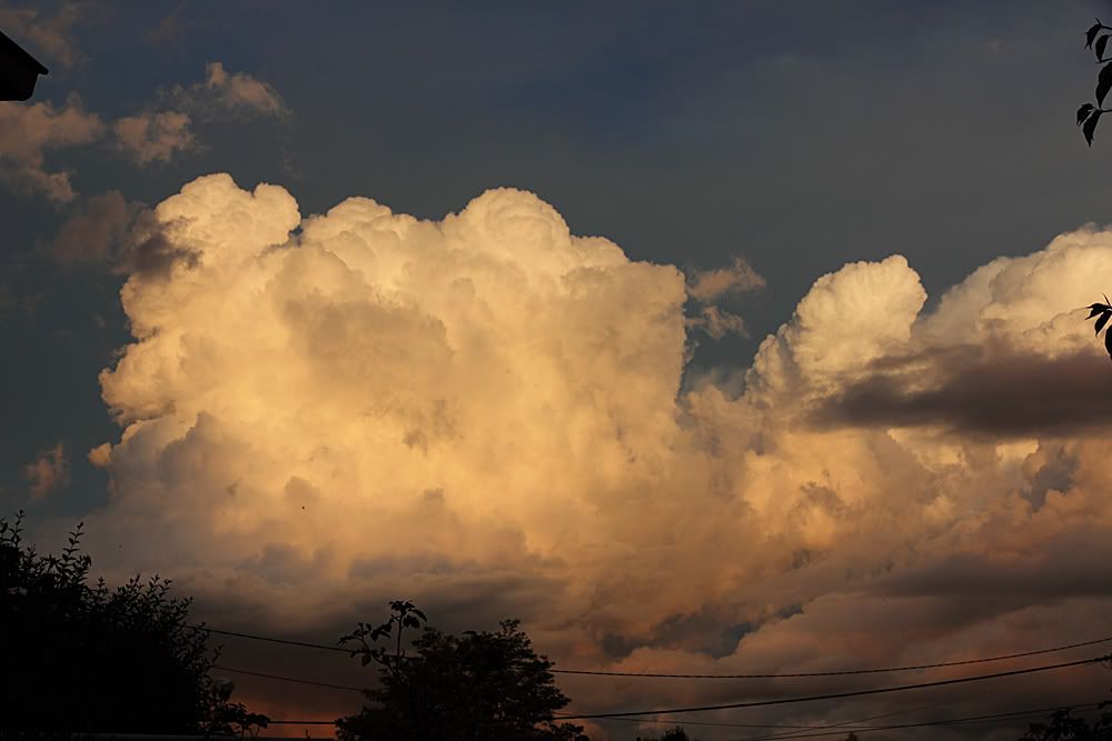
This was enough evidence to convince me to go for a drive to see what was happening. Whilst this wasn't some incredible severe storm or anything, there certainly was some nice structure and ground hugging cloud around that made the chase, albeit a short one, quite enjoyable.
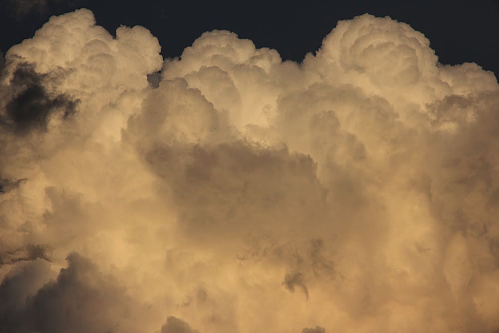
Nice tower lit up by the evening sun...
Light was gone by this point, so I headed home. Caught a few flashes while I was walking the dog, which was a nice bonus.
Pics from a quick chase around the industrial areas of Bendigo (Strathdale area)...
First couple from the backyard of some nice towers...
This was enough evidence to convince me to go for a drive to see what was happening. Whilst this wasn't some incredible severe storm or anything, there certainly was some nice structure and ground hugging cloud around that made the chase, albeit a short one, quite enjoyable.
Nice tower lit up by the evening sun...
Light was gone by this point, so I headed home. Caught a few flashes while I was walking the dog, which was a nice bonus.
Re: Meso's Photo's and chase reports
North Central Vic Thunderstorms - November 26th 2010
First few are around the Rushworth area. Mainly just convection, distance cells and anvils. Excuse the splatterings on the windscreen in one of the shots. Damn locusts were out in great numbers yesterday!
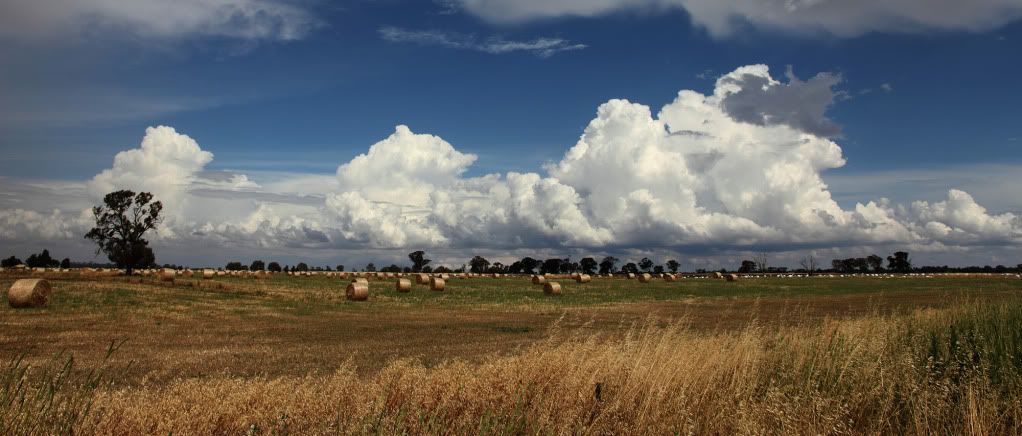
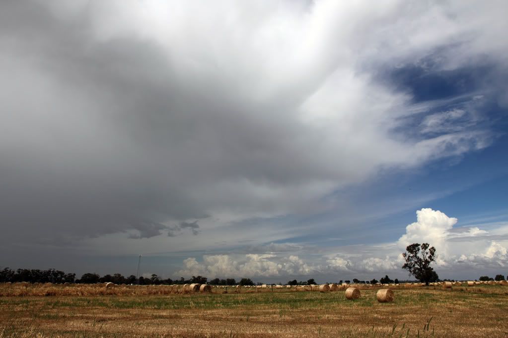
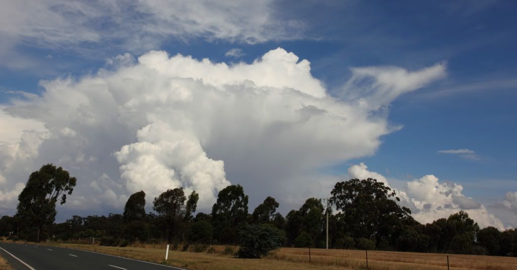
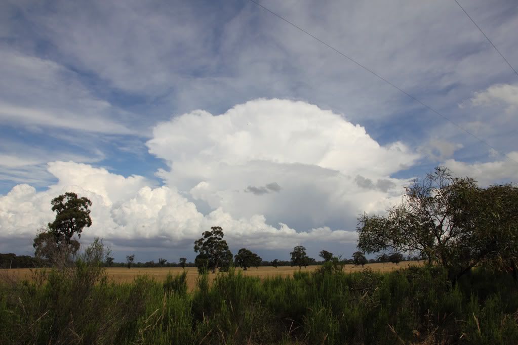
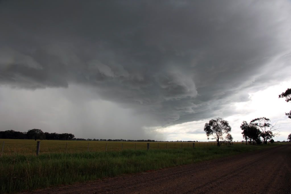
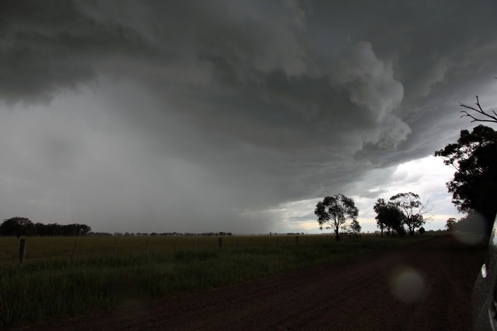
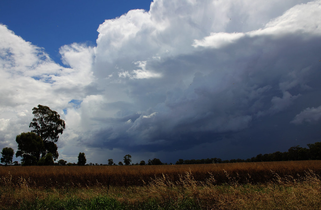
Then the storm I intercepted later that evening just outside Marong heading north towards Bridgewater...
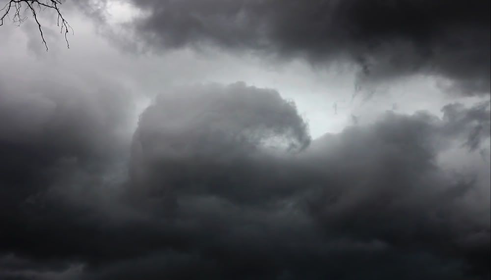
First shot is of a weird dome like cloud with striations looking back to the east, dunno what caused it?
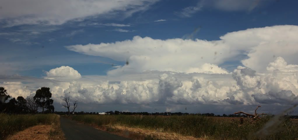
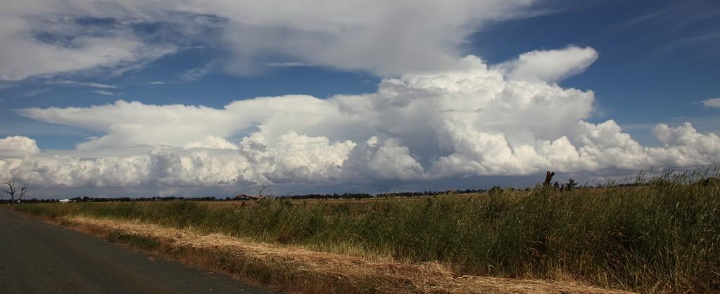
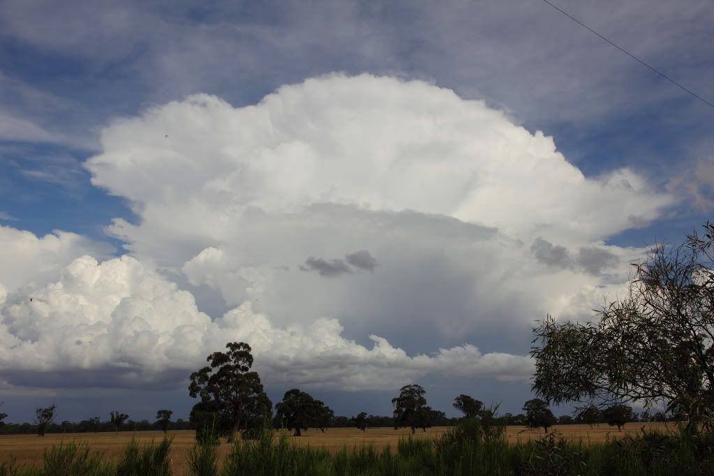
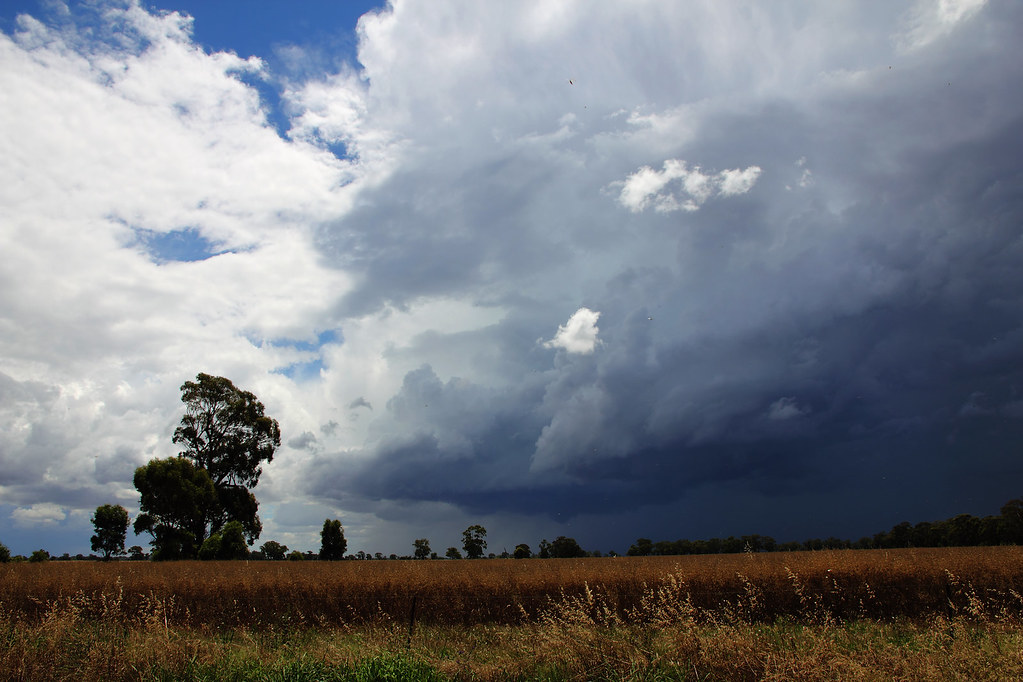
Next few as the main course arrived. Was a joy to watch as we'd positioned ourselves perfectly for a change and could just sit back and watch as the structure of the storm slowly revealed itself. The waves in the mid levels clouds were very nice too...bordering on mammatus, but not quite.
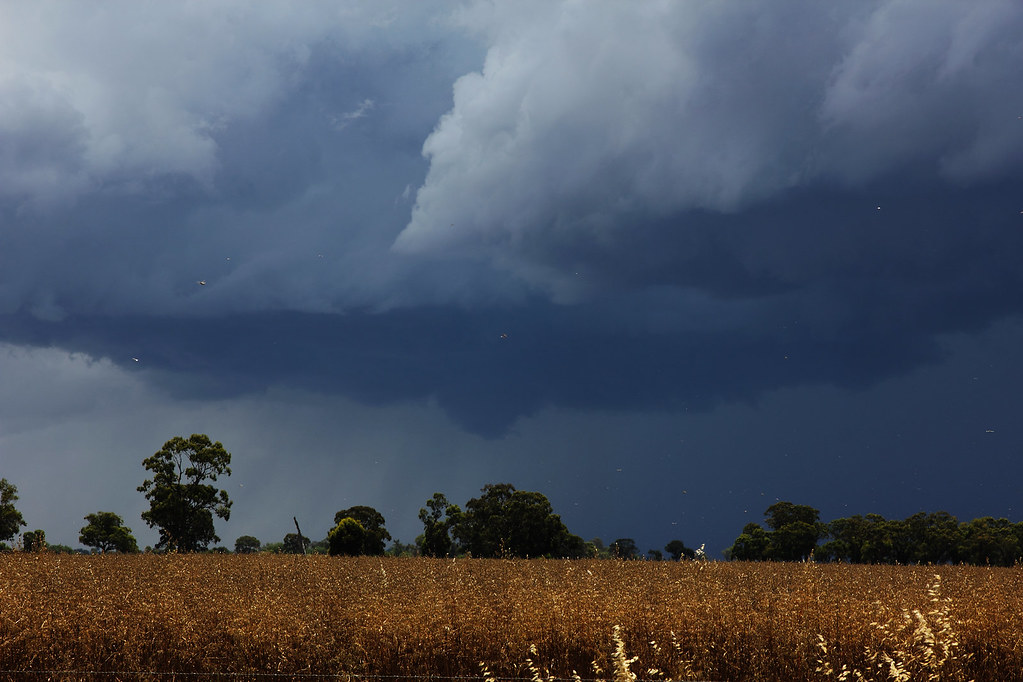
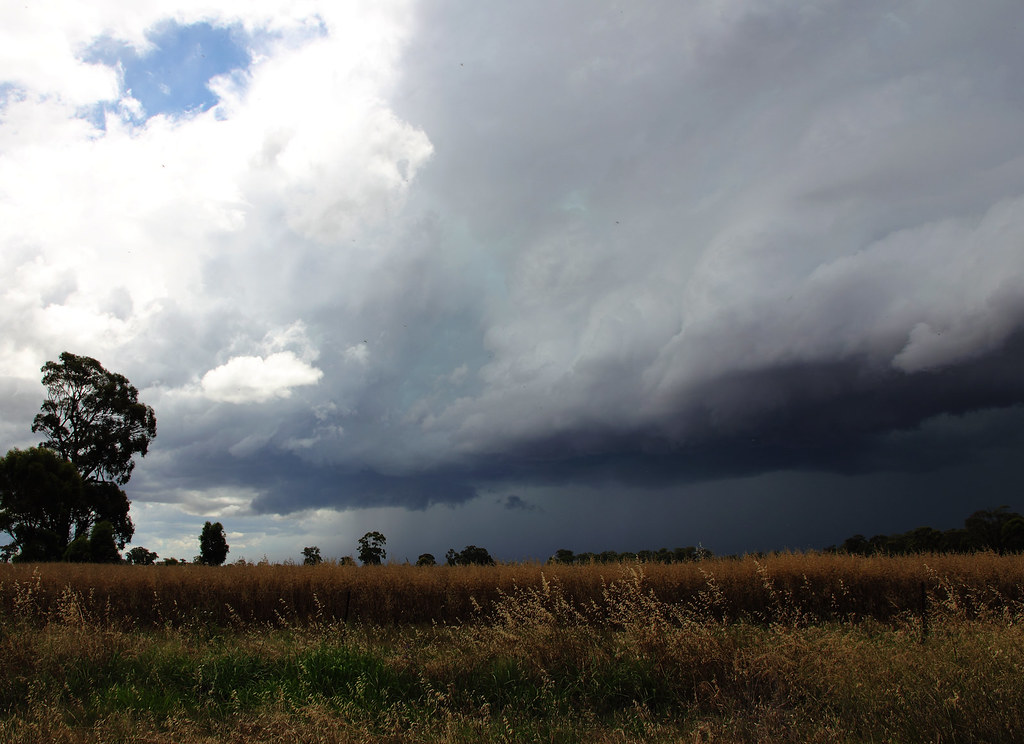
After a good 30-40 mins the storm had finally made it to where we were located and it all got a little messy...
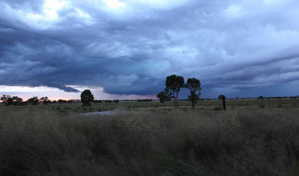
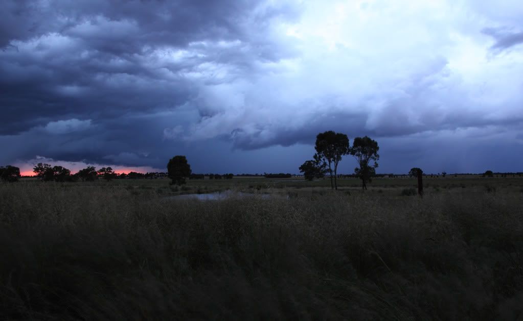
So in the end, a very nice storm to watch roll in across the open paddocks. I will definitely be marking the location down for future reference. Shot some video too which I'll try find the time to edit together and post here.
First few are around the Rushworth area. Mainly just convection, distance cells and anvils. Excuse the splatterings on the windscreen in one of the shots. Damn locusts were out in great numbers yesterday!
Then the storm I intercepted later that evening just outside Marong heading north towards Bridgewater...
First shot is of a weird dome like cloud with striations looking back to the east, dunno what caused it?
Next few as the main course arrived. Was a joy to watch as we'd positioned ourselves perfectly for a change and could just sit back and watch as the structure of the storm slowly revealed itself. The waves in the mid levels clouds were very nice too...bordering on mammatus, but not quite.
After a good 30-40 mins the storm had finally made it to where we were located and it all got a little messy...
So in the end, a very nice storm to watch roll in across the open paddocks. I will definitely be marking the location down for future reference. Shot some video too which I'll try find the time to edit together and post here.
- rikjpool
- Storm Chaser
- Reactions:
- Posts: 989
- Joined: Thu Nov 26, 2009 1:46 pm
- Location: Home: North Bendigo-just behind Lake Weeroona, Vic. Work: 1.5Km SE from Bendigo AWS
Re: Meso's Photo's and chase reports
This one is a winner mate! Up there with the best, and certainly worthy of any competition if you were to enter one.
I live in a world where I dont see to believe, but I believe to see...
- Lily
- Supercell
- Reactions:
- Posts: 4014
- Joined: Wed Nov 25, 2009 10:29 pm
- Location: Rowville/Lysterfield
Re: Meso's Photo's and chase reports
Meso, I commented in the BW thread, but wanted to reiterate that I think this photo is just beautiful, I love it. Well done once again, great stuff 
Re: Meso's Photo's and chase reports
Thanks Rik, lily
I will be struggling to top that one for the rest of the season I think.
I will be struggling to top that one for the rest of the season I think.
Re: Meso's Photo's and chase reports
Northern Vic Thunderstorms - December 2nd 2010
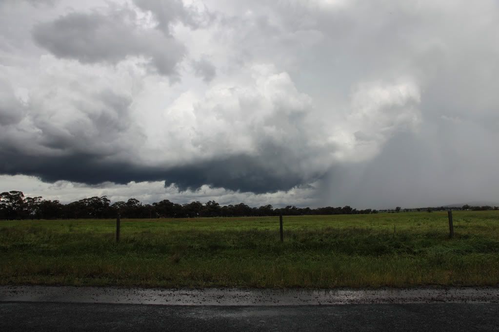
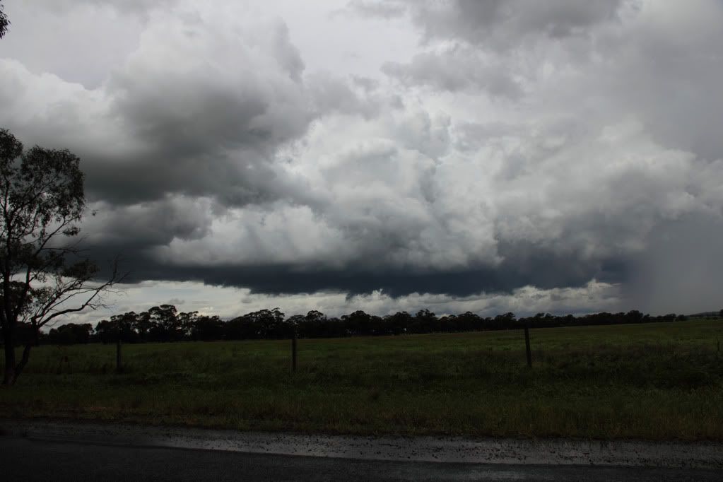
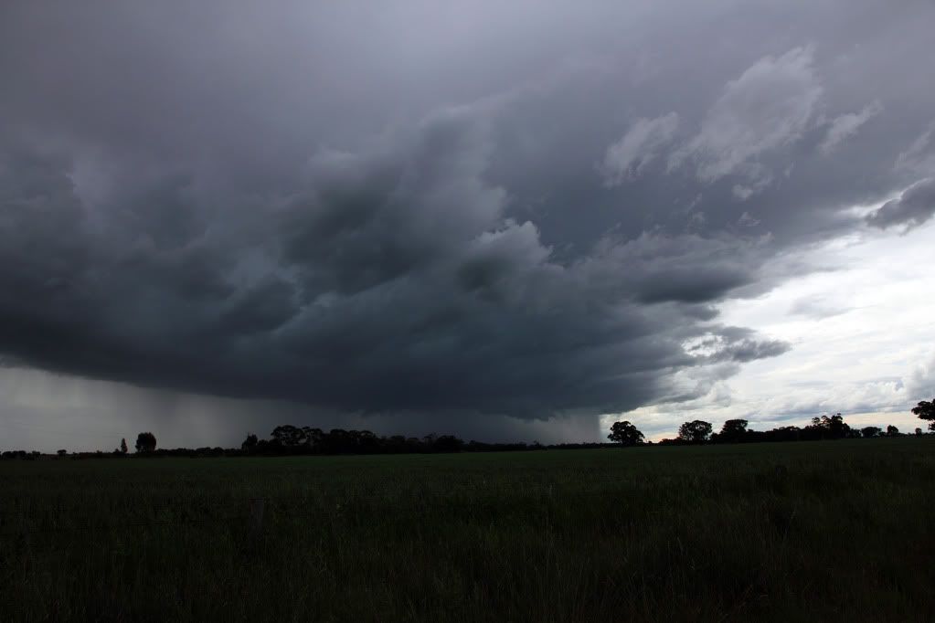
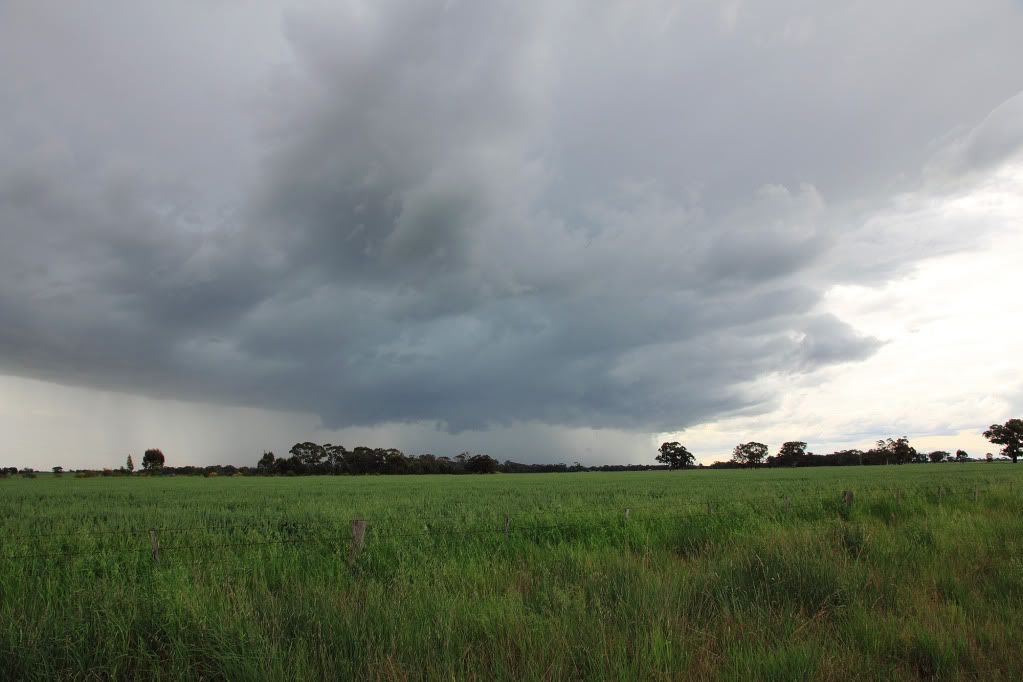
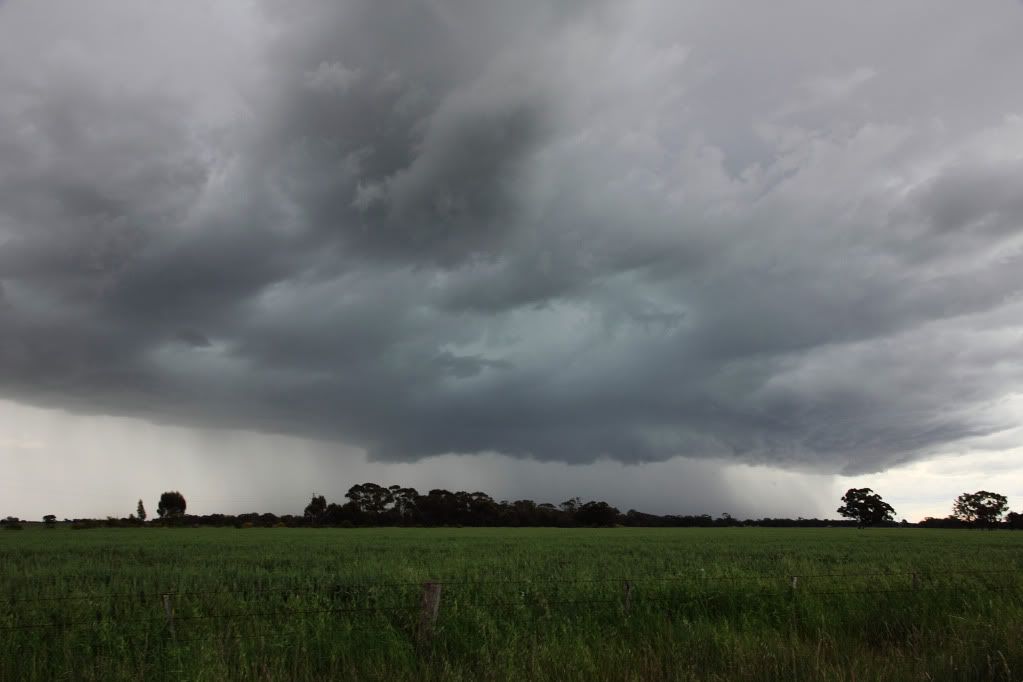
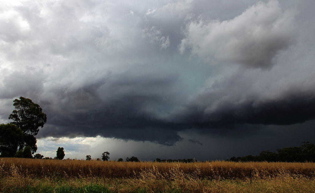
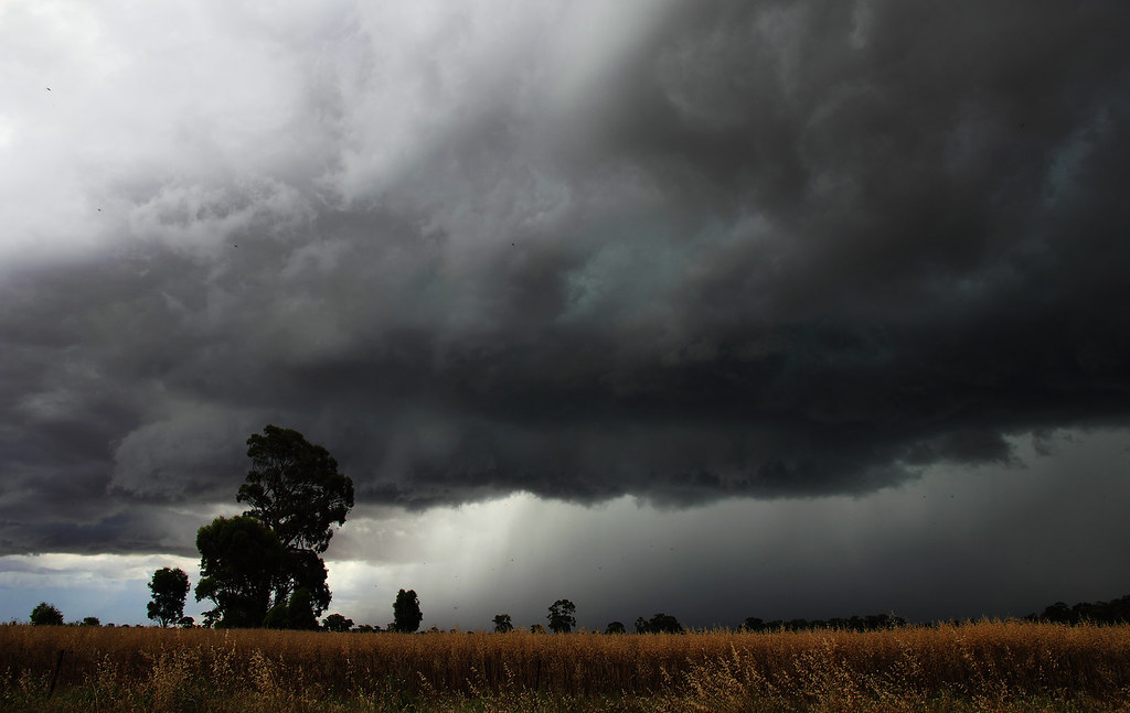
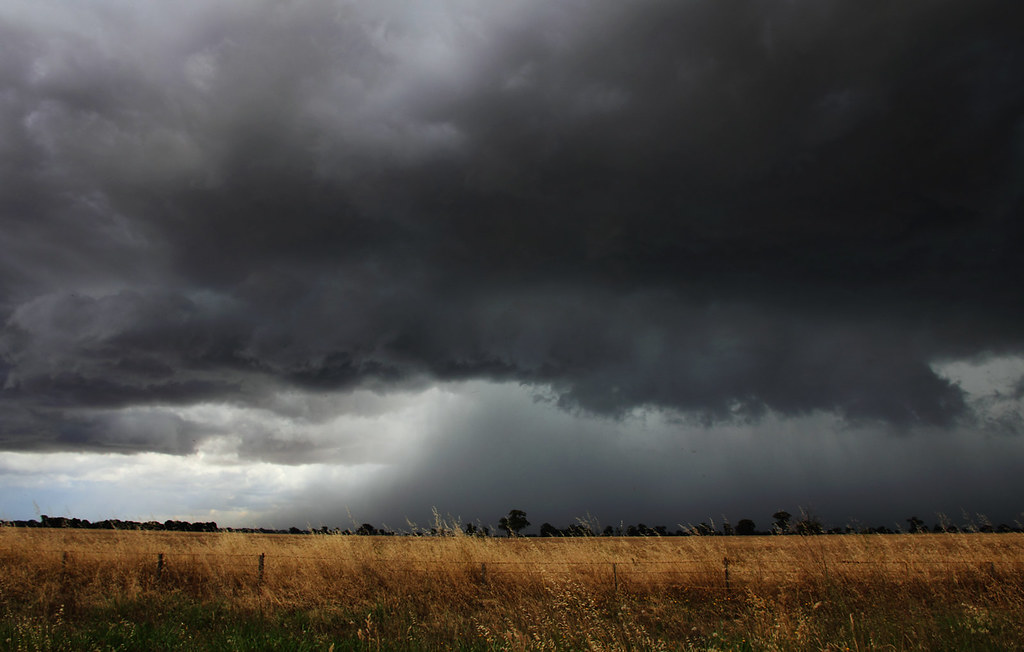
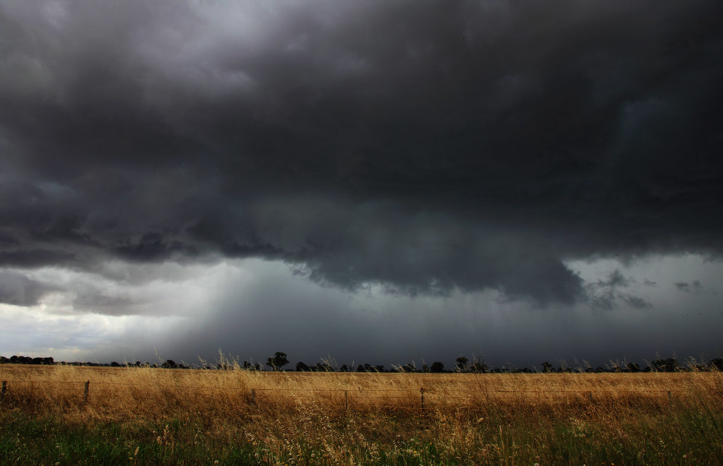
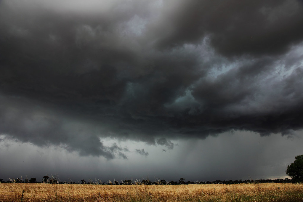
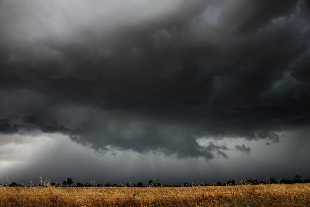
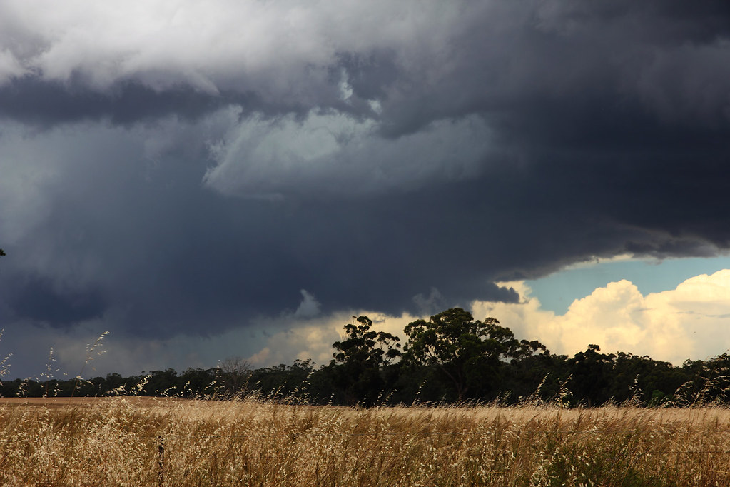
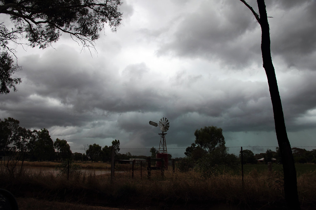
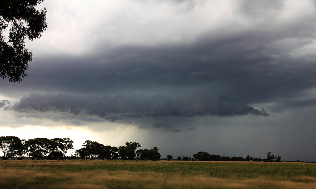
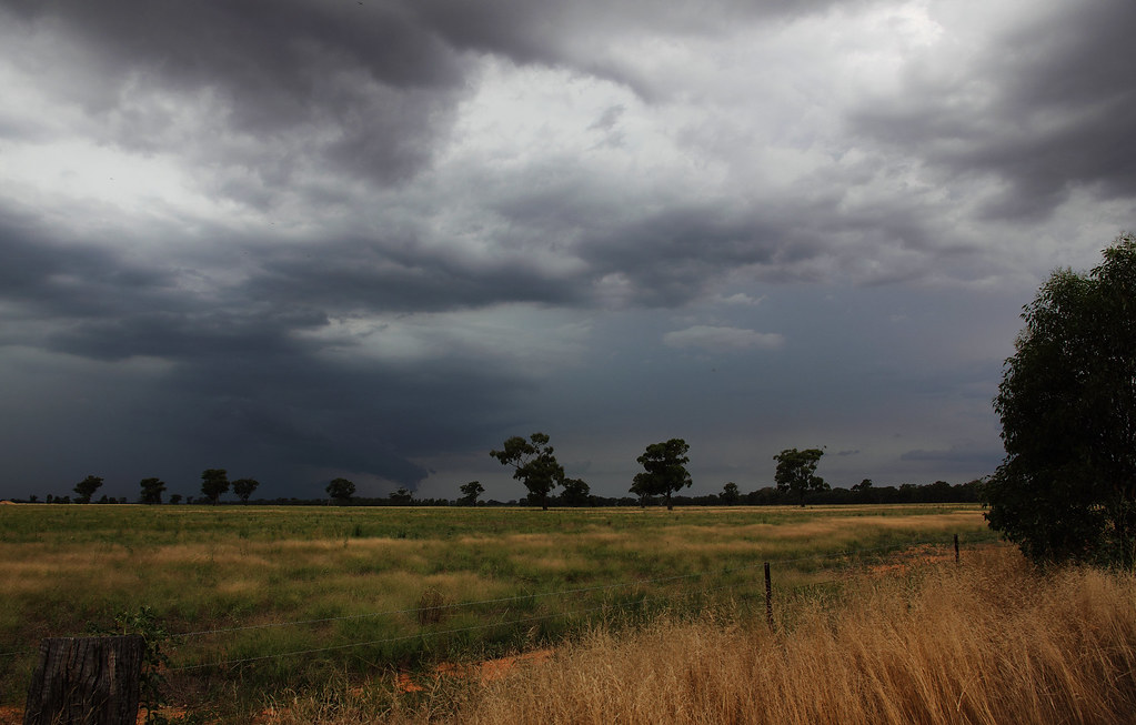
First few from the storm that originated out of NSW in the morning. I caught it just north of Corop. Thanks to Rikki for the advice about heading that way! This storm was rumbling like you wouldn't believe, continuous thunder. The inflow band and updraft base in the pics is what really caught my eye tho...
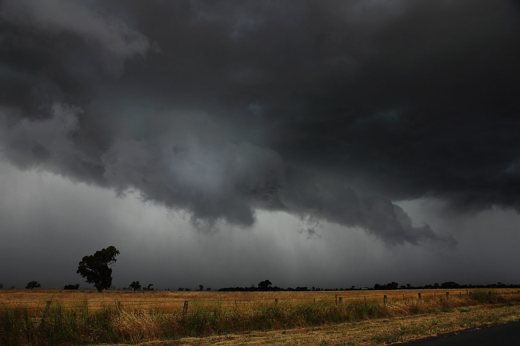
And the rest are from a storm I caught later in the day between Marong and Leichhardt. Didn't look that exciting at first...
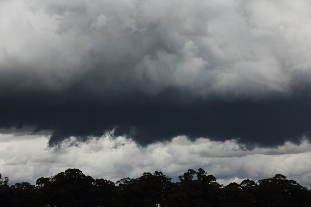
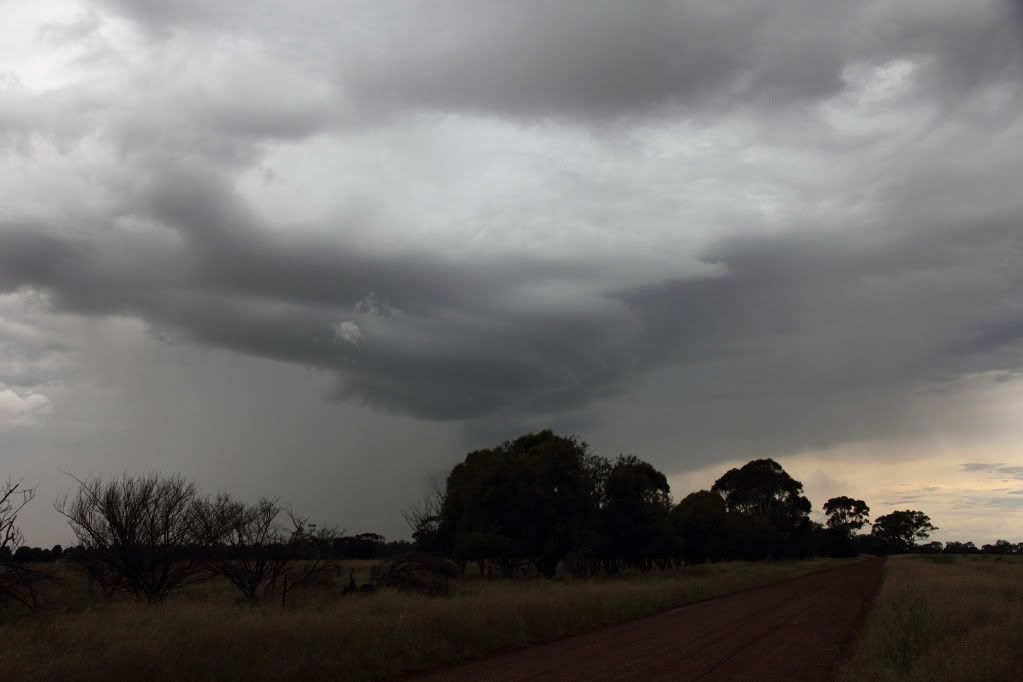
Although their were some interesting lowerings. Wall cloud, inflow? I dunno, probably neither, but it was interesting to watch....
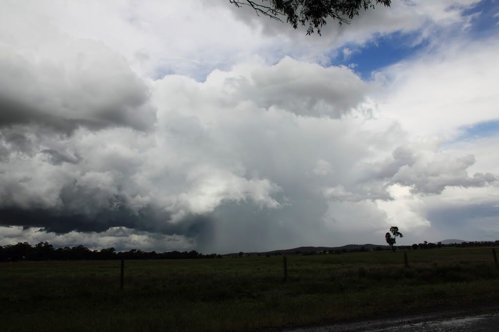
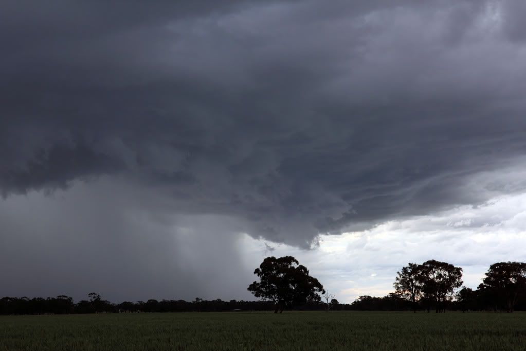
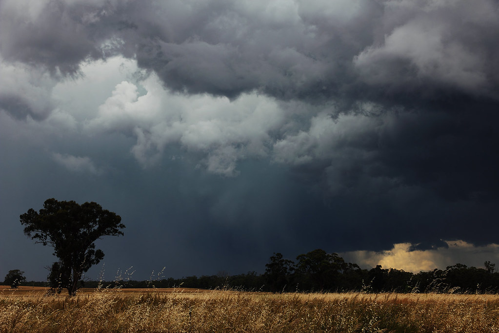
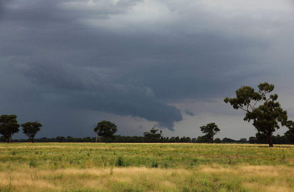
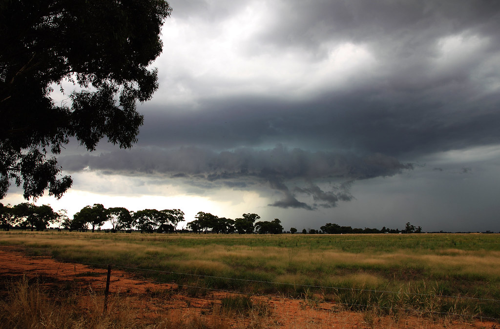
Rain started falling on me after a while in this spot, so darted around a bit more to try get a better view and was eventually greeted by this which stopped me dead in my tracks...
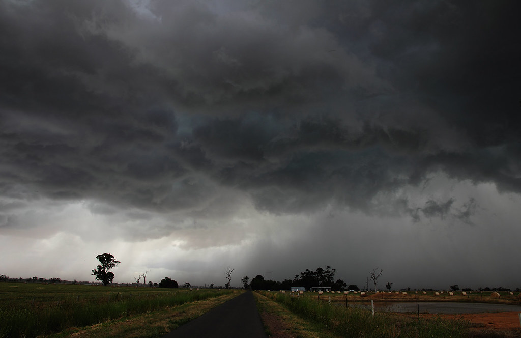
And then the storm as it moved away towards Bendigo...
An awesome day. Little did I know it was going to get even better on Friday.
First few from the storm that originated out of NSW in the morning. I caught it just north of Corop. Thanks to Rikki for the advice about heading that way! This storm was rumbling like you wouldn't believe, continuous thunder. The inflow band and updraft base in the pics is what really caught my eye tho...
And the rest are from a storm I caught later in the day between Marong and Leichhardt. Didn't look that exciting at first...
Although their were some interesting lowerings. Wall cloud, inflow? I dunno, probably neither, but it was interesting to watch....
Rain started falling on me after a while in this spot, so darted around a bit more to try get a better view and was eventually greeted by this which stopped me dead in my tracks...
And then the storm as it moved away towards Bendigo...
An awesome day. Little did I know it was going to get even better on Friday.
Re: Meso's Photo's and chase reports
Northern Vic Thunderstorms - December 3rd 2010
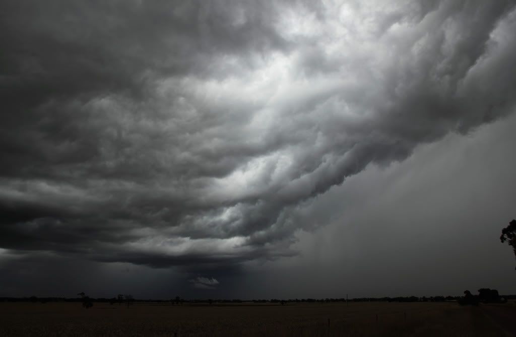
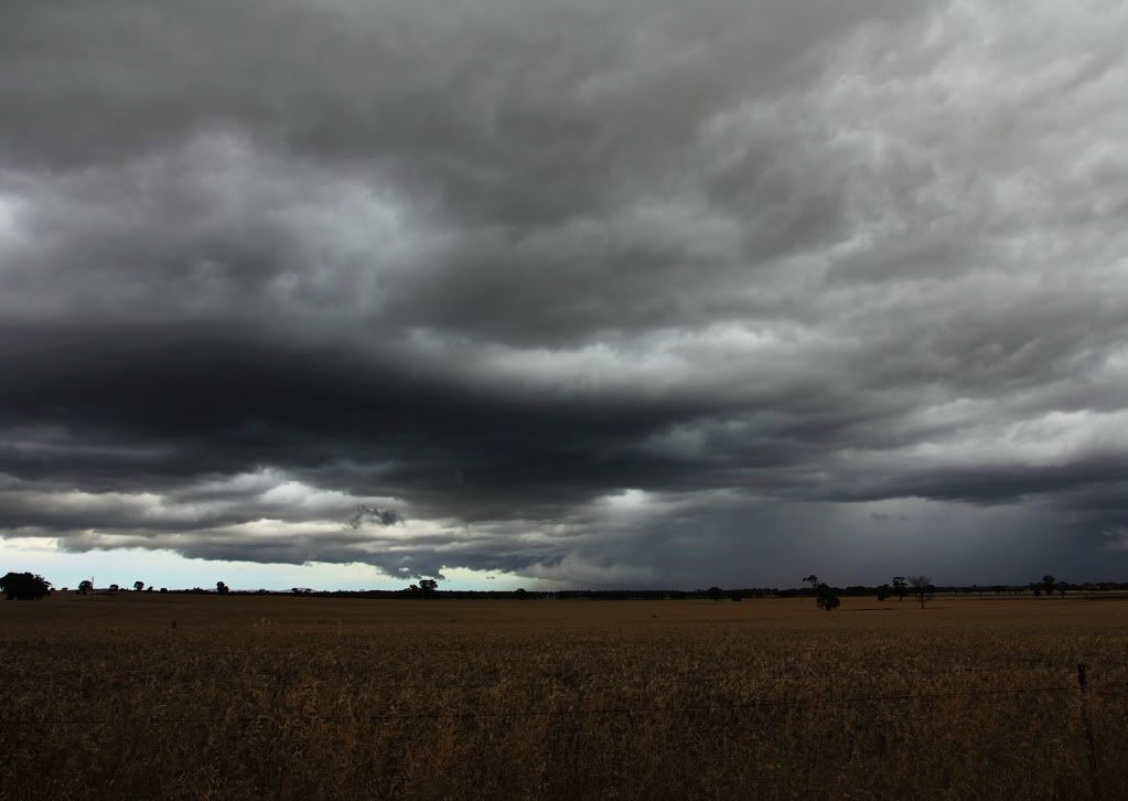
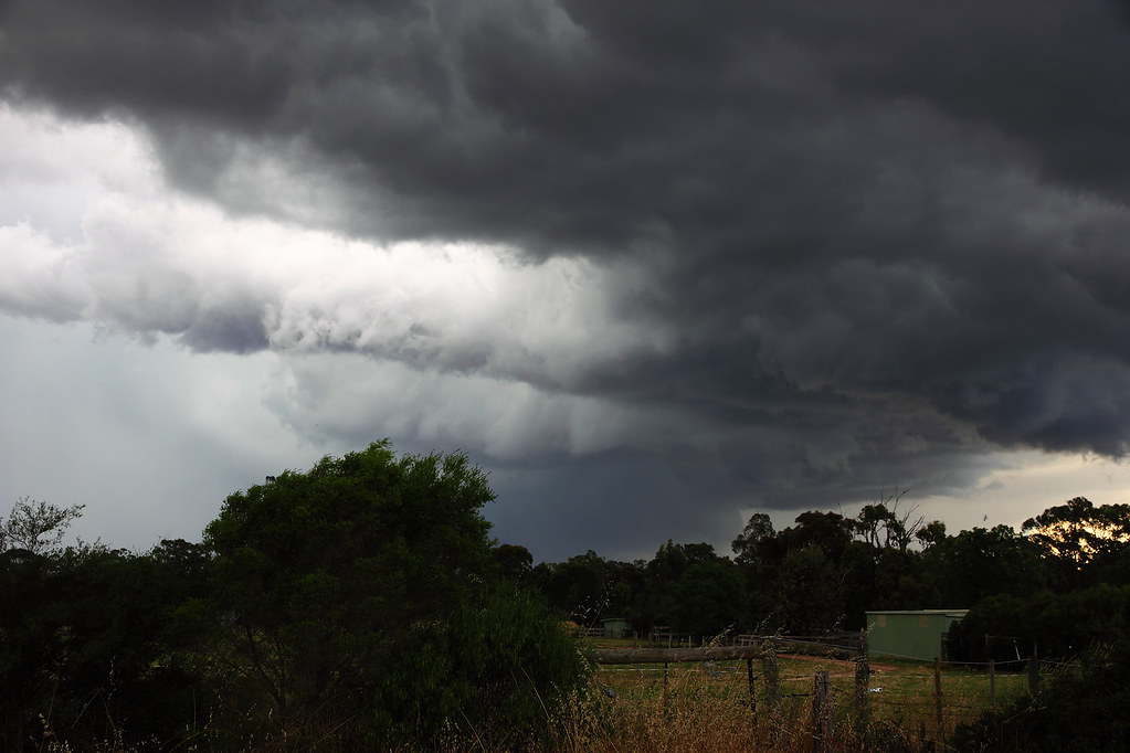
First few are the storm just north of Goornong, as it was when I first sighted it and found a good enough viewing spot...
Next few...if I've understood what I've read properly...are of a wall cloud with fractus trying to form a tail cloud?
The storm eventually got too close with strong outflow winds enough to make me jump in the car and find another spot down the road. Once I noticed the trees weren't nearly getting blown over...I jumped out for a few more snaps...
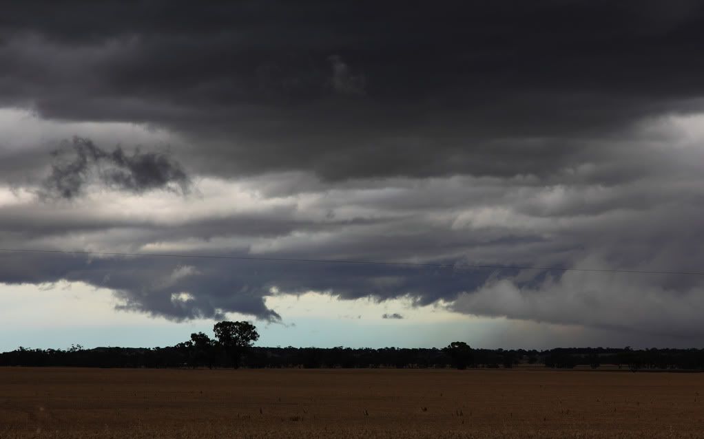
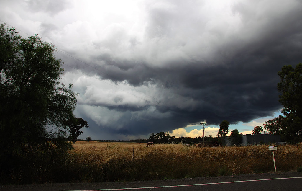
It eventually caught up with me, so I had to try get in front of it again. Came to a dead end, but still had a few minutes before the core caught up with me, so I grabbed a few more...
After navigating a few tree lined roads I was eventually able to find a side road that allowed me to get another view on it...
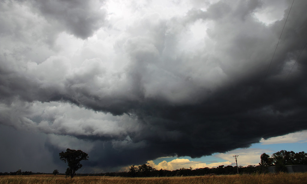
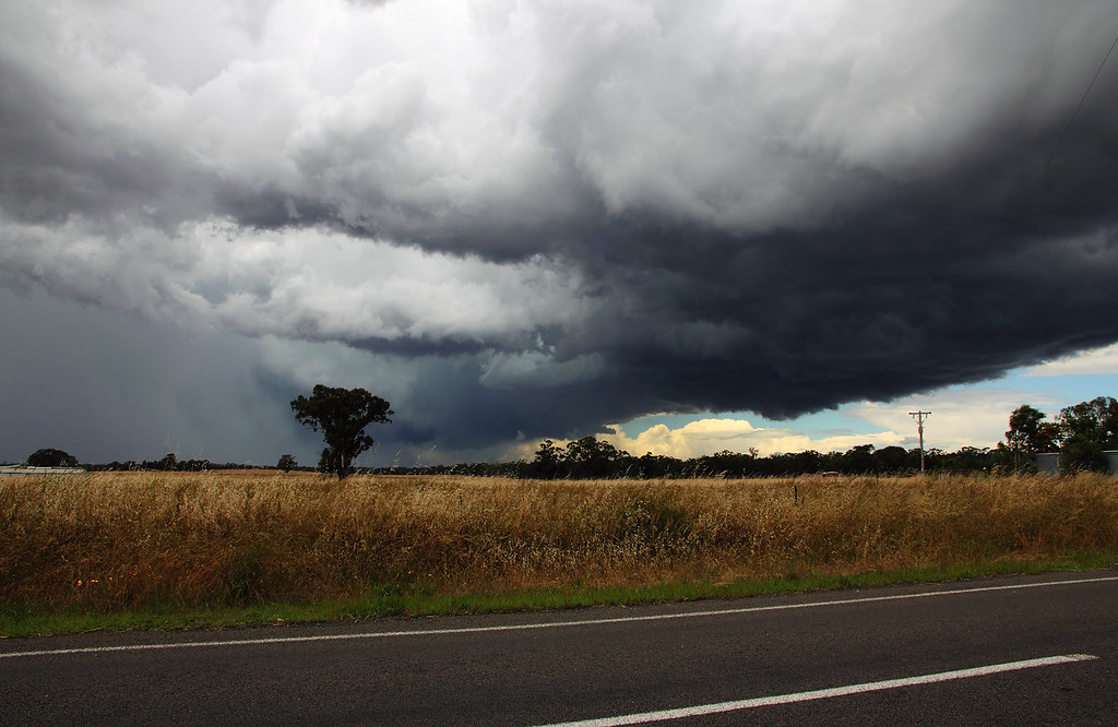
It was all tree laden roads on the way back to Bendigo from there, so I wasn't really able to get anymore photos. Got this last one of it approaching the northern end of town...
Pretty crazy day.
Edit:
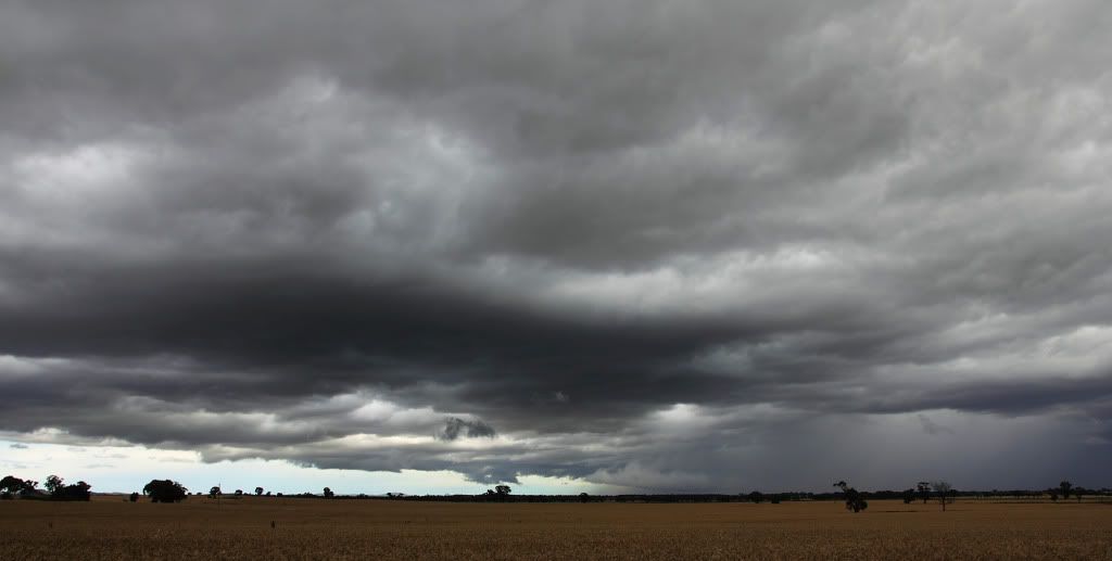
Pano of the above storm. Exposure is a little uneven on the right hand side, must remember to lock it in next time...

First few are the storm just north of Goornong, as it was when I first sighted it and found a good enough viewing spot...
Next few...if I've understood what I've read properly...are of a wall cloud with fractus trying to form a tail cloud?
The storm eventually got too close with strong outflow winds enough to make me jump in the car and find another spot down the road. Once I noticed the trees weren't nearly getting blown over...I jumped out for a few more snaps...
It eventually caught up with me, so I had to try get in front of it again. Came to a dead end, but still had a few minutes before the core caught up with me, so I grabbed a few more...
After navigating a few tree lined roads I was eventually able to find a side road that allowed me to get another view on it...
It was all tree laden roads on the way back to Bendigo from there, so I wasn't really able to get anymore photos. Got this last one of it approaching the northern end of town...
Pretty crazy day.
Edit:
Pano of the above storm. Exposure is a little uneven on the right hand side, must remember to lock it in next time...
Last edited by Meso on Tue Dec 14, 2010 8:17 pm, edited 1 time in total.
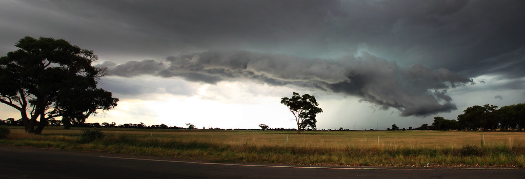
Re: Meso's Photo's and chase reports
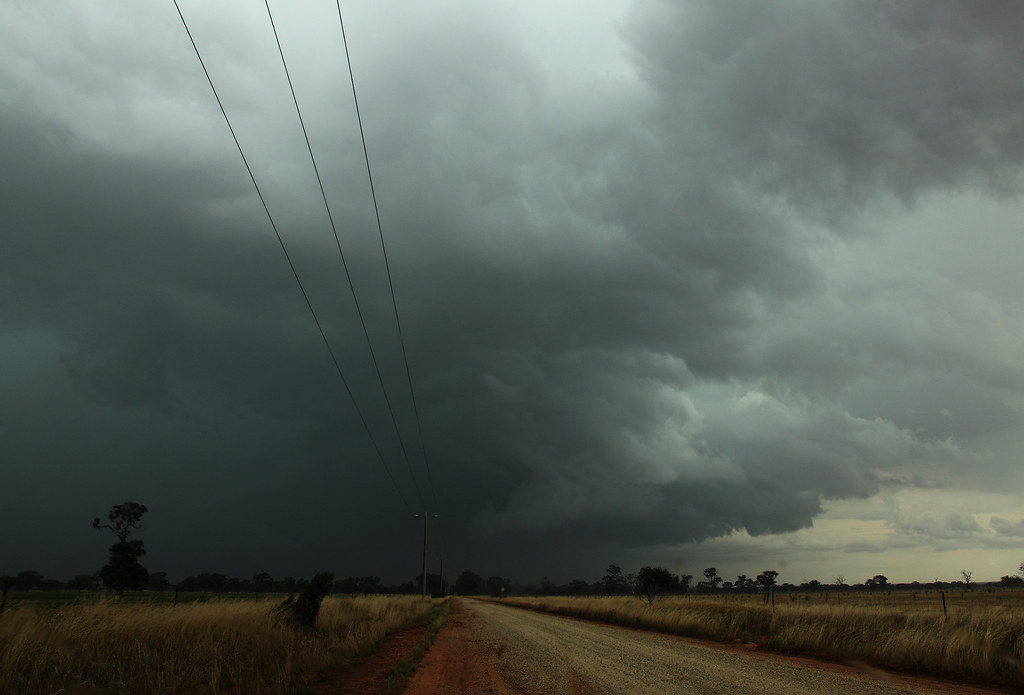
Marong/Bendigo Thunderstorm - December 6th 2010
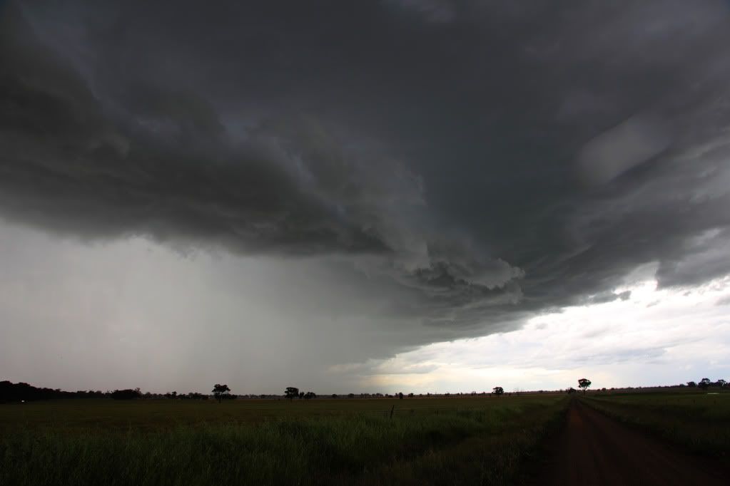
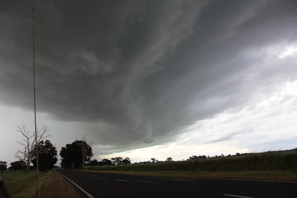
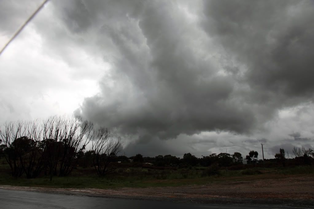
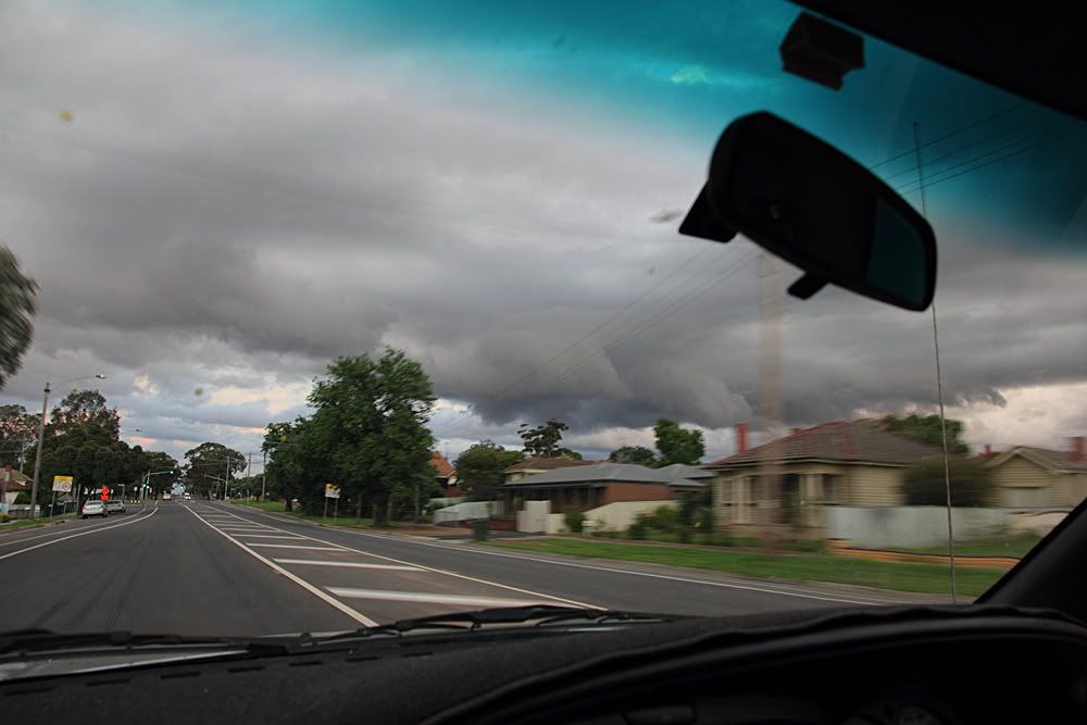
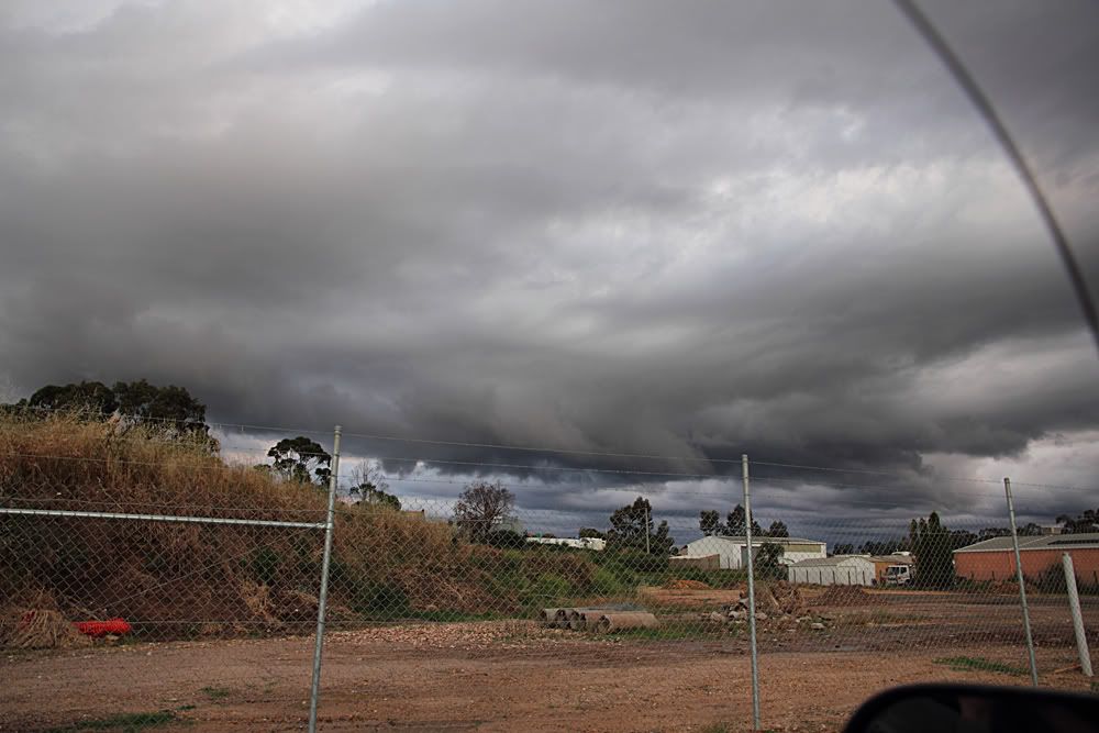
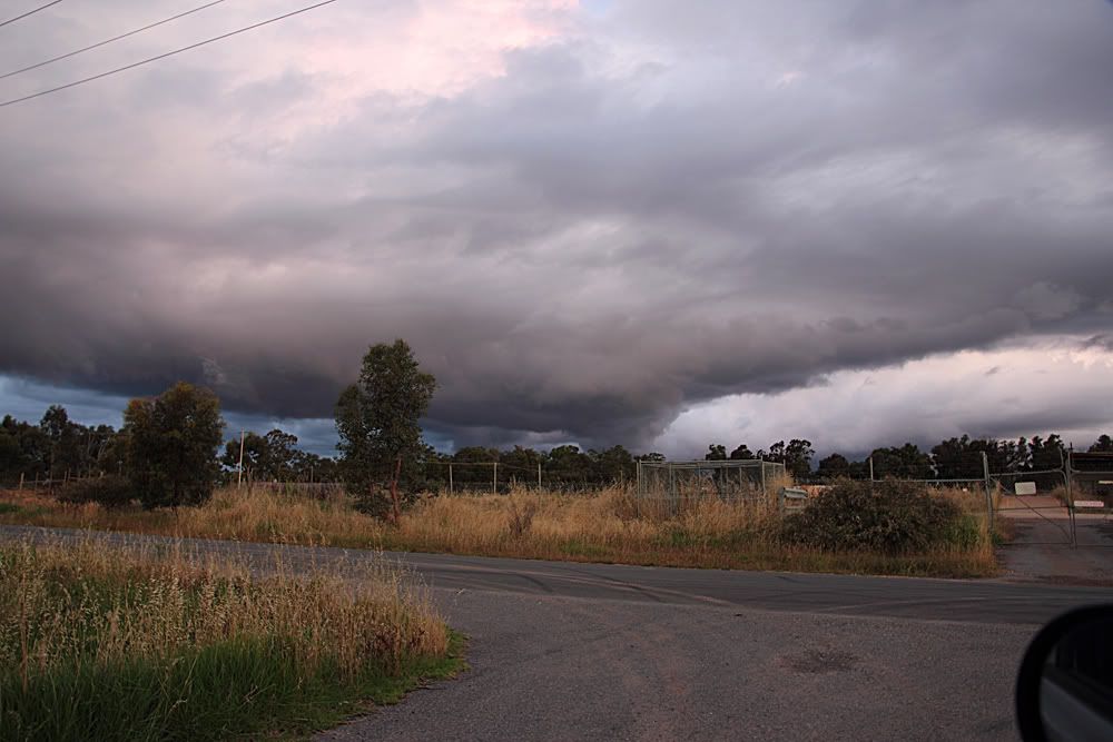
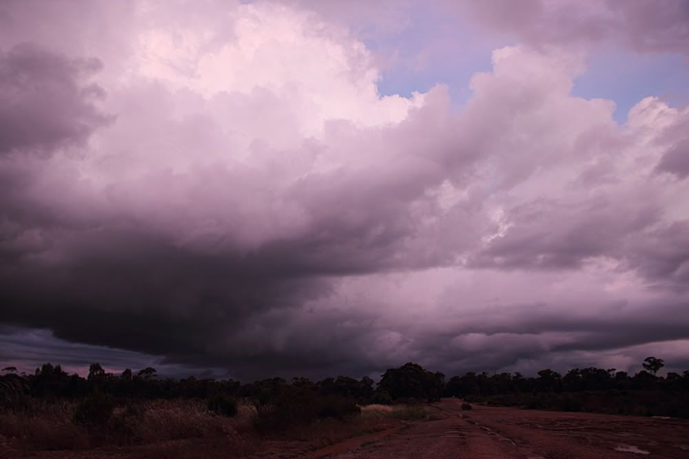
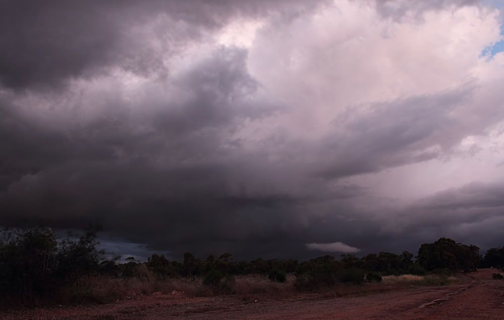
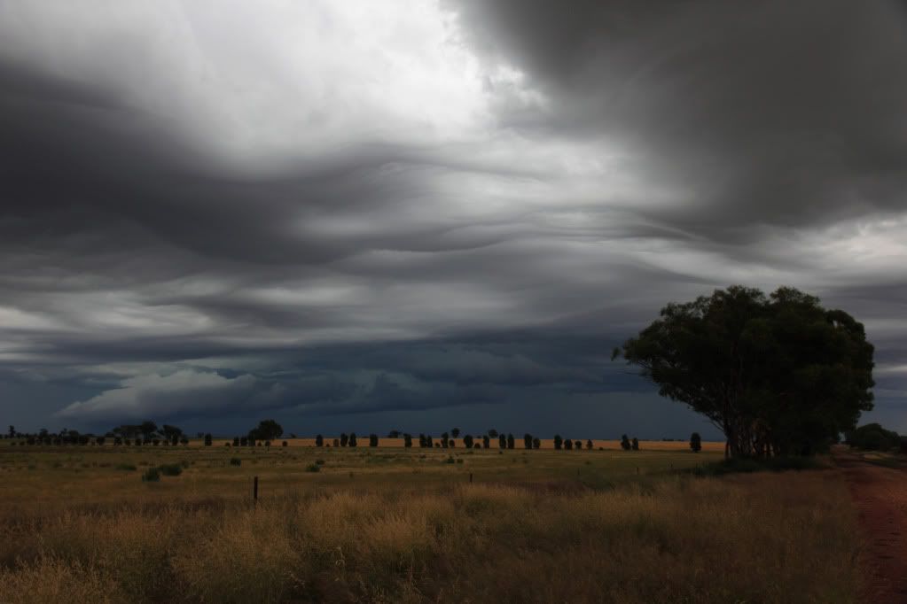
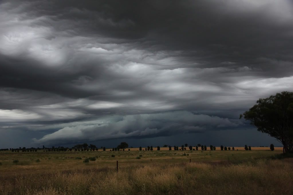
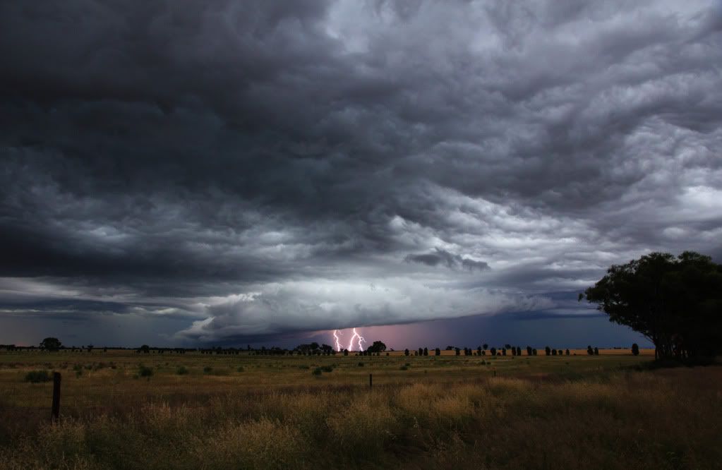
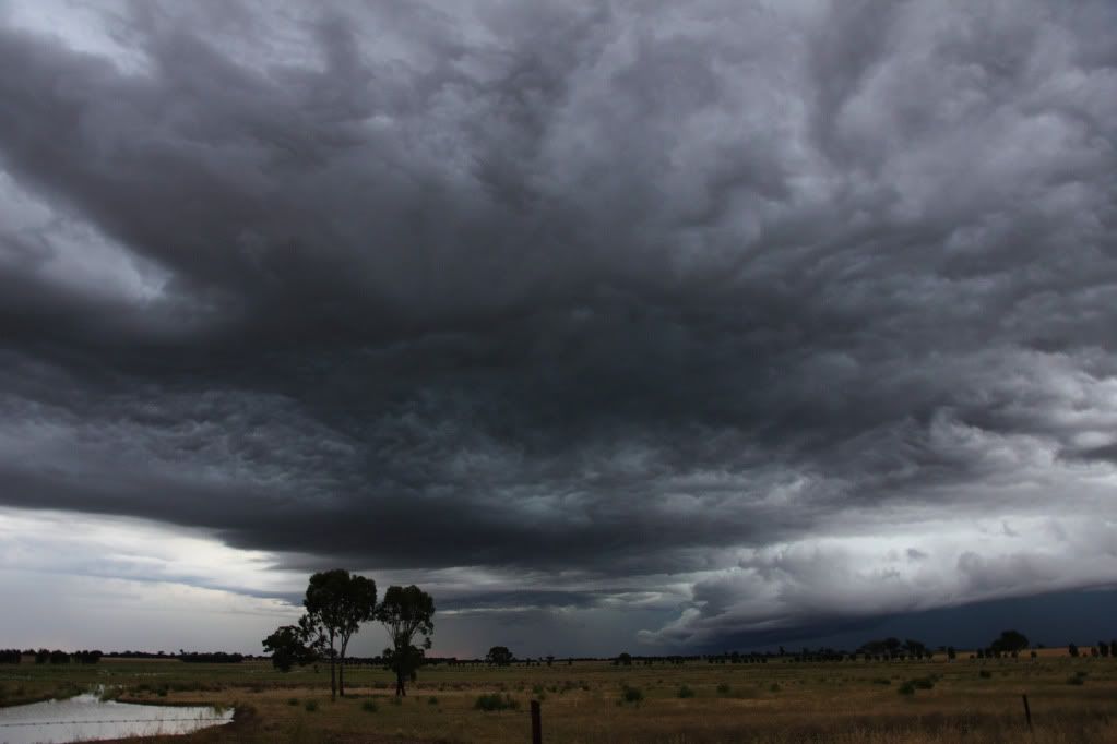
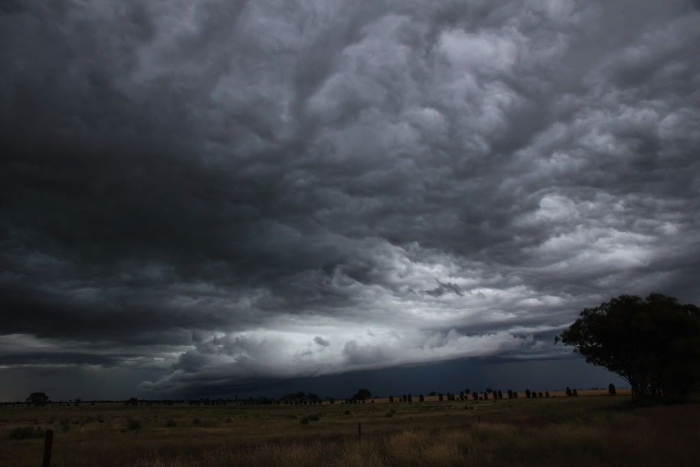
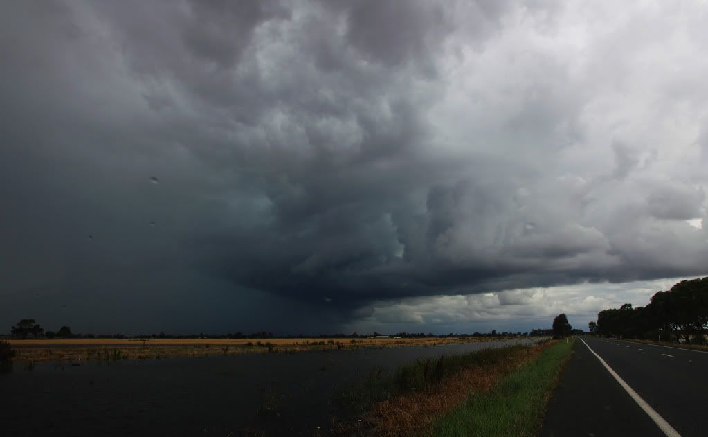
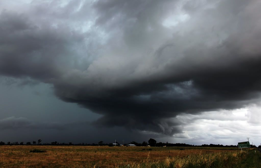
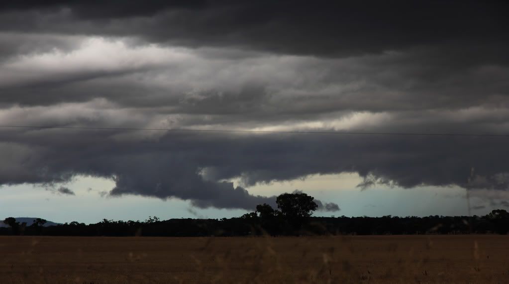
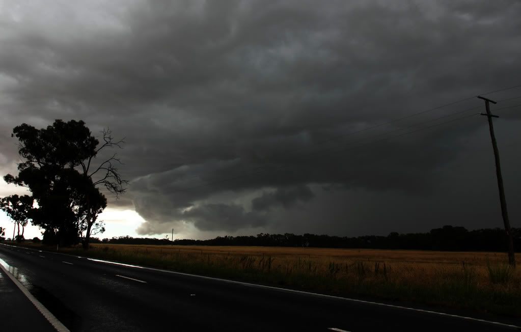
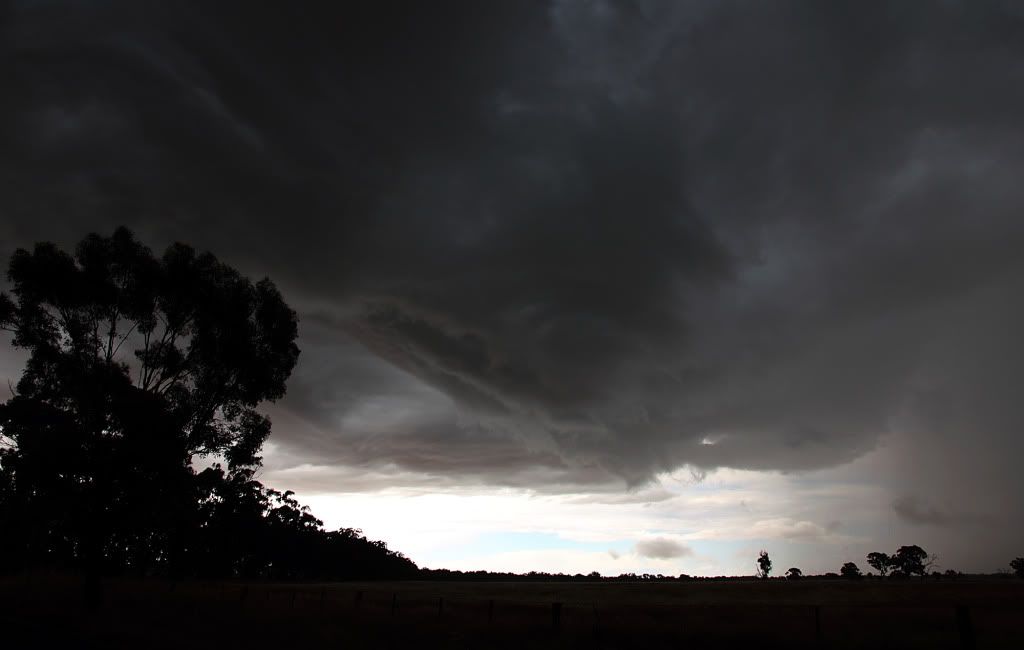
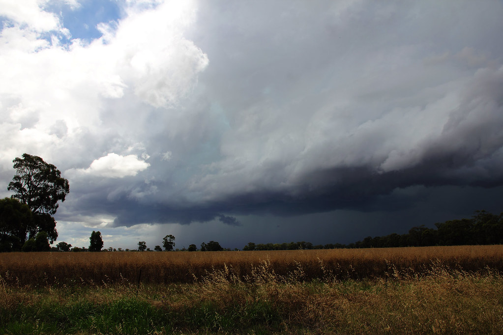
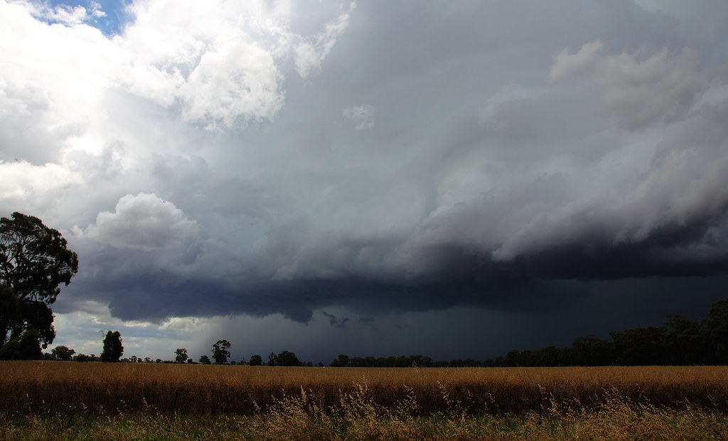
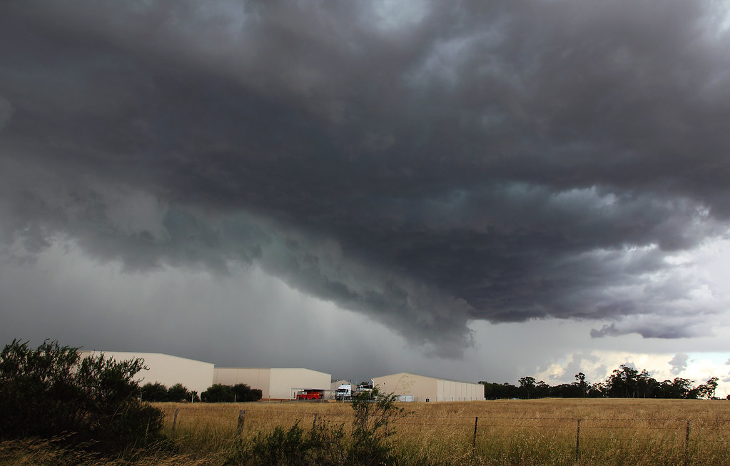
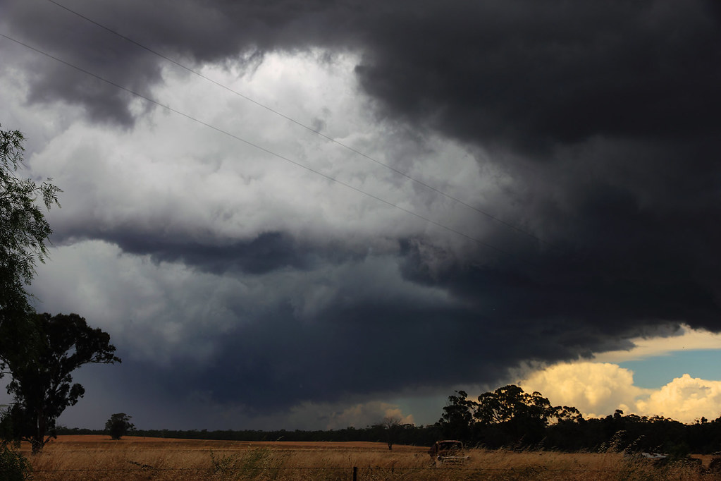
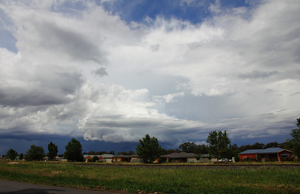
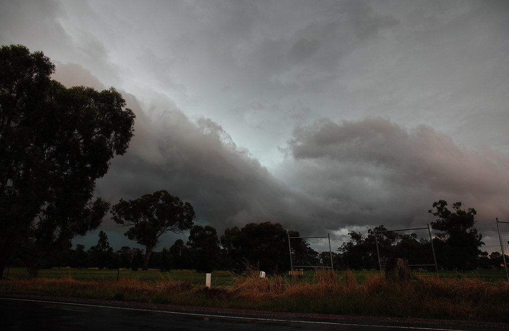
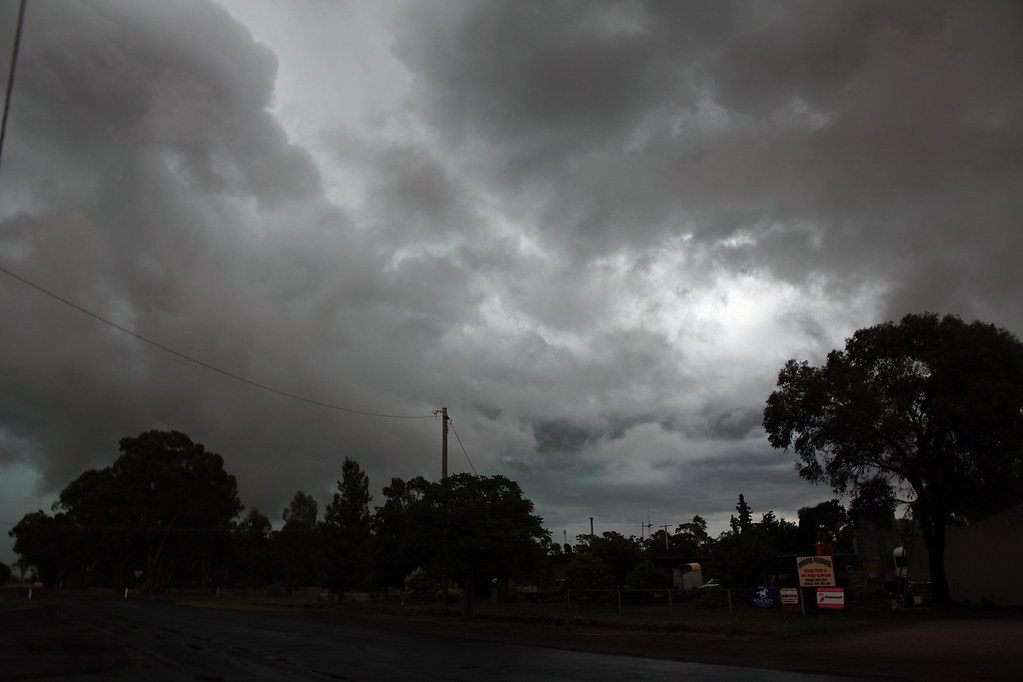
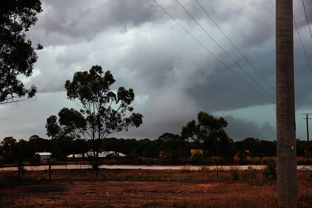
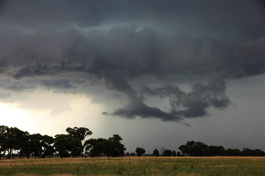
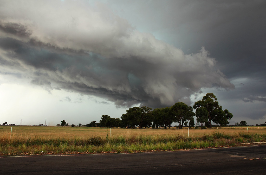
Here's my photos from the amazing gust front that came across from the west and seemed to peak in Marong on the 6th of December.
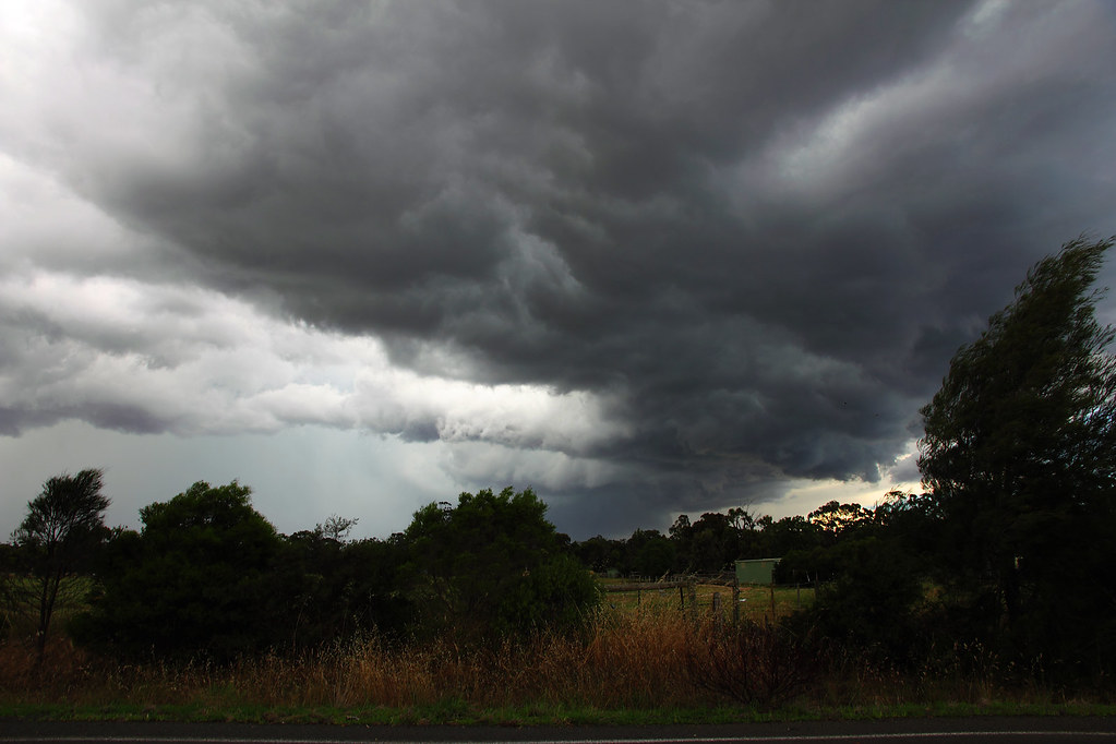
First batch is from Leichardt, just north of Marong. The storm was barely visible for the first 10 mins or so that I was there, but it gradually began to reveal itself...
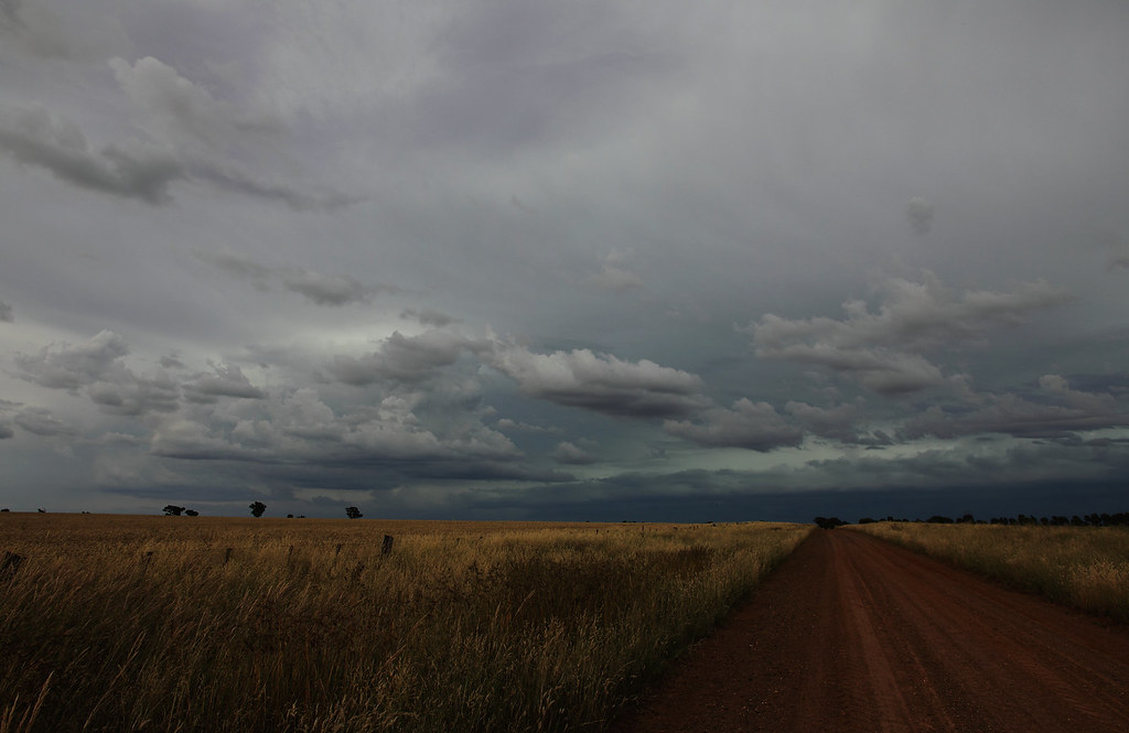
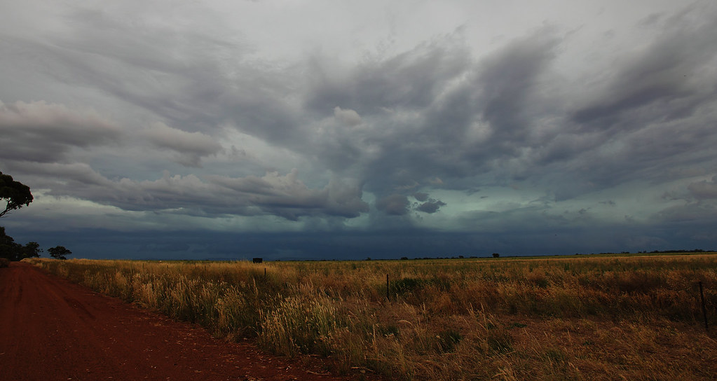
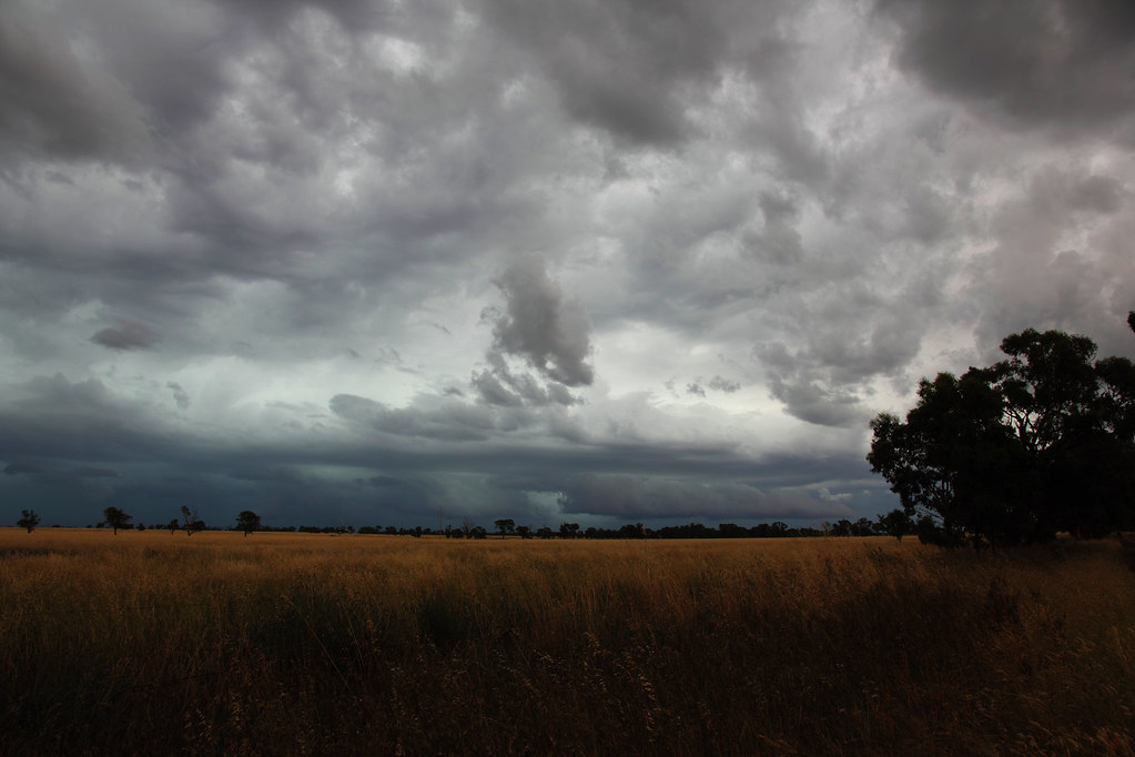
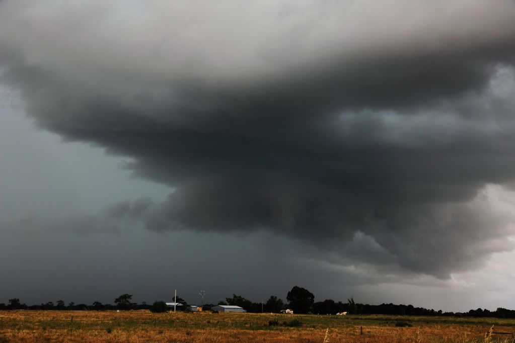
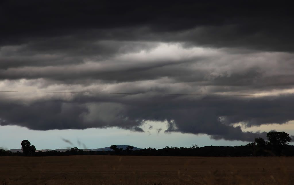
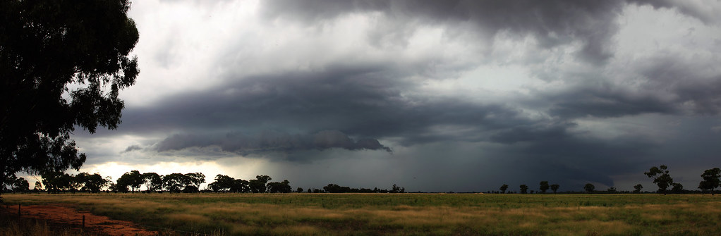
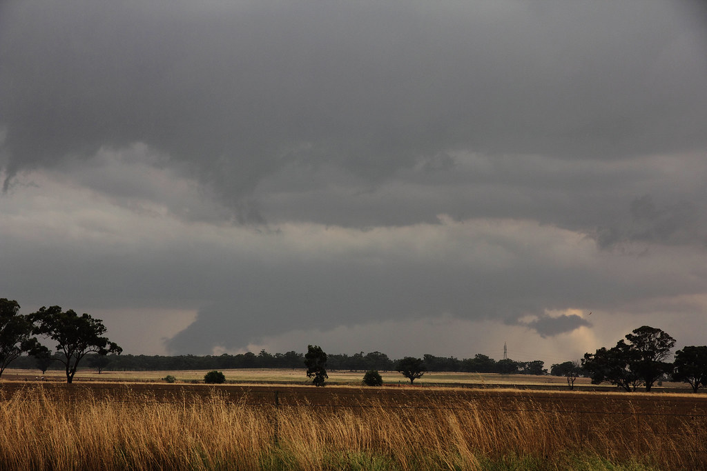
After about 30 mins of slowly creeping up the road to get closer to it and find new vantage points, I noticed that the rolling clouds associated with the guster were just about on top of me!
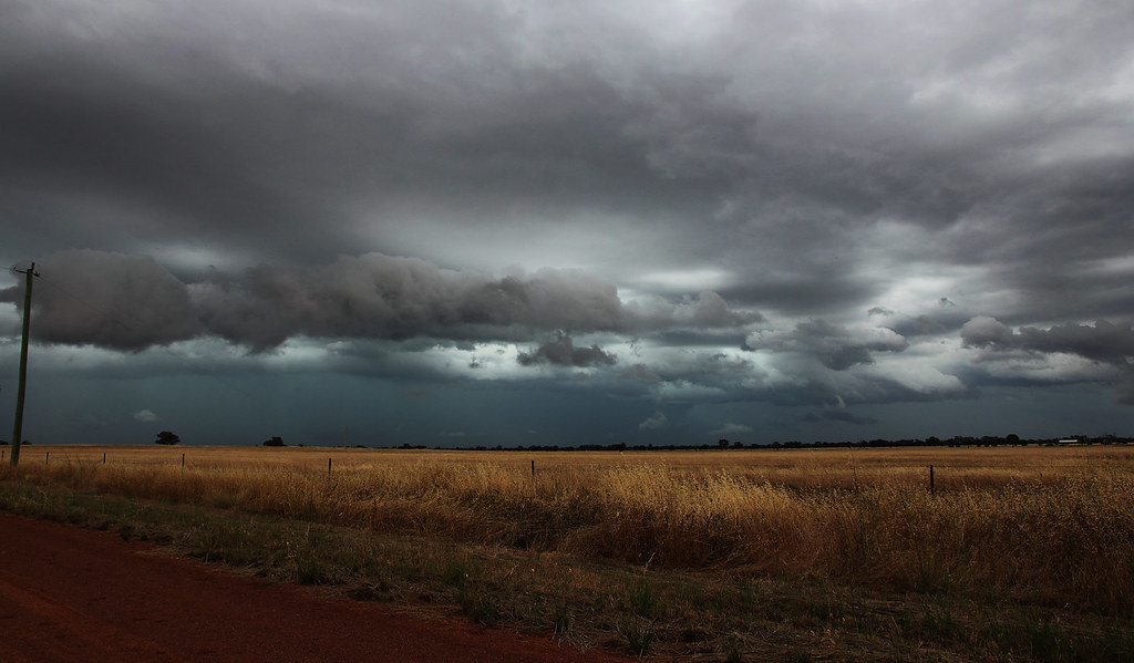
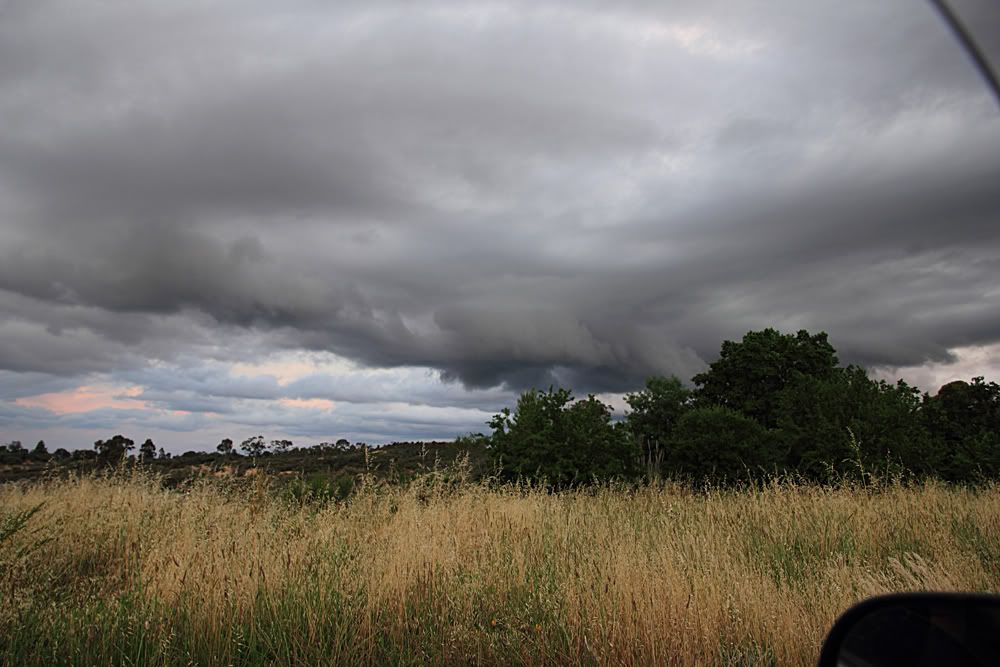
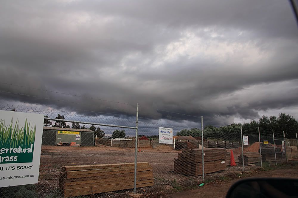
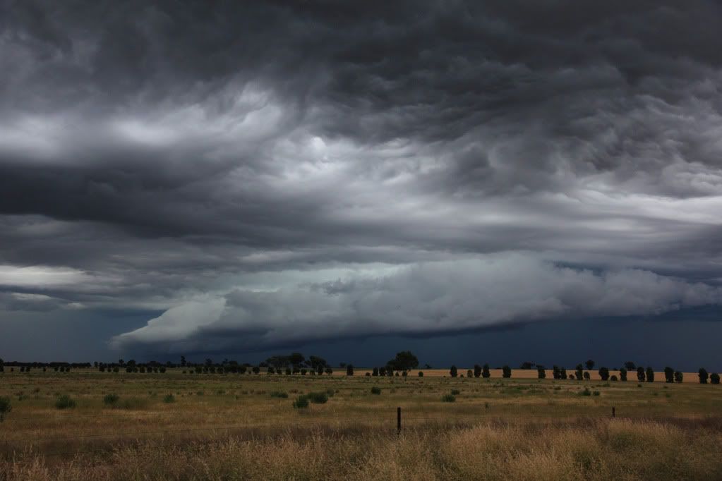
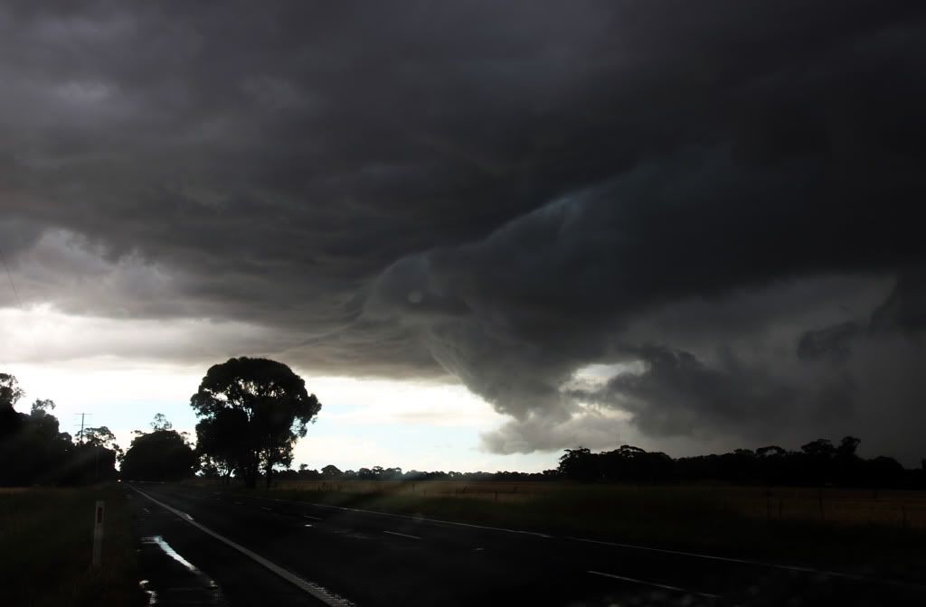
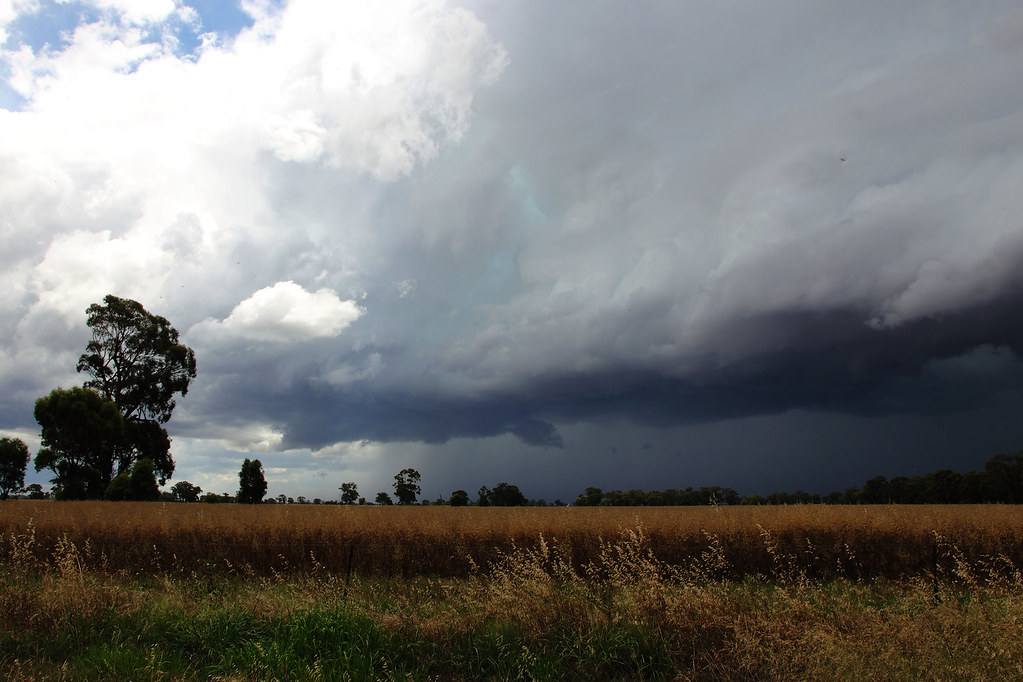
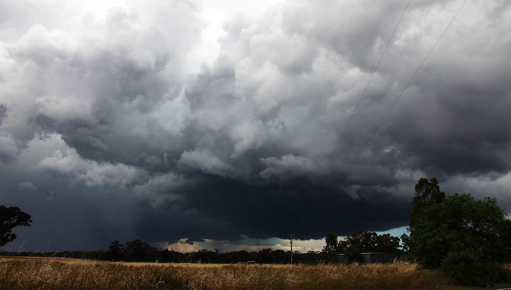
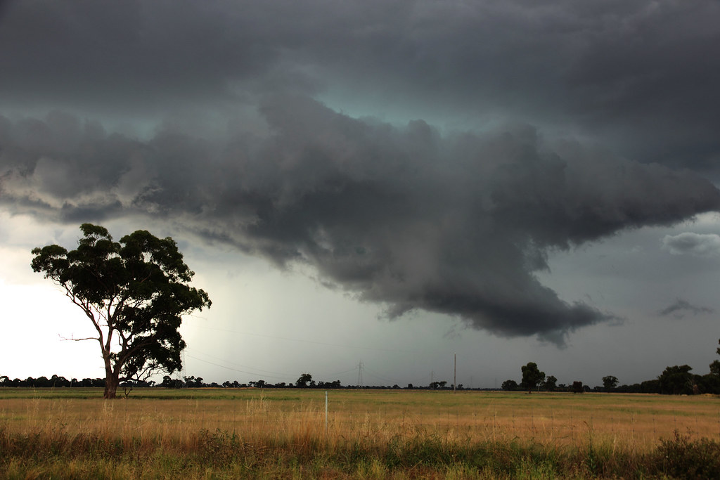
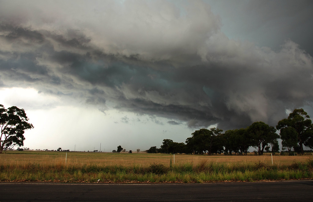
The winds really picked up at this point so it was time to get moving. But of course I wasn't gonna let it go, so I hovered in front of it, snapping photos at any available opportunity...
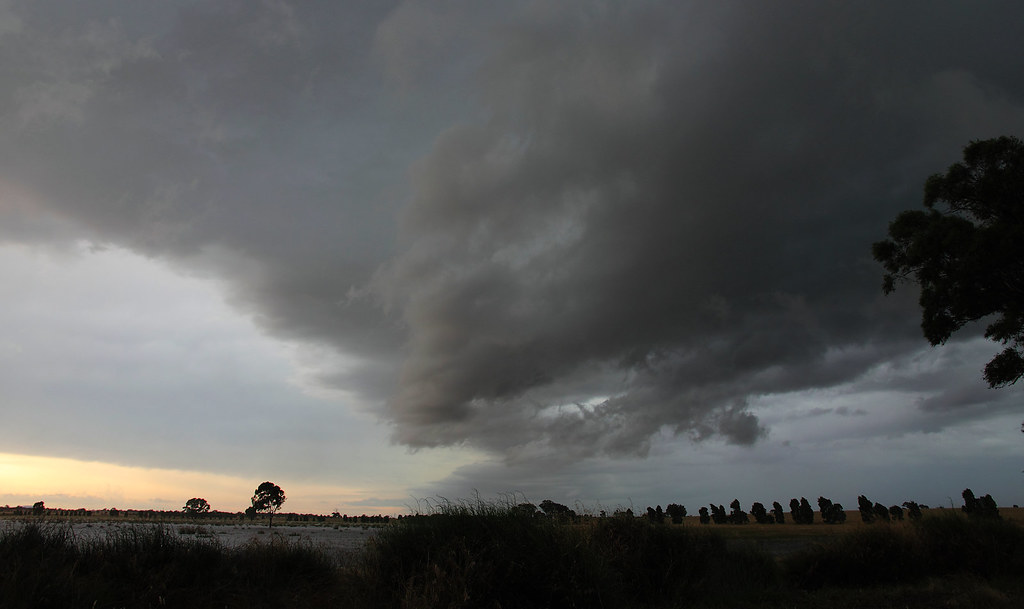
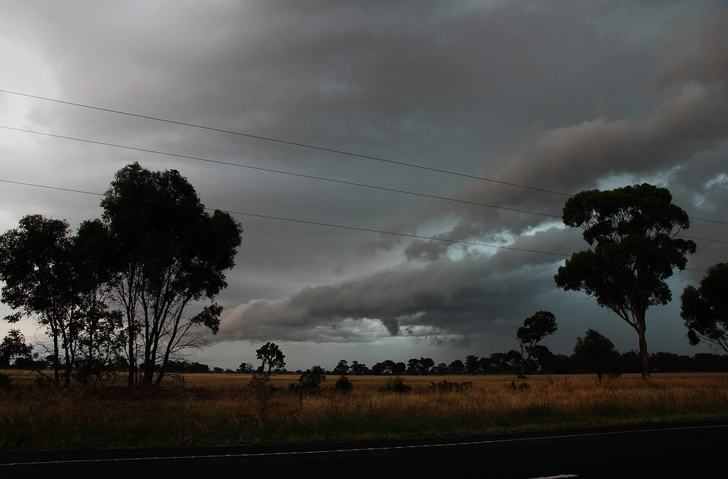
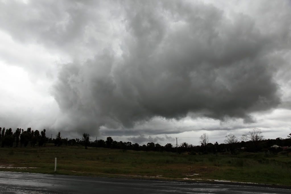
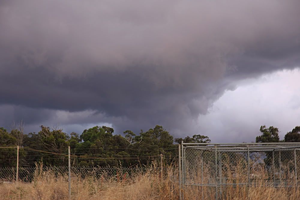
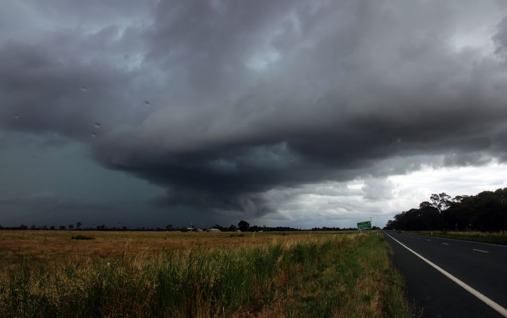
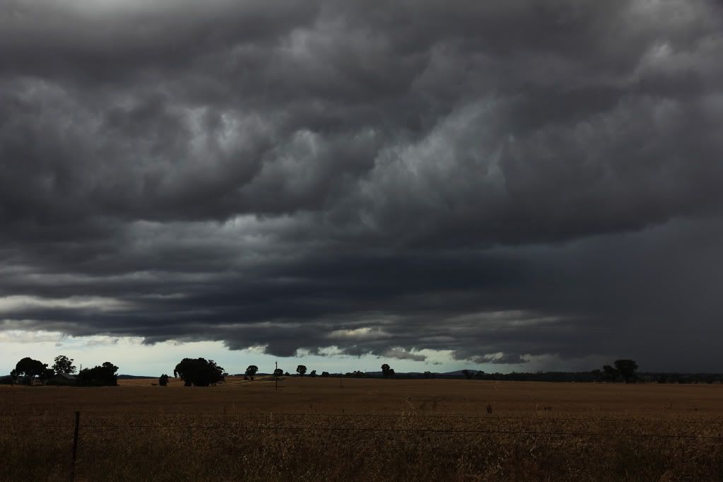
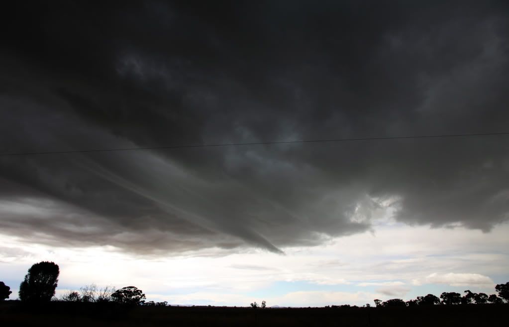
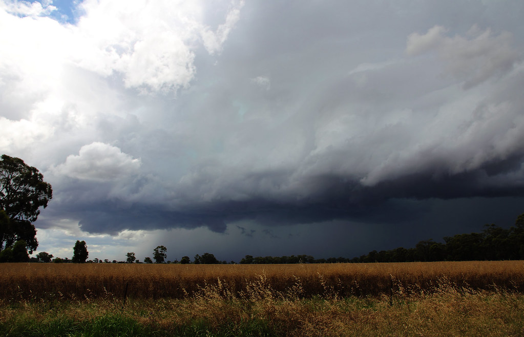
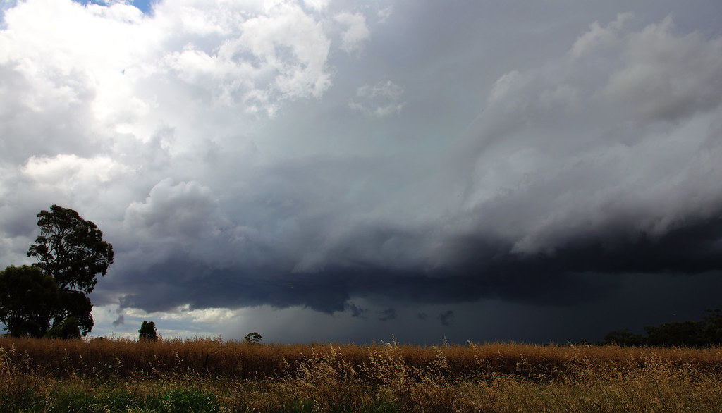
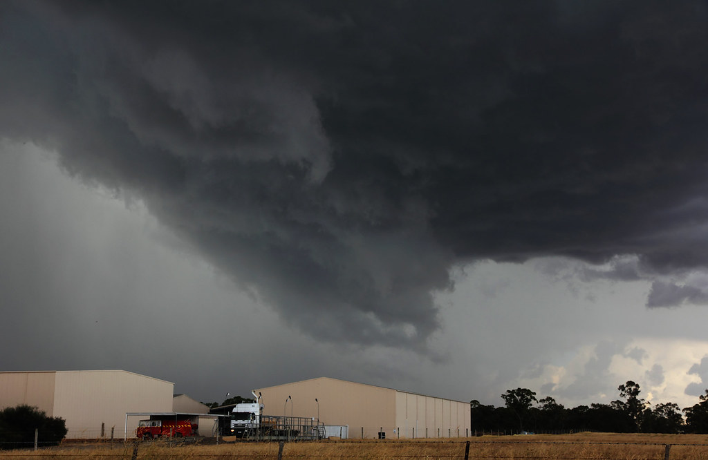
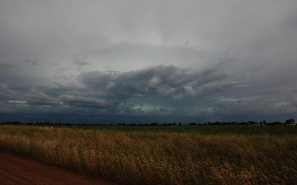
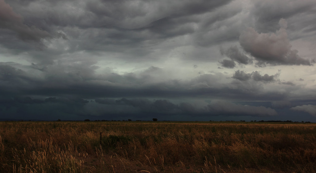
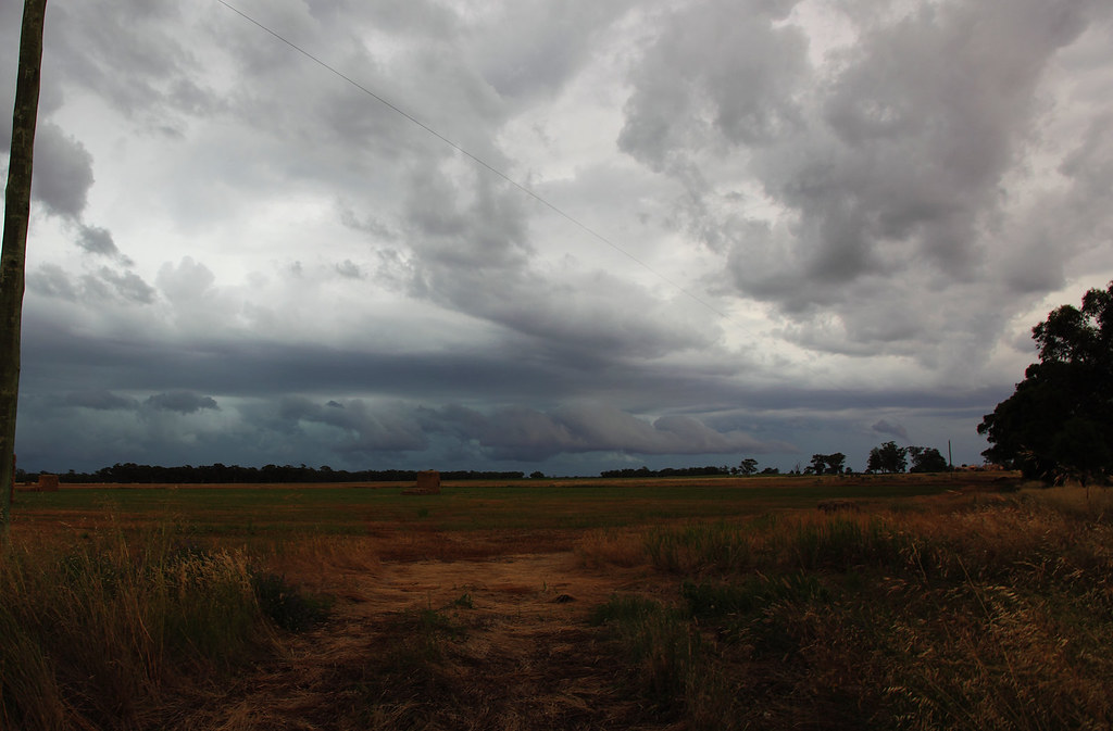
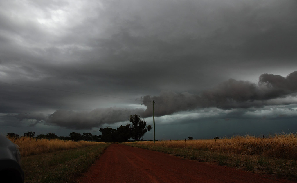
The guster really seemed to peak and take shape at Marong (as I'm sure Brad will confirm), turning the sky green and providing some sweet ground hugging cloud action!
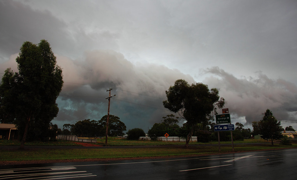
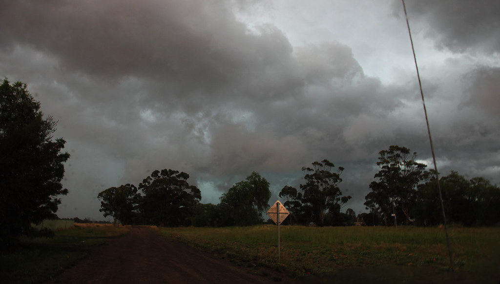
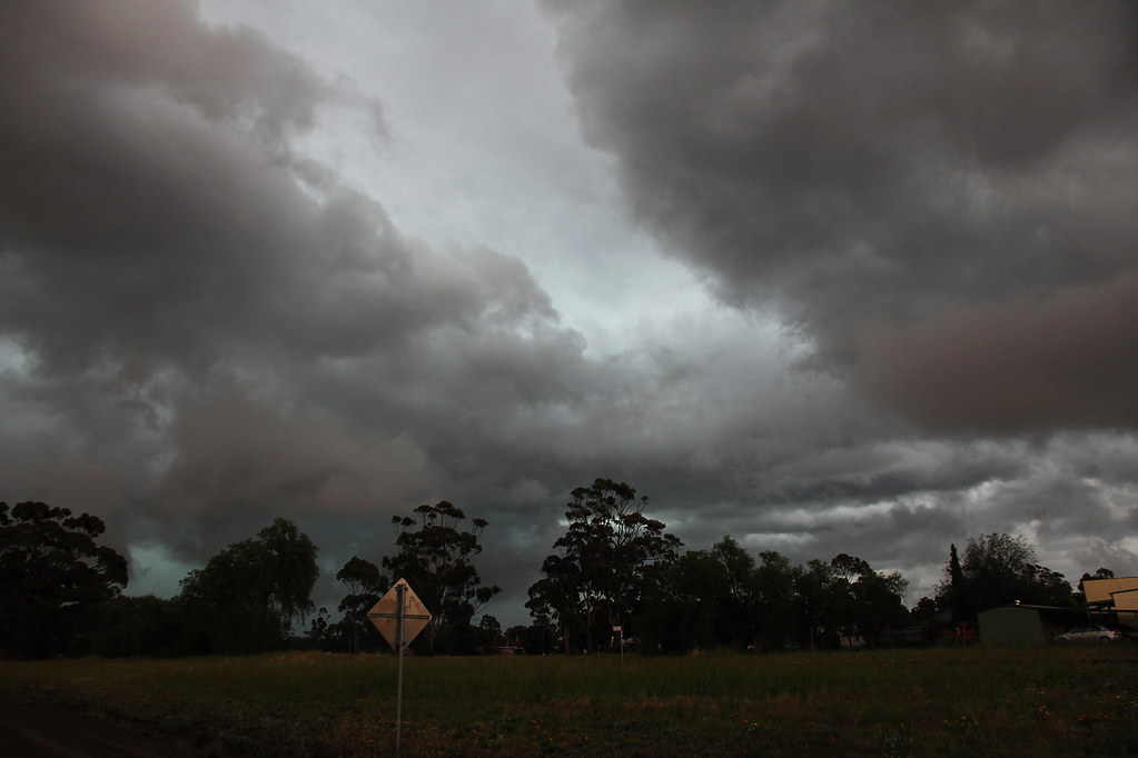
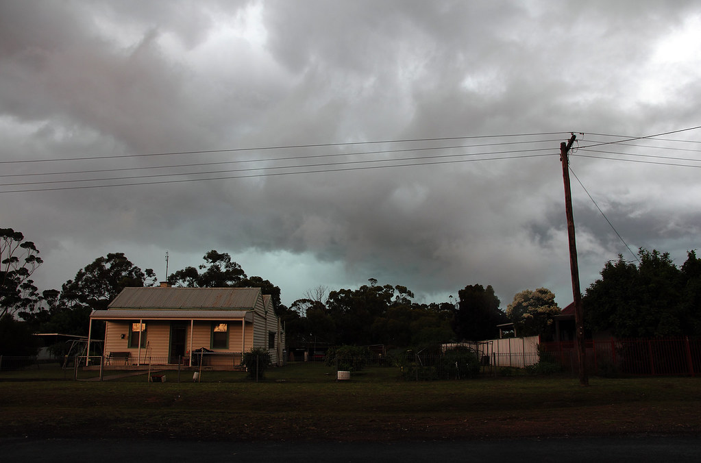
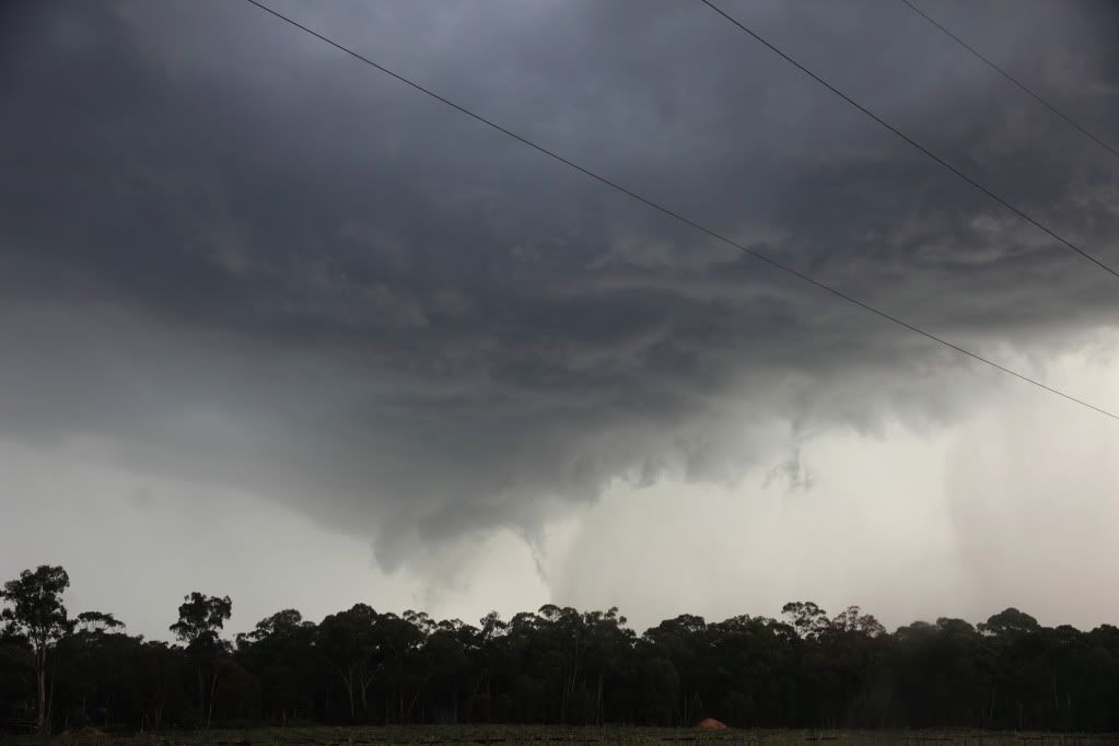
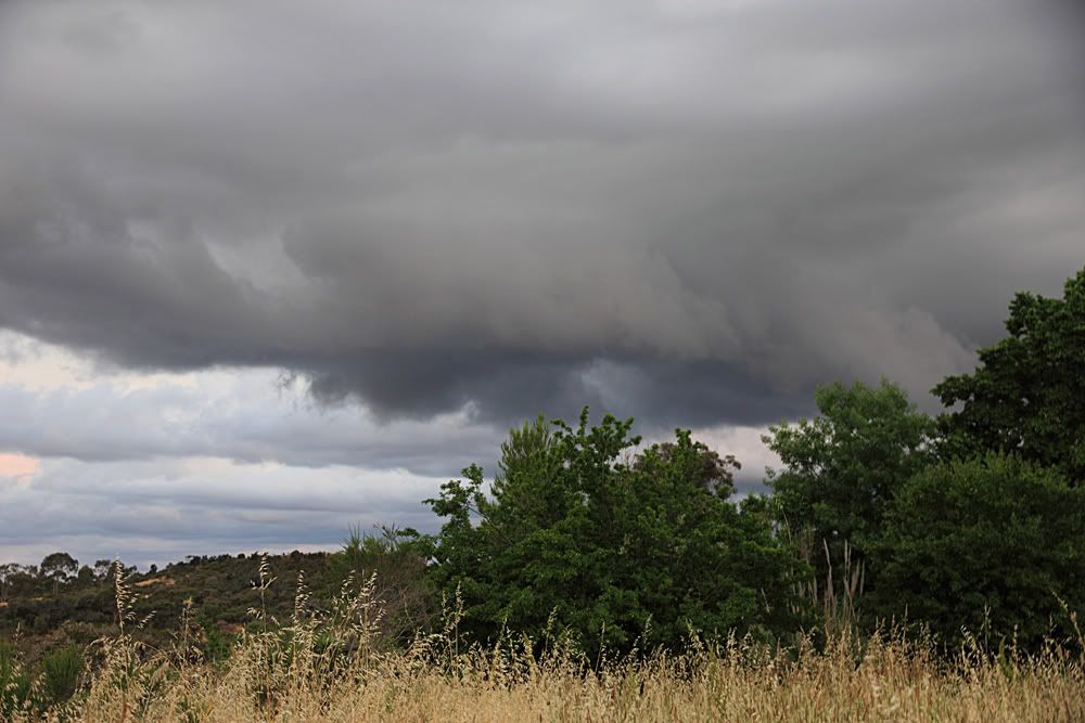
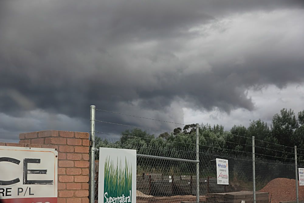
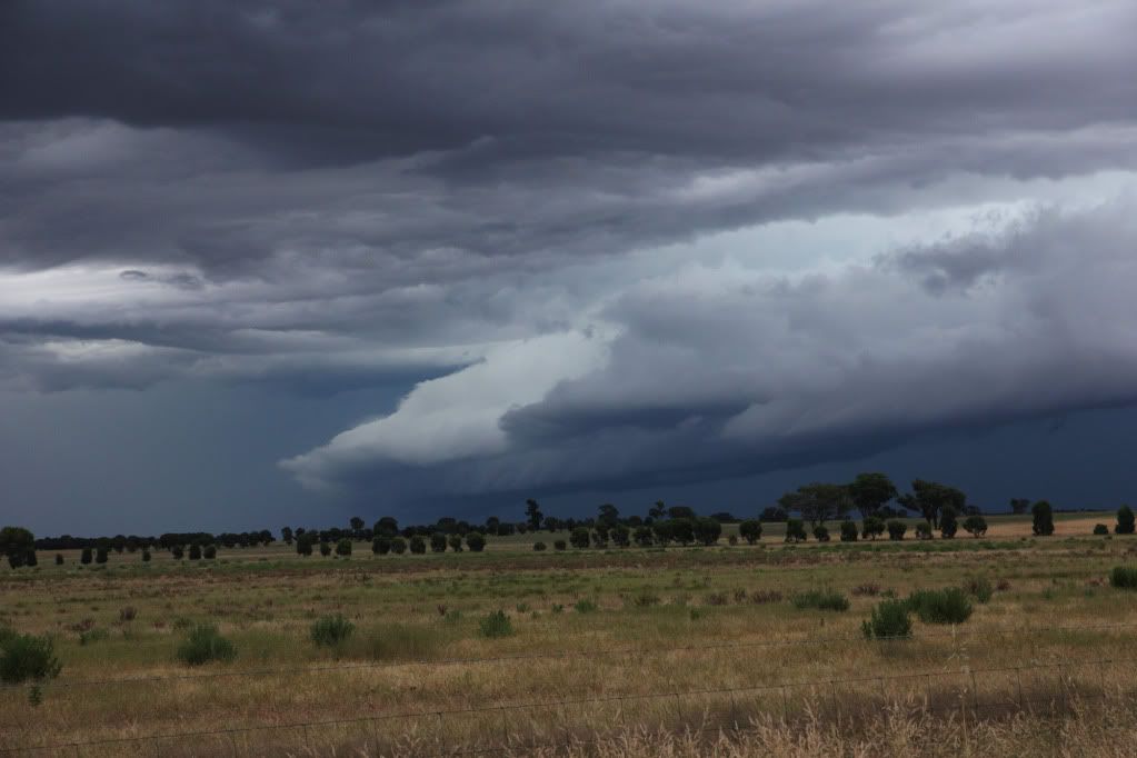
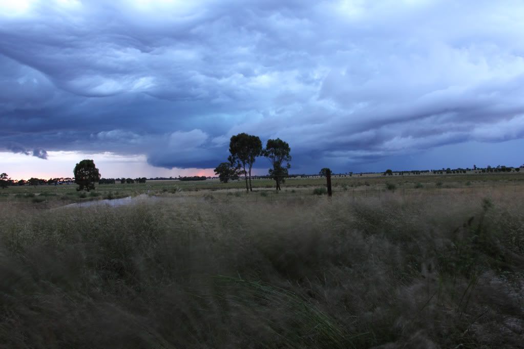
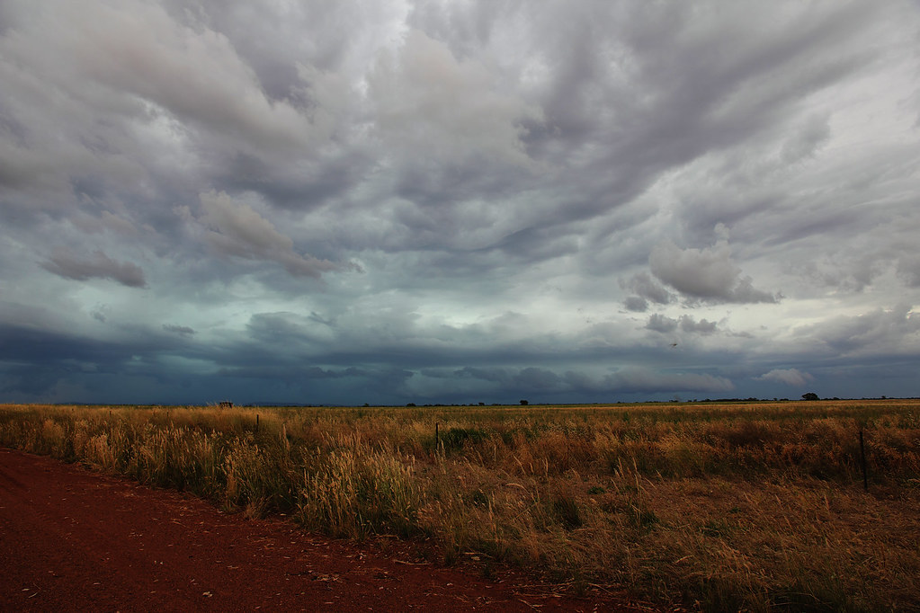
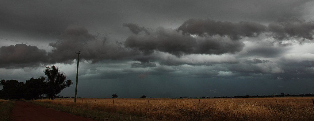
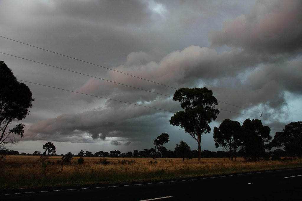
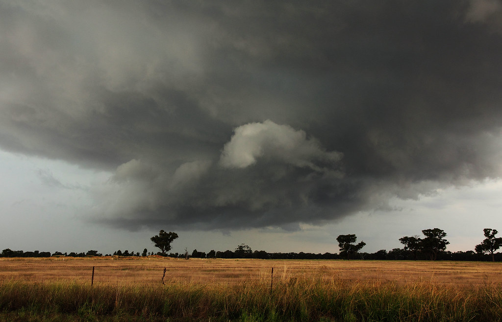
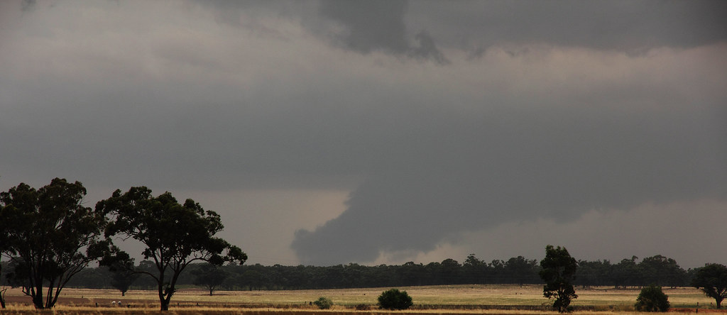
As these next couple of shots were taken I'm pretty sure I saw some rotation in the clouds, but so much was happening at the time so I won't go so far as to say I'm 100% sure. Was interesting to watch nonetheless.
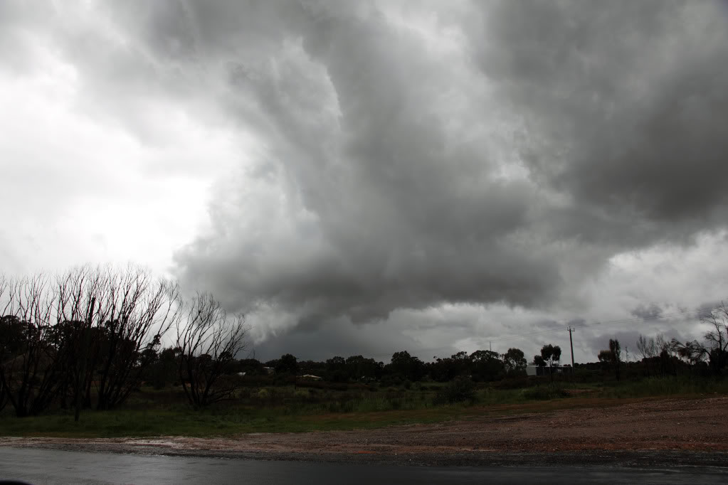
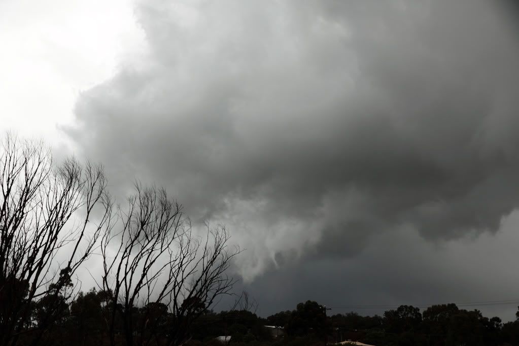
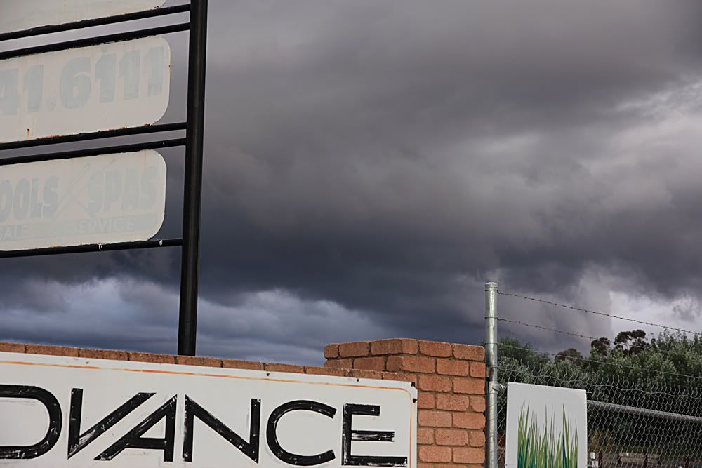
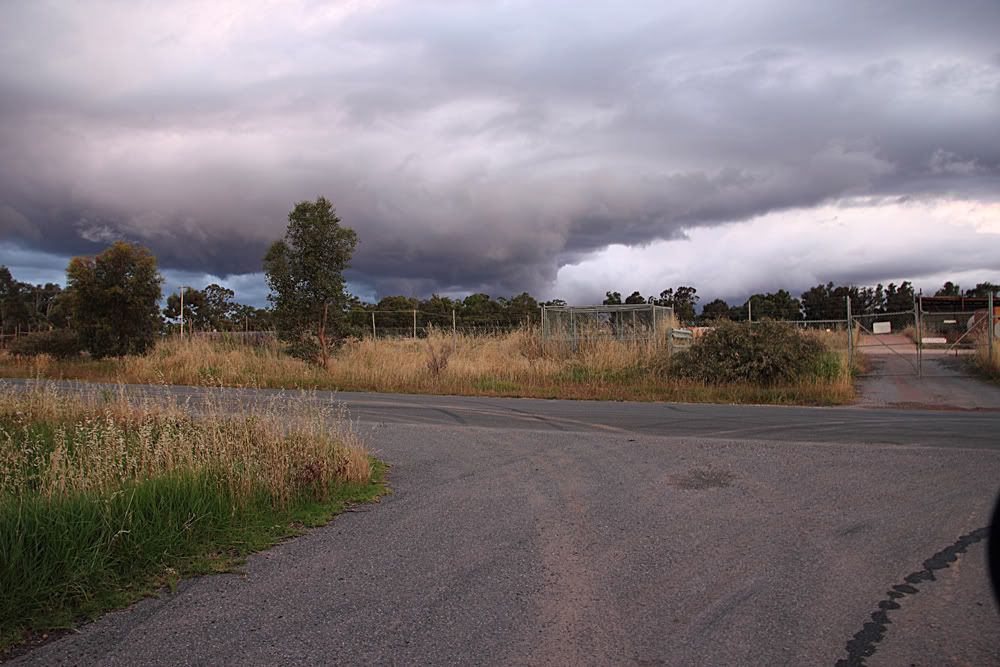
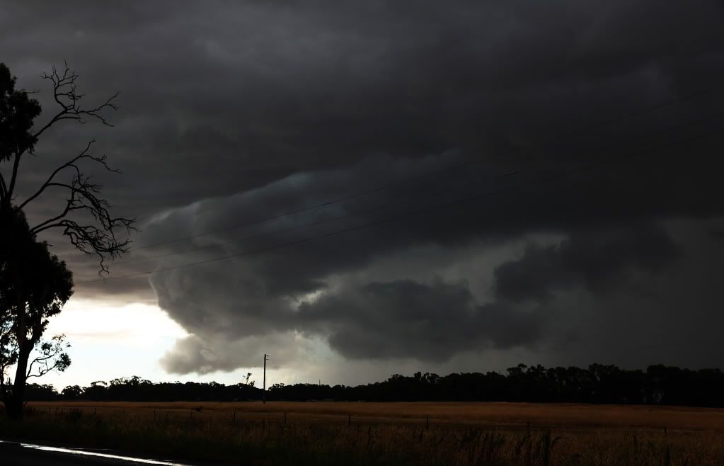
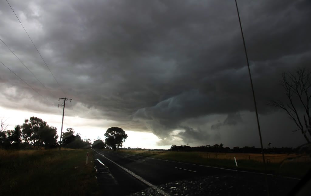
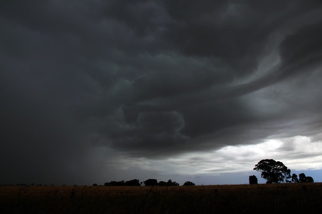
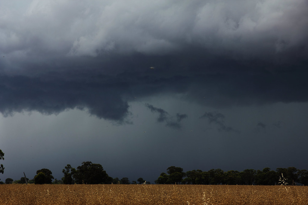
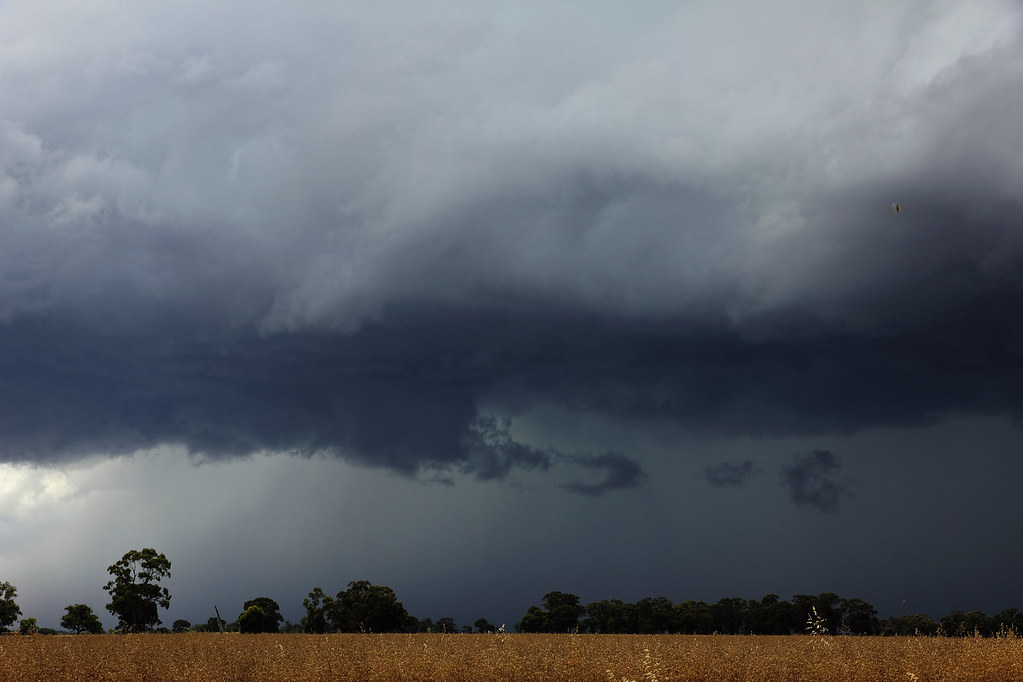
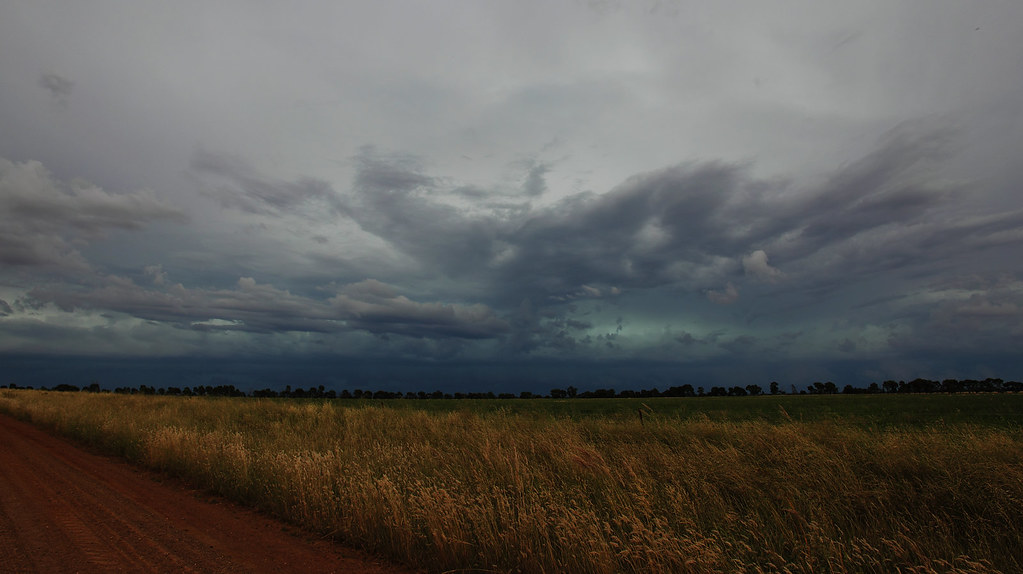
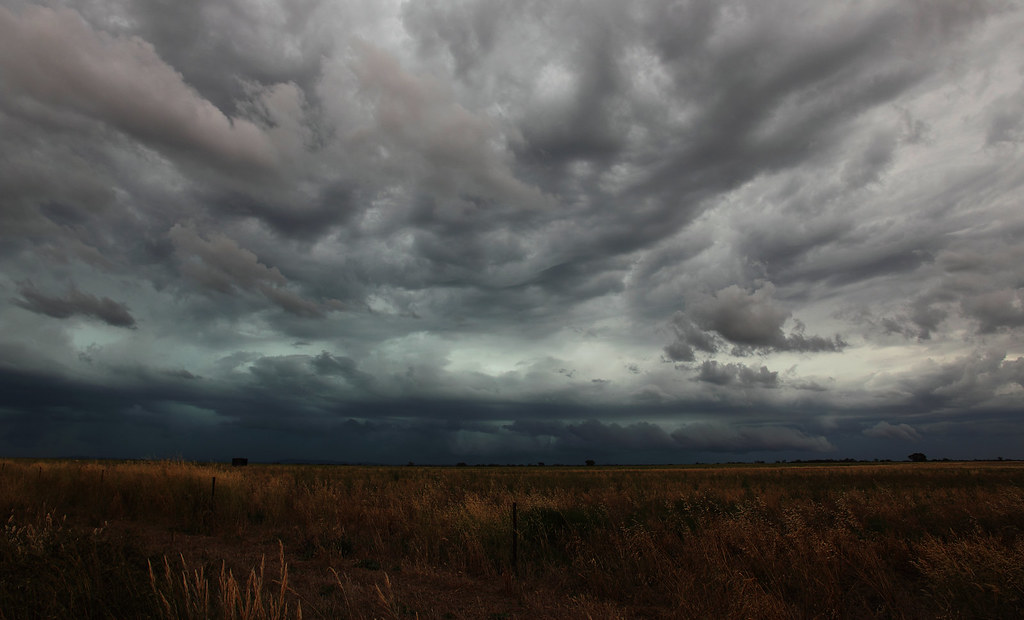
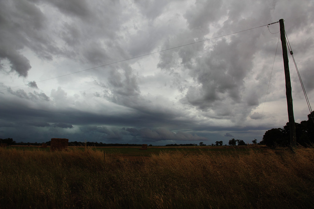
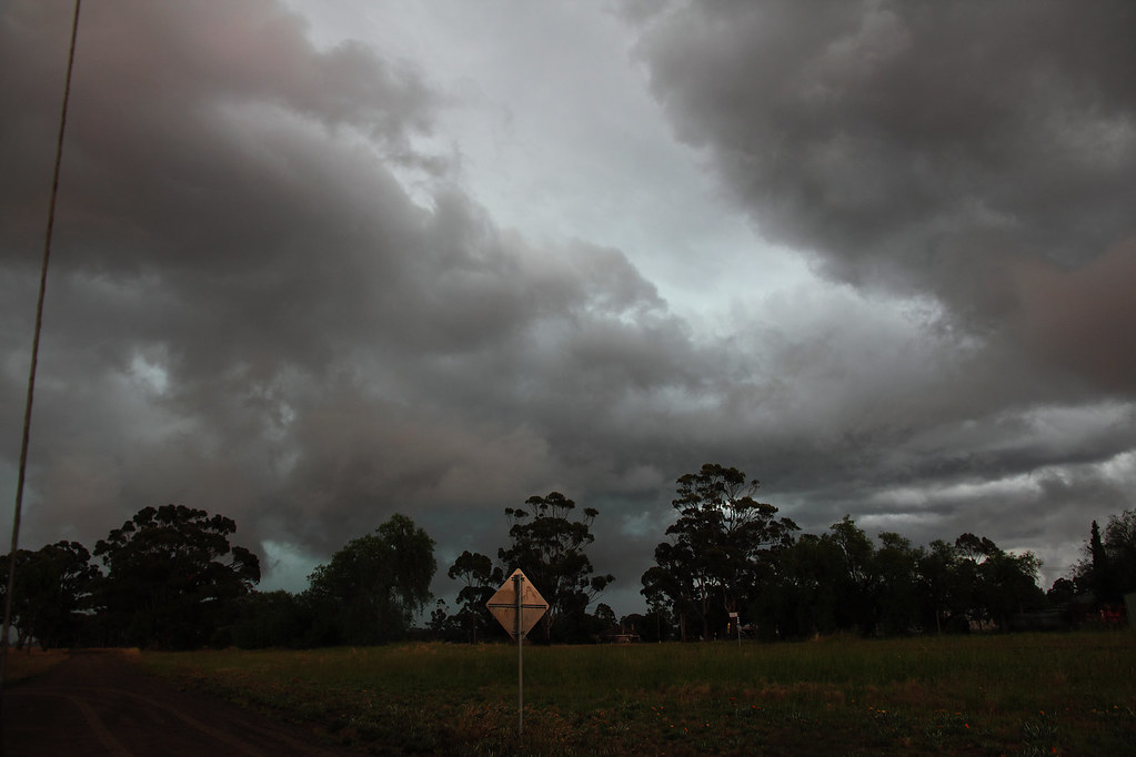
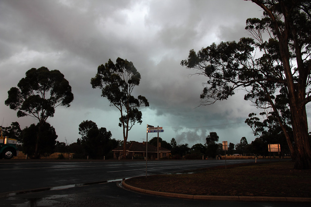
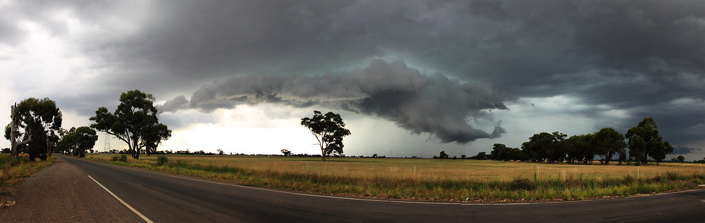
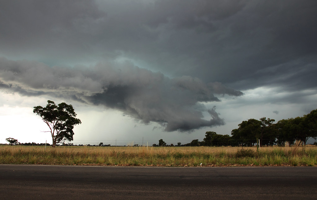
Would love to know what anyone thinks is going on in this first pic as the low cloud appears to be attached to the parent by a rope...
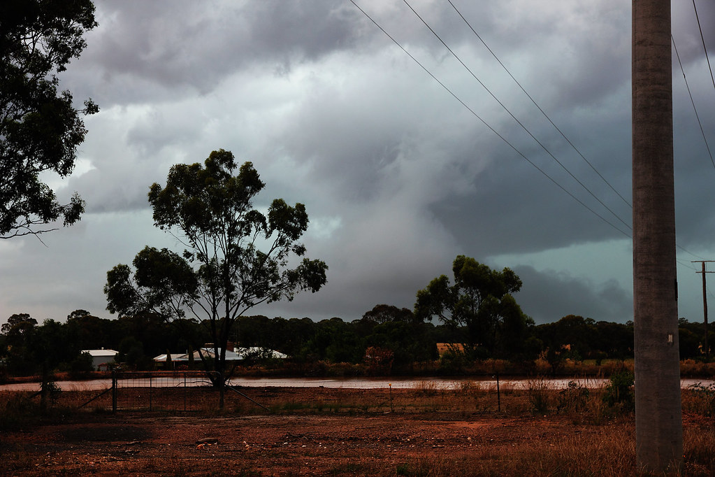
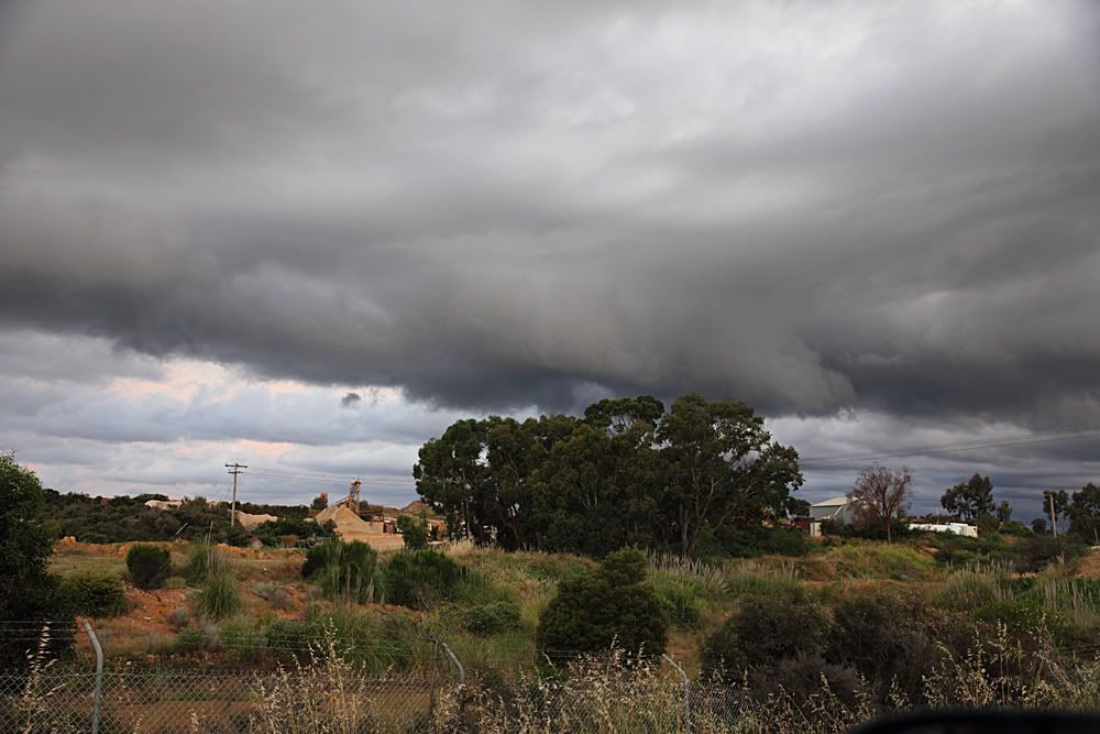
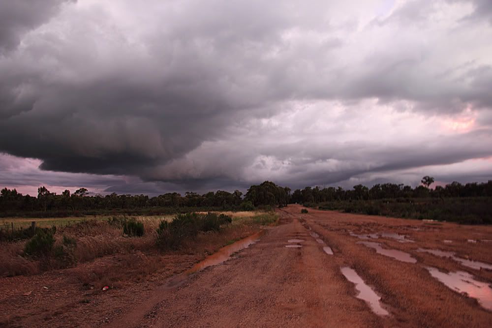
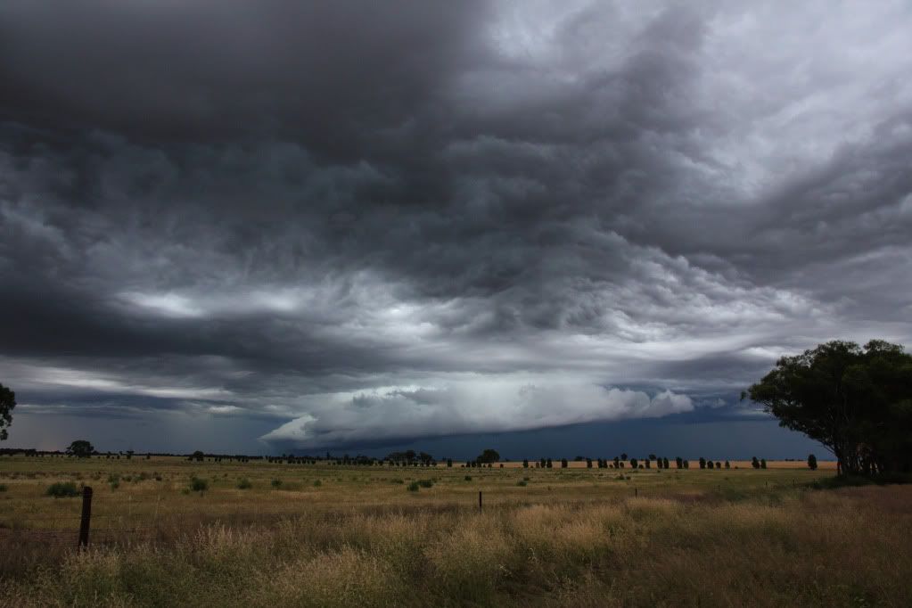
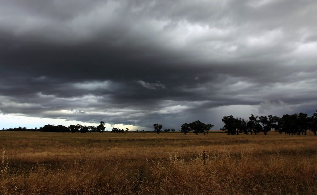
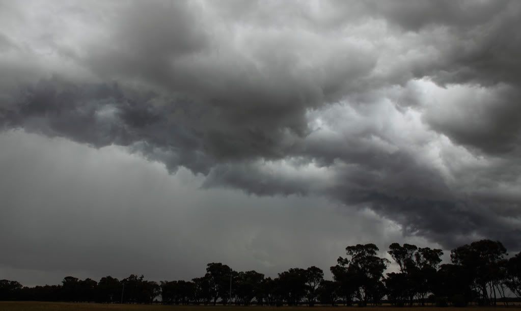
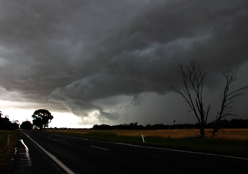
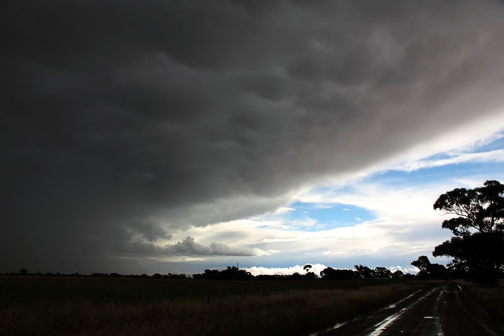
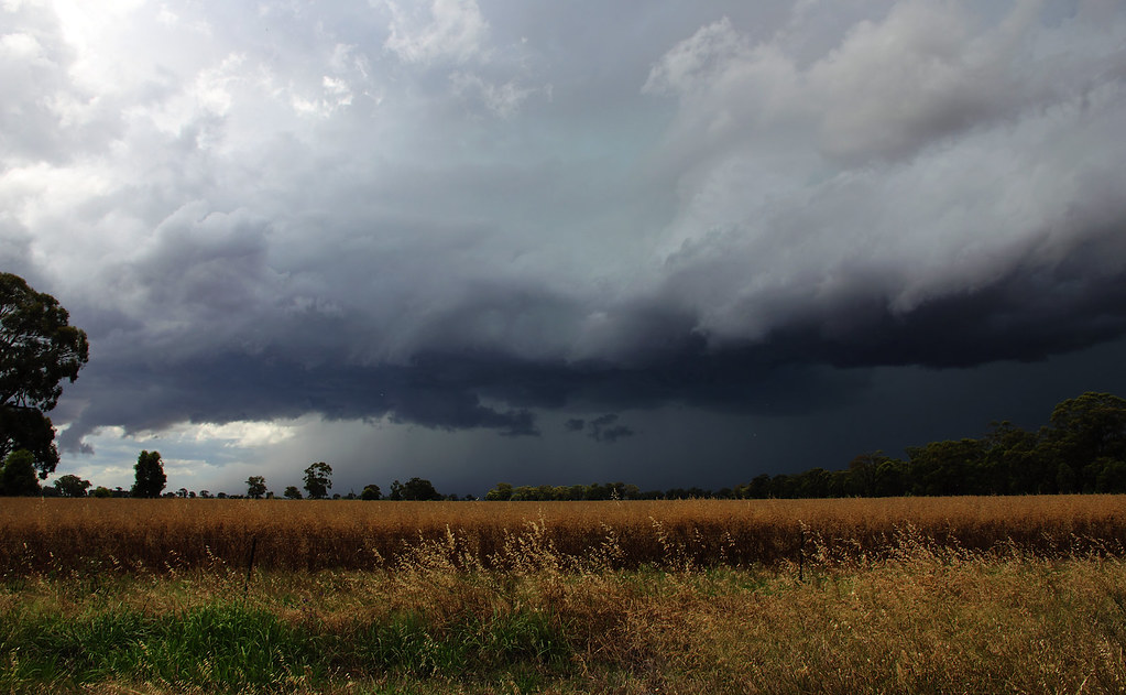
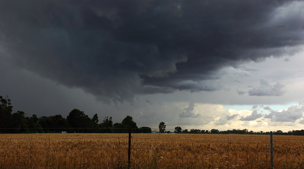
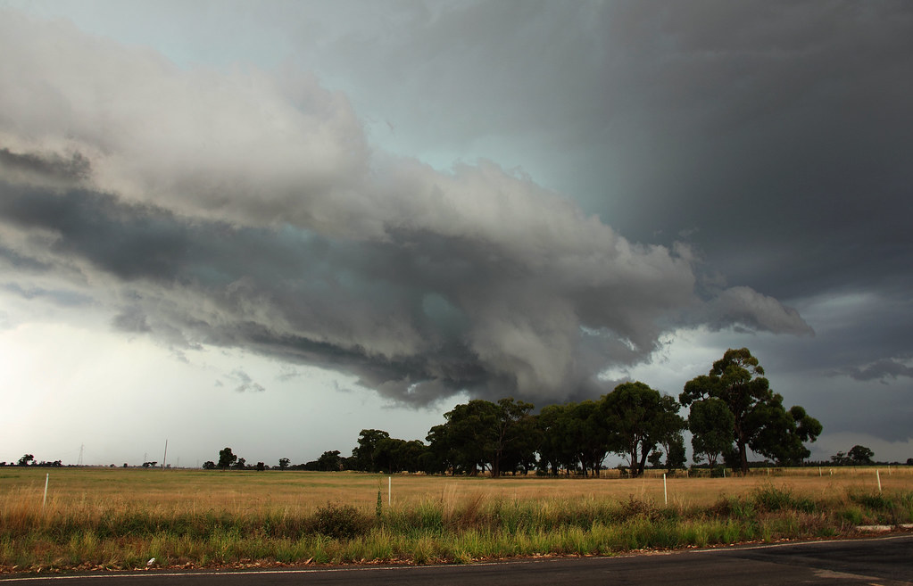
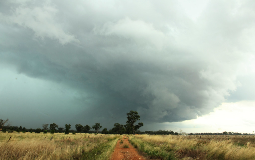
And then the last shot I got of it at Maiden Gully, before letting it go...
Good fun
Here's my photos from the amazing gust front that came across from the west and seemed to peak in Marong on the 6th of December.
First batch is from Leichardt, just north of Marong. The storm was barely visible for the first 10 mins or so that I was there, but it gradually began to reveal itself...
After about 30 mins of slowly creeping up the road to get closer to it and find new vantage points, I noticed that the rolling clouds associated with the guster were just about on top of me!
The winds really picked up at this point so it was time to get moving. But of course I wasn't gonna let it go, so I hovered in front of it, snapping photos at any available opportunity...
The guster really seemed to peak and take shape at Marong (as I'm sure Brad will confirm), turning the sky green and providing some sweet ground hugging cloud action!
As these next couple of shots were taken I'm pretty sure I saw some rotation in the clouds, but so much was happening at the time so I won't go so far as to say I'm 100% sure. Was interesting to watch nonetheless.
Would love to know what anyone thinks is going on in this first pic as the low cloud appears to be attached to the parent by a rope...
And then the last shot I got of it at Maiden Gully, before letting it go...
Good fun
Last edited by Meso on Tue Dec 14, 2010 8:14 pm, edited 2 times in total.
- Hamlan
- Storm Chaser
- Reactions:
- Posts: 449
- Joined: Tue Dec 22, 2009 11:05 pm
- Location: Northern suburbs
Re: Meso's Photo's and chase reports
Hey Greg, I can confirm that the low cloud in your pic was connected to the main cloud base via a funnel. I got pics and video of it over and maybe just west of Marong from my vantage just east of Marong town centre. The feature formed behind the initial gust front which had produced gust front funnels and lots of crazy gust front behaviour. Then I saw this feature trailing behind the gust front build rapidly and become well defined and persistent in a low block shaped wall cloud (cant think of another description) with a strong but short inflow tail on the north side and clear upmotion into the cloud above which I commented on in my video from memory. This is what I was referring to on the night when I mentioned for locals like yourself to keep an eye and ear out for any word on damage in Marong. It was low and if it hadve produced a tornado it wouldve done damage in or near town. I am assuming it didnt. I will post pics in the next few days.Meso wrote:Marong/Bendigo Thunderstorm - December 6th 2010Would love to know what anyone thinks is going on in this first pic as the low cloud appears to be attached to the parent by a rope...
Brad.
- rikjpool
- Storm Chaser
- Reactions:
- Posts: 989
- Joined: Thu Nov 26, 2009 1:46 pm
- Location: Home: North Bendigo-just behind Lake Weeroona, Vic. Work: 1.5Km SE from Bendigo AWS
Re: Meso's Photo's and chase reports
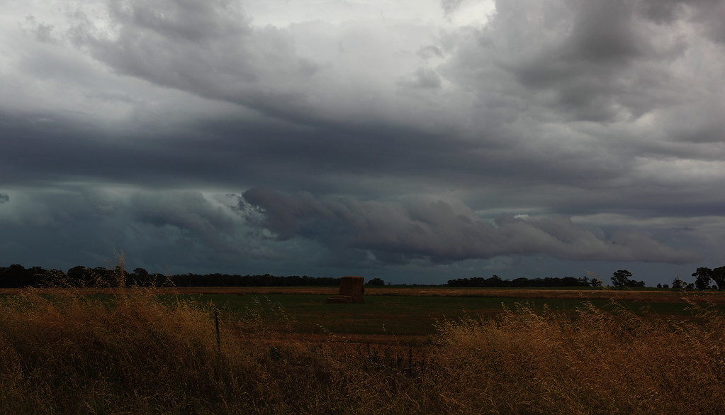
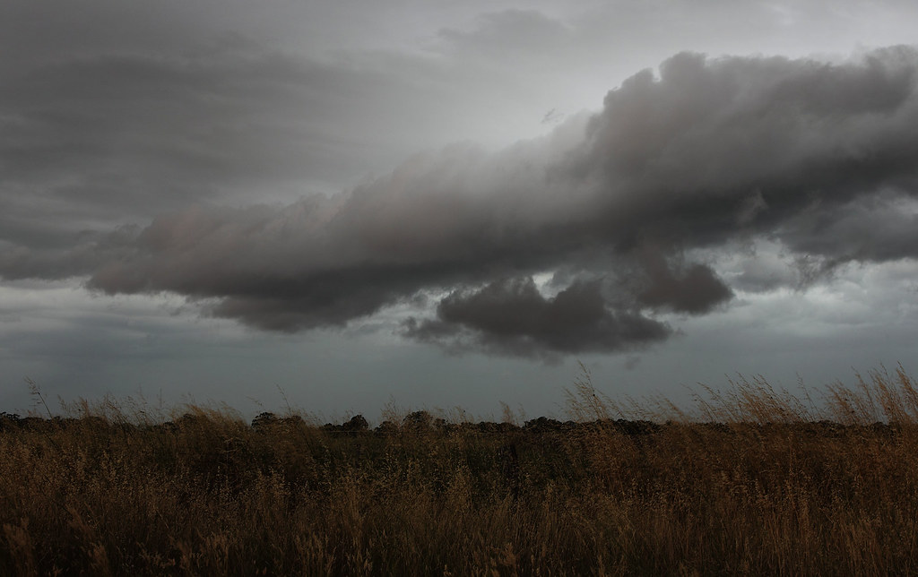
Here is another view on that feature as well...

And a little further on about 10km further along....

And a little further on about 10km further along....
I live in a world where I dont see to believe, but I believe to see...
-
Supercellimpact

- Supercell
- Reactions:
- Posts: 1237
- Joined: Thu Oct 07, 2010 8:39 pm
- Location: Bendigo
Re: Meso's Photo's and chase reports
Fantastic Pics Rikki
Re: Meso's Photo's and chase reports
Glad I wasn't the only one who thought something odd was occurring that night. I'll have another look through my shots later and play around with the contrast to see if I can find anything else of interest.
There is a couple of trees down along the side of the highway north of Marong. But, I doubt it's related, they're isolated from each other...more likely just from all the rain.
There is a couple of trees down along the side of the highway north of Marong. But, I doubt it's related, they're isolated from each other...more likely just from all the rain.
Re: Meso's Photo's and chase reports
Cape Nelson...or thereabouts...
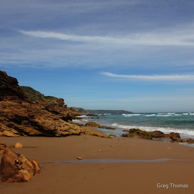
Would have preferred a more dramatic skyline. But, I was only there for about an hour, so I had to make do with what was happening when I got there.
Would have preferred a more dramatic skyline. But, I was only there for about an hour, so I had to make do with what was happening when I got there.
Re: Meso's Photo's and chase reports
Thunderstorms - February 3rd 2011
Here's all my photos from the chase yesterday, 3rd Feb. Mostly taken between Bridgewater and Raywood. Was very nice structure wise for about 30 mins, before I was left playing catch up as it moved towards Bendigo. Spat out some fantastic CG's! One when I was driving...the thunder was maybe half a second to a second after the flash and was nothing but a crack, no rumble at all. So, a very close strike.
Got stuck in the core on the way home with visibility down to a few meters and flash flooding all over the place as it dumped its guts over Bendigo.