Rhino.

Welcome New Members! We want to hear from you. Register, stop lurking and start posting!
Storms and rain Feb 25th-March 2nd.
- Rhino
- Supercell
- Reactions:
- Posts: 1227
- Joined: Mon Nov 30, 2009 11:37 am
- Location: Carisbrook-Near Maryborough
Storms and rain Feb 25th-March 2nd.
Looking unstable, humid and stormy for the first half of the week then possible rain event developing later in the week but still a little uncertain. Up to wed/thur looking real good for some storms and rainfall with EC giving good falls around tue-wed for a lot of areas and OCF generally 10-25mm everywhere except the far west and SW but tue especially looking real nasty at the moment in regards to storm activity, GFS throwing out some big instability so time will tell. Could be some big falls about by next weekend if it all falls into place. Good to see some rainfall on the charts though  .
.
Rhino.
Rhino.


Re: Storms and rain Feb 25th-March 2nd.
Yes Rhino looking slightly unstable Tomorrow bit more so Monday and alot more Tuesday and Wednesday with and ahead of the front/trough, all models at one time or another have flirted with the idea of a cut off low developing near Victoria later in the week first it was EC then ACCESS then GFS, now ACCESS and GFS have pulled back but EC is back onto it so interesting to see how this plays out.
Re: Storms and rain Feb 25th-March 2nd.
latest 00z GFS brings back the low
- droughtbreaker
- Supercell
- Reactions:
- Posts: 2844
- Joined: Wed Nov 25, 2009 7:50 pm
- Location: Mount Macedon, VIC, 520m asl
Re: Storms and rain Feb 25th-March 2nd.
Overall, it certainly is looking promising. The only thing that I find a bit unsettling is just how much the models are changing and flip flopping. It is very nice to see GFS and EC both developing the upper low and associated cut off/ECL because most of the time EC is the quicker to develop these scenarios and they often don't eventuate. With both models on board and not too far off into the future either, it is looking pretty good. Also some really cool days if this scenario comes off. I think the constant heat here is starting to drive me a bit mad.
GFS looks to have chucked in a big seabreeze effect on Monday and Tuesday so it's looking fairly dodgy for Melbourne metro and south of the ranges generally, perhaps not that much activity in this region if this trend continues. Inland parts looking very stormy though with locally heavy rain likely. Wednesday sees the trough move through a little too early in the GFS progs although the cooler air behind hopefully will lead to a rain band even if storm potential decreases a little.
If the cut off develops then most of southern and central Victoria should see showers and a 'wrap around' rain band, especially with the warm bay in effect.
Re: Storms and rain Feb 25th-March 2nd.
Well EC begs to differ has the wind change coming through in the Afternoon so has decent storms and good rainfall with the change for Central areas and Melbourne. Beyond that EC is all over the shop chops and changes so much these days hard to believe obly 3-4 Years ago this model was so supreme in picking systems out 6-7 days away and stuck with it
- droughtbreaker
- Supercell
- Reactions:
- Posts: 2844
- Joined: Wed Nov 25, 2009 7:50 pm
- Location: Mount Macedon, VIC, 520m asl
Re: Storms and rain Feb 25th-March 2nd.
Having seen the model updates and OCF, I'd say Wednesday is a pretty firm bet to come off at this stage. Hopefully we will see a band of moderate to heavy rain and storms for mainly central and eastern VIC. Tuesday looks good for storms as well although Monday not so much at this stage. After Wednesday it gets really complex with some seriously disturbed patterns happening, pretty much as far from zonal as you can get. It's been probably early December since we've seen regular frontal systems and a LWT and westerly belt presence although I guess this time of year we are generally dominated by highs and at times tropical lows/troughs.
Cooler days should occur from Wednesday onwards but a lot of it comes down to whether that low develops to our near east. The high ridge is set to dive well south so the easterly wind pattern is set to continue in the long term. Hopefully the westerlies break through at some stage with regular frontal passages although Autumn traditionally follows the summer patterns just with cooler temps and more cut off lows.
Cooler days should occur from Wednesday onwards but a lot of it comes down to whether that low develops to our near east. The high ridge is set to dive well south so the easterly wind pattern is set to continue in the long term. Hopefully the westerlies break through at some stage with regular frontal passages although Autumn traditionally follows the summer patterns just with cooler temps and more cut off lows.
- Rhino
- Supercell
- Reactions:
- Posts: 1227
- Joined: Mon Nov 30, 2009 11:37 am
- Location: Carisbrook-Near Maryborough
Re: Storms and rain Feb 25th-March 2nd.
EC really ramping up the forecast in this morning run, now has 55mm here for tue-wed, OCF around 25mm so looks like a good system in the offering for most probably bar the far west at this stage. GFS going beserk in it's 12z run so will see on that, although has only modest falls up to wed. Only thing that worries me about these type of systems is that like the other systems of late being convective storm type setups some will get a good amount and 5km up the road they get 2 drops despite what the models are predicting and a nice rainband type setup and the falls forecast would probably get me a bit more excited. With that said we should all get something, whether it's the 2 drops or the good falls is to be seen, although I'd imagine a lot of 2 drop falls around the metro areas  and probably more of this unfortunatly
 but looks like a nice system for some.
Rhino.
Rhino.
-
Poncho
- Cumulus
- Reactions:
- Posts: 35
- Joined: Fri Nov 12, 2010 9:18 pm
- Location: Work: Albert Park, Home: Armadale
Re: Storms and rain Feb 25th-March 2nd.
Hi all.. any commentary on next Sunday 3rd March? A family wedding with an outdoor ceremony around Midday EC was looking good for no rainfall although now US/GFS has thrown up a spanner in the works. I have one job for the wedding - weatherman.
- Geoff
- Supercell
- Reactions:
- Posts: 2538
- Joined: Tue Jul 05, 2011 9:46 pm
- Location: Olinda VIC (470m ASL)
Re: Storms and rain Feb 25th-March 2nd.
Ha! That's a thankless task Poncho, what are you going to do, change the weather?Poncho wrote: I have one job for the wedding - weatherman.
I think Rhino is right, a lot of people are again going to be frustrated with little or nothing again this week, however the difference this time could be the introduction of a bit of colder air behind the front on Wednesday, which gives me hope that southern areas could finally see some action as the airmasses interact. We live in hope!
AWF Rainfall Details - Monthly rainfall stats. Please post your totals here at the end of each month, thank you –
http://www.theaustralianweatherforum.co ... &start=180
http://www.theaustralianweatherforum.co ... &start=180
- droughtbreaker
- Supercell
- Reactions:
- Posts: 2844
- Joined: Wed Nov 25, 2009 7:50 pm
- Location: Mount Macedon, VIC, 520m asl
Re: Storms and rain Feb 25th-March 2nd.
I disagree that areas will see zero for the entire period in question, except maybe the far west of the state that is going to have the Wednesday system coming through too quick and early in the day for much development (if any). Wednesday should see a general rain band with storms developing ahead of and with the change if it occurs the way the synoptics are set up and model outputs suggest.
I do agree however that Tuesday, although looking very good at this stage for scattered storms right across most of the state (however mainly central and eastern), will see some places miss out as is the case with the cellular and discrete nature of thunderstorms, someone usually has bad luck and gets in the gaps or 'behind a shield'. Having said this though, chances are atm (based on model output) that more areas will get hit by storms and moderate to heavy rain on Tuesday than will miss out. The main activity will be on and north of the ranges though.
Tomorrow looks good for storms according to GFS although south of the ranges is set to struggle again with a seabreeze effect progged.
The thing that is still irritating me atm is the flip flop of the models with regards to the potential upper low that GFS has lingering over us for several days from Thursday. If this were to come off we would see an extended period of wet and cool weather. EC has gone right off this scenario though and I tend to believe what it is saying. These strong and persistent upper lows are fairly uncommon over the far SE and when they do occur rarely last more than a few days. GFS seems to be too keen on it to me, particularly since EC (which first picked it up) has dropped it now.
Anyway, we'll see.....
-
93ben
- Site Admin
- Reactions:
- Posts: 603
- Joined: Tue Dec 27, 2011 12:28 am
- Location: Templestowe, Victoria
- Contact:

Re: Storms and rain Feb 25th-March 2nd.
It's looking likely there will be storm activity over night into Monday, Tuesday and Wednesday! Hopefully this happens so I can take more awesome photos. Maybe it's a good idea to take my Camera to TAFE this week lol
- Rhino
- Supercell
- Reactions:
- Posts: 1227
- Joined: Mon Nov 30, 2009 11:37 am
- Location: Carisbrook-Near Maryborough
Re: Storms and rain Feb 25th-March 2nd.
Certainly hope your right in regards to a rainband Andrew would be ideal. GFS ramping up falls especially around west parts of the nth country and nth central, 75-100mm until thurs, so am liking it in regards to putting the heavy falls back in the mix, just where they will fall is anyones guess at this stage.
Rhino.
Rhino.
- Geoff
- Supercell
- Reactions:
- Posts: 2538
- Joined: Tue Jul 05, 2011 9:46 pm
- Location: Olinda VIC (470m ASL)
Re: Storms and rain Feb 25th-March 2nd.
Well for what it's worth, I've just taken our girls to a playground down in Kilsyth, and there were 10 million,gazillion ants all marching out of holes in the ground and up the nearest trees. Do you reckon they know something??? 
AWF Rainfall Details - Monthly rainfall stats. Please post your totals here at the end of each month, thank you –
http://www.theaustralianweatherforum.co ... &start=180
http://www.theaustralianweatherforum.co ... &start=180
Re: Storms and rain Feb 25th-March 2nd.
Liking the look of the models ATM , most have very heavy falls in NE victoria from wednesday onwards. Bom 3-day giving 100mm on wednesday alone for NE VIC. gfs has the low deepening over east victoria, with heavy falls throughout the east from wednesday to friday, with far east victoria going for over 100mm on friday alone before moving west across the state and bringing heavy falls to northern victoria (weakening though) . CMC has the heaviest falls in the melbourne metro with 50-60mm on wednesday, looking good !
Go the bombersss!
Re: Storms and rain Feb 25th-March 2nd.
The Bay temp is close to 24c and Northern part of the bay a tad higher closer to 24.5c it doesn't get much higher than this
Re: Storms and rain Feb 25th-March 2nd.
Yep 00z GFS still has the upper low scenario planted right over us, 4 days now from this evolving so models will have to start agreeing soon, GFS has also slightly slow down the system on Wednesday more inline with EC hence the better falls for Central areas too with the windchange
- Dane
- Supercell
- Reactions:
- Posts: 1661
- Joined: Thu Nov 26, 2009 9:51 am
- Location: Sebastopol 420m ASL
- Contact:
Re: Storms and rain Feb 25th-March 2nd.
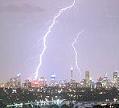
Storms firing over the eastern ranges and the Latrobe ATM.
Re: Storms and rain Feb 25th-March 2nd.
Yep saw those Dane looking good that way.
EC is being a pain not interested with the upper low, can't understand how this model has shown it twice this scenario in the past 10 days only to drop it twice since I have been following EC closely this is the first time I've seen it do this, usually if it has a system then drops it and brings it back thats the most likely scenario to happen but never seen it prog it twice and drop it twice.
EC is being a pain not interested with the upper low, can't understand how this model has shown it twice this scenario in the past 10 days only to drop it twice since I have been following EC closely this is the first time I've seen it do this, usually if it has a system then drops it and brings it back thats the most likely scenario to happen but never seen it prog it twice and drop it twice.
- Geoff
- Supercell
- Reactions:
- Posts: 2538
- Joined: Tue Jul 05, 2011 9:46 pm
- Location: Olinda VIC (470m ASL)
Re: Storms and rain Feb 25th-March 2nd.
Could be interesting then if we do get a cool s/w - s/e flow for a day or two then Johnno!johnno wrote:The Bay temp is close to 24c and Northern part of the bay a tad higher closer to 24.5c it doesn't get much higher than this
AWF Rainfall Details - Monthly rainfall stats. Please post your totals here at the end of each month, thank you –
http://www.theaustralianweatherforum.co ... &start=180
http://www.theaustralianweatherforum.co ... &start=180