Page 7 of 9
Re: Major upper and surface lows 1 - 5 May
Posted: Thu May 02, 2019 9:31 am
by StratoBendigo
Dane wrote: ↑Thu May 02, 2019 9:19 am
Thunderstorms in the early houirs of this morning gave most of Ballarat a good drenching.
Falls generally ranged from around 20mm's near the Airport (to the North) to over 30mm's
down south around Buninyong.
Airport got 19.2mm's in the 24 hours to 9am MTD now 27.6mm's.
I got 27.4mm's In Sebastopol MTD now 35.8mm's.
So already the wettest month of the year, lets hope we can get some good follow up soon.

Just 22mm for us so far. It's welcome but less than I was expecting.
But late next week it looks like a classic winter cold front and Bass Strait cut-off Low may affect Vic, which could be a great follow up.
Re: Major upper and surface lows 1 - 5 May
Posted: Thu May 02, 2019 9:55 am
by JasmineStorm
Squeezed out another 5mm with that last band and up to 41mm now. NE is the next part of deluge tomorrow morning. Won't be much more here on the back end tomorrow night but totals may add up down in Melbourne's east and SE if the SW flow kicks in.
Yes SB, looks like another big upper cut off low in a week except more north east than this one and much colder. An eastern Bass strait / ECL / Tasman mid latitude cyclone. MJO and that negative SAM from mid April are delivering

Re: Major upper and surface lows 1 - 5 May
Posted: Thu May 02, 2019 10:13 am
by snowfall
Picked up 17.3mm overnight to give an event total of 21.3mm. Very welcome! Great to see all the good falls in areas that have been parched for many months.
Re: Major upper and surface lows 1 - 5 May
Posted: Thu May 02, 2019 10:26 am
by Macedonian
Now up to 30mm at Macedon and now 37mm at Mt Macedon.
Not enough to start Turritable Creek running again. That demonstrates how horribly dry it has been.
Re: Major upper and surface lows 1 - 5 May
Posted: Thu May 02, 2019 10:47 am
by James
another dissapointer for this area, just a few distant rumbles and light showers overnight - is that really all for this area?
Re: Major upper and surface lows 1 - 5 May
Posted: Thu May 02, 2019 11:14 am
by hillybilly
12mm In FC so far. Should about double that on Saturday as we go wstly then swly late Friday into Saturday, so on track for a handy inch or so. Good to see most get a bit, and many get their autumn break
Hoping for a decent follow up next week.
Re: Major upper and surface lows 1 - 5 May
Posted: Thu May 02, 2019 12:28 pm
by Adam38
Very nice drop of rain, my neighbour had 20mm in the gauge so much more than I expected here.
Re: Major upper and surface lows 1 - 5 May
Posted: Thu May 02, 2019 12:28 pm
by QldTwister
Wonderful event for many in N and W Vic with lots of 20-50mm falls, but sadly the far W and NW missed out again, and the dry rolls on
More heavy rain east of Echuca Melb late today and overight, NE Vic easy get 30-60mm tonight with the next wave of rain
Great event for many inland folk after record dry
Much more needed but
14mm here
This shows it really nicely
cant upload image so here is link
http://www.bom.gov.au/vic/flood/
Re: Major upper and surface lows 1 - 5 May
Posted: Thu May 02, 2019 12:33 pm
by PapaD
Got 34 mm at Hanging Rock for the event. About 20mm of that came from an intense storm about 4am.
Re: Major upper and surface lows 1 - 5 May
Posted: Thu May 02, 2019 1:04 pm
by Macedonian
hillybilly wrote: ↑Thu May 02, 2019 11:14 am
12mm In FC so far. Should about double that on Saturday as we go wstly then swly late Friday into Saturday, so on track for a handy inch or so. Good to see most get a bit, and many get their autumn break
Hoping for a decent follow up next week.
Just out of interest, i had never heard the term "Autumn Break" until i moved to Victoria.
I suppose as a native of the Sydney area where it rains all the time in summer it's not really a thing
Re: Major upper and surface lows 1 - 5 May
Posted: Thu May 02, 2019 1:07 pm
by Sean
Only 12mm here. Wanted a lot more, but at least the heaviest falls fell in places more deserving
Re: Major upper and surface lows 1 - 5 May
Posted: Thu May 02, 2019 1:11 pm
by Sean
Macedonian wrote: ↑Thu May 02, 2019 1:04 pm
hillybilly wrote: ↑Thu May 02, 2019 11:14 am
12mm In FC so far. Should about double that on Saturday as we go wstly then swly late Friday into Saturday, so on track for a handy inch or so. Good to see most get a bit, and many get their autumn break
Hoping for a decent follow up next week.
Just out of interest, i had never heard the term "Autumn Break" until i moved to Victoria.
I suppose as a native of the Sydney area where it rains all the time in summer it's not really a thing
That term is gaining more and more relevance given these flash droughts of late.
Re: Major upper and surface lows 1 - 5 May
Posted: Thu May 02, 2019 1:18 pm
by JasmineStorm
Upper low and 2 surface lows are now drawing moisture back down from the tropics as the cogs turn. Mid levels now have increased moisture again. Looks like the converging winds are on the far eastern edge of Melbourne Metro.
Re: Major upper and surface lows 1 - 5 May
Posted: Thu May 02, 2019 2:16 pm
by Gordon
Macedonian wrote: ↑Thu May 02, 2019 1:04 pm
hillybilly wrote: ↑Thu May 02, 2019 11:14 am
12mm In FC so far. Should about double that on Saturday as we go wstly then swly late Friday into Saturday, so on track for a handy inch or so. Good to see most get a bit, and many get their autumn break
Hoping for a decent follow up next week.
Just out of interest, i had never heard the term "Autumn Break" until i moved to Victoria.
I suppose as a native of the Sydney area where it rains all the time in summer it's not really a thing
The Autumn Break has been a big deal all my country life in Victoria (which is most of it). Farmers locally regard a single fall of an inch (25mm) after St Pats Day but before Anzac Day as the break. Their thinking is that too soon, and you risk a false break when the grass/ crop shoots but then dies during a subsequent warm/ dry spell; too late and there's not enough warmth for any significant growth. This break is considered a good one locally despite being late, because it's still relatively warm and should stay that way (frost free) for another week or so.
Btw, I've now had three reports from neighbours between Springbank, Warranheip and Millbrook who've recorded 70mm, 72mm & 79mm. Seems to be a lack of official gauges in this triangle and good falls here are often overlooked in BOM reports.
Re: Major upper and surface lows 1 - 5 May
Posted: Thu May 02, 2019 3:02 pm
by Australis(Shell3155)
Radar colours looks to be a little more in line with us HB..
fingers crossed..
Re: Major upper and surface lows 1 - 5 May
Posted: Thu May 02, 2019 3:31 pm
by Sean
Australis(Shell3155) wrote: ↑Thu May 02, 2019 3:02 pm
Radar colours looks to be a little more in line with us HB..
fingers crossed..
Looks northeast-centric today. Rain and cloud look to be converging on the Mansfield area.
It's developing too far east for central areas. We might get some back building tho. So fingers crossed
Re: Major upper and surface lows 1 - 5 May
Posted: Thu May 02, 2019 3:35 pm
by JasmineStorm
The big squeeze zone is taking shape beautifully through the centre of Vic and southern NSW. That cell just north of Cobram now has around a -70c cloud top
Re: Major upper and surface lows 1 - 5 May
Posted: Thu May 02, 2019 4:02 pm
by mick
I left, so now it rains and storms. I took one for the team, good for you.
No rain her ein the mid north of SA, 8mm in 6 weeks.
Re: Major upper and surface lows 1 - 5 May
Posted: Thu May 02, 2019 4:10 pm
by mick
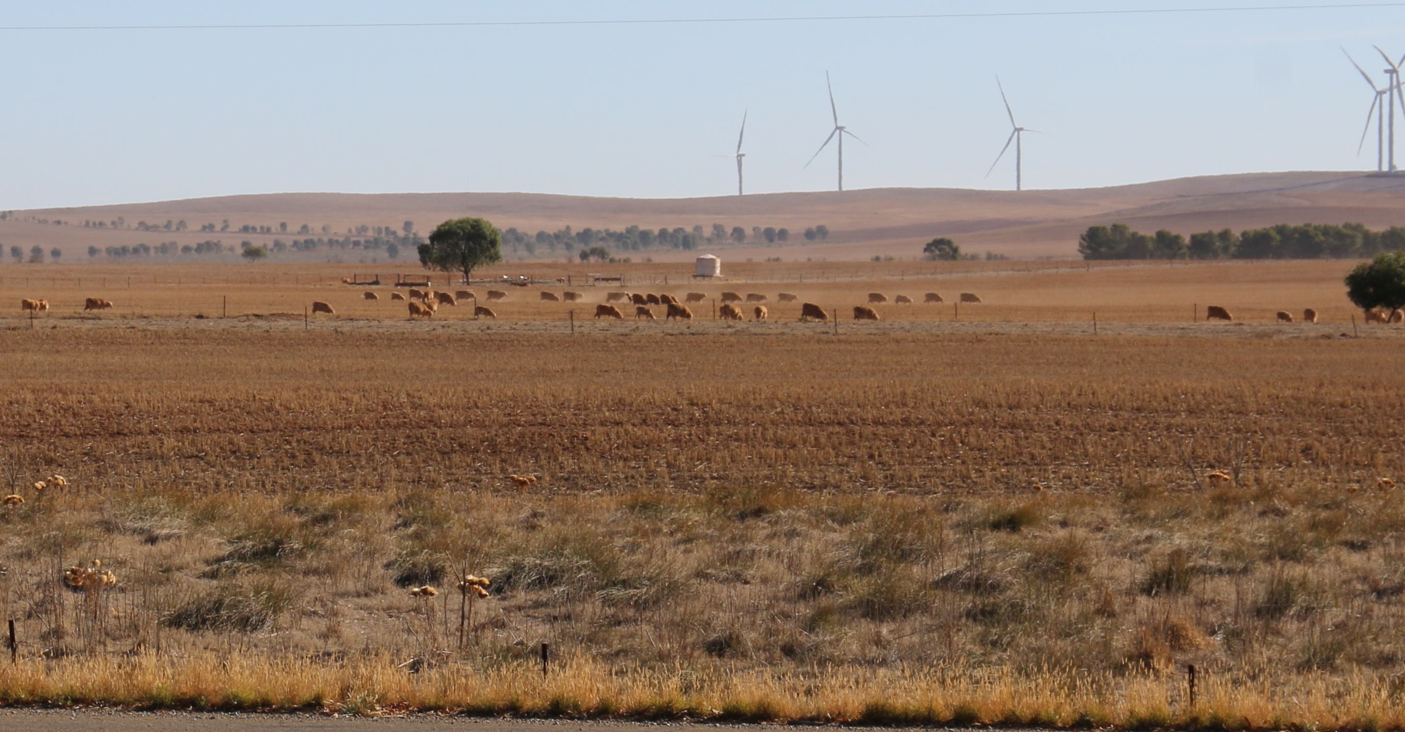
- 008.jpg (514.71 KiB) Viewed 11560 times
Re: Major upper and surface lows 1 - 5 May
Posted: Thu May 02, 2019 4:51 pm
by JasmineStorm
nice and dry Mick.
The upper Low below S.A has jagged back west slightly bringing everything else with it in the last 6 hours. I love cut off lows
This looks to me that the rain and storm line has moved back west 100km to what was expected. Interesting observing coming up in the next few hours
