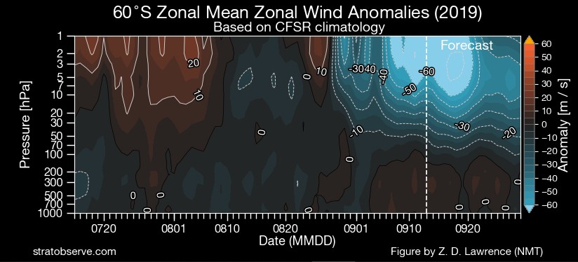
Re the SSW descending, this appears to show similar:


How do you know re coupling ahead of time? What do you look at?JasmineStorm wrote: ↑Mon Sep 16, 2019 11:26 am SSW seems to be coupling near the Jetstream in a week, hard to tell still on when full potential reaches the lower troposphere.
The vortex circulation in the upper troposphere is aligning in position to the above stratospheric vortex. An aggressive long wave trough is also jagging northward in the same area near Sth America.Didjman wrote: ↑Mon Sep 16, 2019 2:47 pmHow do you know re coupling ahead of time? What do you look at?JasmineStorm wrote: ↑Mon Sep 16, 2019 11:26 am SSW seems to be coupling near the Jetstream in a week, hard to tell still on when full potential reaches the lower troposphere.
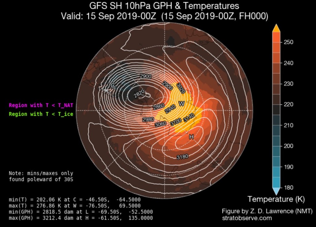
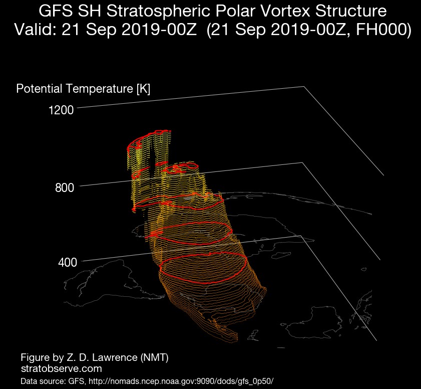
There is a 2nd vortex circulation developing around the tropopause at 150 hPA below the main upper stratospheric vortex near Sth America around 72 hours, viewed on https://www.stratobserve.com/prs_gphws_maps
Seen that. So that is the coupling or beginning of? Wow! You have taught me sooo muchJasmineStorm wrote: ↑Mon Sep 16, 2019 6:25 pm There is a 2nd vortex circulation developing around the tropopause at 150 hPA below the main upper stratospheric vortex near Sth America around 72 hours, viewed on https://www.stratobserve.com/prs_gphws_maps
No probsDidjman wrote: ↑Mon Sep 16, 2019 6:53 pmSeen that. So that is the coupling or beginning of? Wow! You have taught me sooo muchJasmineStorm wrote: ↑Mon Sep 16, 2019 6:25 pm There is a 2nd vortex circulation developing around the tropopause at 150 hPA below the main upper stratospheric vortex near Sth America around 72 hours, viewed on https://www.stratobserve.com/prs_gphws_mapsThank you!!
So that coupling appears to last only a couple of days. Is that it, or will there be other couplings ahead for near our region?JasmineStorm wrote: ↑Mon Sep 16, 2019 7:18 pm No probsThat 2nd circulation and the upper low in the troposphere below it is a sign that they have coupled with the upper stratosphere above. Chaos reins and the polar jet is thrown northward near Sth America

The coupling of the event will be sporadic. Which means fast unusual windy heat and cold events, just like NSW and Canberra saw todayDidjman wrote: ↑Mon Sep 16, 2019 7:29 pmSo that coupling appears to last only a couple of days. Is that it, or will there be other couplings ahead for near our region?JasmineStorm wrote: ↑Mon Sep 16, 2019 7:18 pm No probs
Ok. Makes sense. many thx againJasmineStorm wrote: ↑Tue Sep 17, 2019 1:55 pm The coupling of the event will be sporadic. Which means fast unusual windy heat and cold events, just like NSW and Canberra saw today
Yes it looks like it according to this article as being one of the strongest on record.StratoBendigo wrote: ↑Thu Sep 19, 2019 10:01 am Looks like the +ve IOD is going to head towards Neutral by summer. Although a neutral/weak El-Nino appears to keep hanging around.
http://www.bom.gov.au/climate/enso/
I'm going to crunch some numbers. The last 5 years (2015-2019) seem to be quite similar to 1987-1991....
So what effect is this likely to have?? Lifting of the Tropopause with more severe storms, cyclones.....?Raiderpete wrote: ↑Sun Sep 22, 2019 9:07 pm All defined stratospheric pressure levels are seeing new temperature minimums set over the Tropics, this is the 30mb level. The other SH SSW years have not had this kind of response over the tropics. Interesting times ahead.