Page 4 of 5

Re: Victoria - Troughs and possible low - September 1-7 2019

Posted: Fri Sep 06, 2019 6:09 pm
by BERVY
STW current for Wodonga area. There sure looked to be some rotation on the wind doppler a few passes ago right near Chiltern. Any experts care to give an analysis? Cheers.

Re: Victoria - Troughs and possible low - September 1-7 2019

Posted: Fri Sep 06, 2019 6:18 pm
by BERVY
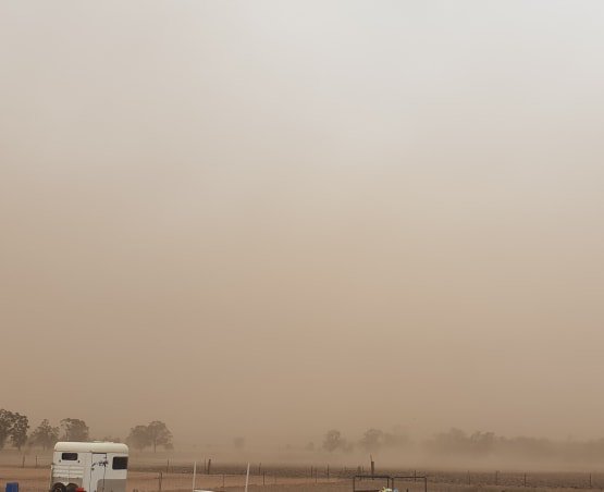
Just been issued an "Emergency Warning - Thunderstorm" for the cell heading toward Wodonga. I am in Wodonga and it's raining but not too bad ATM. Looking at the radar the worst may just be to my south which may be a good thing.

I have had thunderstorm warnings via the Vic Emergency App before, but never an "Emergency" category one. Bit scary.

https://www.emergency.vic.gov.au/respond/

Issued Today at 6:11 PM.

The Bureau of Meteorology has issued a Severe Thunderstorm Warning for Wodonga and surrounding areas.

damaging winds, heavy rain, large hailstones, flash flooding, destructive winds are likely.
If you are located in Wodonga and surrounding areas, you are in danger. You should immediately move indoors to stay safe.
What you should do:
Be aware of potential hazards caused by the severe thunderstorm, including widespread debris.
Stay indoors and away from windows.
Be aware of any hazards near you.
Follow your emergency plan, if you have one.

If you are outside:
You should try to shelter in a safe place indoors.
If you cannot shelter indoors, stay well away from trees, drains, low lying areas and floodwater.

If you are driving:
You should try to shelter in a safe place indoors.
Be aware of very dangerous and unpredictable road conditions.
For road closure information, check the VicTraffic website, contact your local council or call VicRoads (13 11 70).

You should stay informed by listening to emergency broadcasters and monitoring warnings.

Contact family members and neighbours to ensure they are aware of the situation, if safe to do so.

Call Triple Zero (000) in a life threatening emergency. For severe weather related emergency assistance from the SES, phone 132 500.
Impacts in your area:
The potential impacts of thunderstorms in your area include:
Significant building damage.
Fallen trees and branches.
Extremely dangerous flash flooding.
Landslides.
Widespread flooding in properties and homes.
Very dangerous road conditions.
This message was issued by State Emergency Service.

The next update is expected by 06/09/2019 06:40 pm or as the situation changes.

Severe Weather information:
For weather warnings and information, phone the Bureau of Metereology on 1300 659 217 or go to www.bom.gov.au/vic/warnings.
Use multiple sources to stay informed:
www.emergency.vic.gov.au.
VicEmergency Hotline - freecall 1800 226 226.
VicEmergency app.
Facebook or Twitter (#vicstorms).
Tune in to ABC Local Radio, commercial and designated community radio stations, or Sky News TV.
Accessibility:
The following services can help you, or someone you know, access information during an emergency.
To access this information in other languages call the Translating and Interpreting Service on 131 450 (freecall) and ask them to call VicEmergency Hotline.
If you are deaf, hard of hearing, or have a speech/communication impairment contact National Relay Service on 1800 555 677 and ask them to call the VicEmergency Hotline.

Re: Victoria - Troughs and possible low - September 1-7 2019

Posted: Fri Sep 06, 2019 6:20 pm
by Tassiedave
Rain since 9am: Gray 67mm, Fisher River 43mm, Sheffield 30mm, Devonport 26mm, St Helens 20mm, Triabunna 13mm, Launceston 12mm, Hobart 4.8mm

Re: Victoria - Troughs and possible low - September 1-7 2019

Posted: Fri Sep 06, 2019 7:02 pm
by BERVY
Created an animation of the wind doppler for the NE Vic cell. Anyone think it was a tornado? Looked strongest near Springhurst.

Sure had the Emergency Vic people excited. Got a warning similar to a bushfire warning. First was an advice message then it upgraded to an emergency message - that's one below evacuate!

Anyway, thoughts appreciated.
Storm1.gif
Storm1.gif (1.38 MiB) Viewed 12550 times

Re: Victoria - Troughs and possible low - September 1-7 2019

Posted: Fri Sep 06, 2019 7:14 pm
by hillybilly
BERVY wrote: Fri Sep 06, 2019 7:02 pm Created an animation of the wind doppler for the NE Vic cell. Anyone think it was a tornado? Looked strongest near Springhurst.

Sure had the Emergency Vic people excited. Got a warning similar to a bushfire warning. First was an advice message then it upgraded to an emergency message - that's one below evacuate!

Anyway, thoughts appreciated.
That does look like rapid rotation with the wind direction reversing on the Doppler. That is a pretty classic tornado signature, though possible it didn’t reach the ground. Be interesting to see if reports come in at some future point of trees blown over etc.

Took a while to get going here today, but showers really cranking now. 8mm more in the gauge. Been getting small hail with the better showers.

Crazy weather to our north. Record fire danger for the time of year, and multiple very bad fires :( Huge dust storm, and dramatic drop in temperature. In the Upper Blue Mountains it went from over 20C to around 3C in a couple of hours :o Those fires are going to be trouble for a while with conditions record dry and no rain in the outlook atm :?

Re: Victoria - Troughs and possible low - September 1-7 2019

Posted: Fri Sep 06, 2019 9:43 pm
by hillybilly
Reports filtering in of a tornado at Peechelba. You can see the radar signature in the start of the loop.

The cell below. It was a strong left mover.

Image

Re: Victoria - Troughs and possible low - September 1-7 2019

Posted: Fri Sep 06, 2019 9:52 pm
by Rivergirl
Love those clouds Didjman

Re: Victoria - Troughs and possible low - September 1-7 2019

Posted: Sat Sep 07, 2019 5:26 am
by hillybilly
Another mm overnight so 20mm for this part of the event. Tis a bit westerly for us atm. Good to see East Gippsland getting some overnight. Record drought out there atm :?

Video and photos from northern NSW near the front. Hopefully they works??

Today’s looks like mainly a Gippsland day. Strong front coming up for later tomorrow so showers thickening. Looks like more good falls, particularly the usual southern and mountain wet spots.


Image

Re: Victoria - Troughs and possible low - September 1-7 2019

Posted: Sat Sep 07, 2019 6:59 am
by hillybilly
There's video of the tornado on the ABC Goulburn Valley page at

Re: Victoria - Troughs and possible low - September 1-7 2019

Posted: Sat Sep 07, 2019 7:42 am
by Tassiedave
Rainfall in Tas last 24 hours: Gray 153mm, St Helens 77mm, Fingal 68mm, Triabunna 45mm, Swansea 44mm, Upper Esk 37mm, Launceston 20mm, Hobart 13mm

Re: Victoria - Troughs and possible low - September 1-7 2019

Posted: Sat Sep 07, 2019 9:58 am
by Macedonian
Heavy sleet tumbling down here atm.

Re: Victoria - Troughs and possible low - September 1-7 2019

Posted: Sat Sep 07, 2019 11:42 am
by BERVY
hillybilly wrote: Fri Sep 06, 2019 9:43 pm Reports filtering in of a tornado at Peechelba. You can see the radar signature in the start of the loop.

The cell below. It was a strong left mover.
Yeah that was the cell where you can see the rotation in the doppler.

I wonder who issues the warnings from the vic emergency app. Here is the warning we got below. Couldn't see any specific updated STW from the BOM at the time.
IMG_4532.png
IMG_4532.png (1.83 MiB) Viewed 12311 times

Re: Victoria - Troughs and possible low - September 1-7 2019

Posted: Sat Sep 07, 2019 4:22 pm
by stevco123
hillybilly wrote: Sat Sep 07, 2019 6:59 am There's video of the tornado on the ABC Goulburn Valley page at
That must have been one unstable air mass. Have a look at the shape of that hail in one of the pictures. It's like a snowflake on steroids

Re: Victoria - Troughs and possible low - September 1-7 2019

Posted: Sat Sep 07, 2019 9:21 pm
by hillybilly
Cold wet one in FC today. Max of just 7C with 5mm of precip (since I emptied the gauge about 8am). MTD is a healthy 45mm for us now. On track for a decent September at this rate which would be great if it happens :D

Cracker of a front for mid arvo tomorrow. Showers becoming widespread with local hail and thunder. Windy too. Snow levels overnight into Monday drop to about 700m, so decent chance at the usual cold spots :D

Looks like a much warmer week to follow.

Re: Victoria - Troughs and possible low - September 1-7 2019

Posted: Sun Sep 08, 2019 7:24 am
by Tassiedave
Rainfall last 24hrs: Lewis Hill 28mm, Swansea 20mm, St Helens 19mm, Fingal 18mm, Gray 16mm, Lake Leake 11mm, Hobart 4.2 mm

Re: Victoria - Troughs and possible low - September 1-7 2019

Posted: Sun Sep 08, 2019 1:39 pm
by Gordon
Steady rain here for the last couple of hours to add to 10mm we had to 9am, so starting to add up.

Re: Victoria - Troughs and possible low - September 1-7 2019

Posted: Sun Sep 08, 2019 7:42 pm
by snowfall
Had a nice rainy afternoon with a brief period of thunder, small hail, and 7.5mm in total. Got quite cold - down to 6c and currently 6.7c. Wind really picked up as the front passed through with gusts over 50km/h.

Re: Victoria - Troughs and possible low - September 1-7 2019

Posted: Sun Sep 08, 2019 8:40 pm
by hillybilly
Nice winter, err spring, day. 14mm for us. Seems that the official Ferny Creek AWS is under reading a bit ATM, or perhaps we are just getting lucky at our place.

MTD is about 60mm now. Ticking along nicely.

Another 12-18 hours of cold and showery conditions. Should see the odd flurry down to about 700m, so perhaps a dusting around Macedon and Trentham tomorrow. Does look slightly to warm for the Dandenongs.

Northern NSW could see some snow in spots which have just seen fires. Quite stupid weather really... Unfortunately, not much in it, and looks like thinning out as you get much north of about Oberon.

Week ahead looks like a roller coaster.

Re: Victoria - Troughs and possible low - September 1-7 2019

Posted: Mon Sep 09, 2019 2:48 am
by Australis(Shell3155)
Bucketing Down,
Seems 5mm in last couple hours since midnight,
Looking like nearly 50 for the month. WS near Zagames.
Had a truck bogged in front yard, happy to say we're past our dust for a little while.
Edit.. hail.. and 7mm @3.45am

Re: Victoria - Troughs and possible low - September 1-7 2019

Posted: Mon Sep 09, 2019 6:51 am
by Macedonian
Wild night up here, windy as all hell.
We had snow flurries yesterday afternoon but no precip this morning. Impressively cold for a windy September morning.
0.4C now.