didn't think to make a pano & stitch it?rikjpool wrote: Started off with the biggest, brightest, double rainbow i could ever have seen... Even at 10mm it didnt really fit...
Welcome New Members! We want to hear from you. Register, stop lurking and start posting!
SE AUS: Increasing storm potential 8/1 to 16/1
Re: SE AUS: Increasing storm potential 8/1 to 16/1
- apocalypse
- Cumulonumbus Calvas
- Reactions:
- Posts: 761
- Joined: Tue Jan 19, 2010 6:17 pm
- Location: Wagga Wagga, NSW 189m asl
Re: SE AUS: Increasing storm potential 8/1 to 16/1
Those sunset pics are incredible, you guys do such a wonderful job out in the field!
Back at home I snapped a few pics of a storm, and I must say I've never seen structure as good since I started observing, although it pales in comparison to some of the stuff that others post.
Taken on the 9th Jan, looking towards the west of Wagga Wagga.
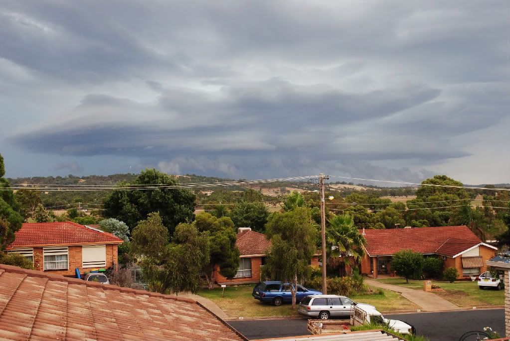
I've never seen a real wall cloud before, but this feature looks similar to ones that I have seen in pictures. Not sure if it's just some scud or actually anything significant.
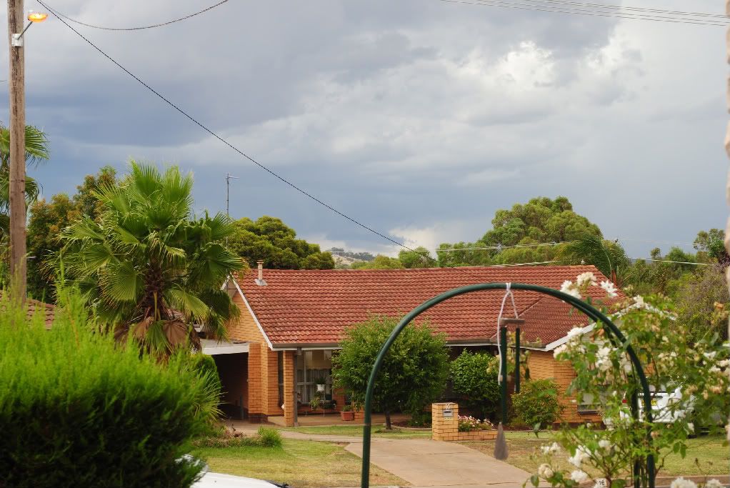
Back at home I snapped a few pics of a storm, and I must say I've never seen structure as good since I started observing, although it pales in comparison to some of the stuff that others post.
Taken on the 9th Jan, looking towards the west of Wagga Wagga.

I've never seen a real wall cloud before, but this feature looks similar to ones that I have seen in pictures. Not sure if it's just some scud or actually anything significant.

Nathan Morris
2013 Rainfall
Jan - 3.8mm
Feb - 27.0mm
Mar - 0.0mm
YTD - 30.8mm
2013 Rainfall
Jan - 3.8mm
Feb - 27.0mm
Mar - 0.0mm
YTD - 30.8mm
- Hamlan
- Storm Chaser
- Reactions:
- Posts: 449
- Joined: Tue Dec 22, 2009 11:05 pm
- Location: Northern suburbs
Re: SE AUS: Increasing storm potential 8/1 to 16/1
wow Apocalypse that first one is a great shot!
- rikjpool
- Storm Chaser
- Reactions:
- Posts: 989
- Joined: Thu Nov 26, 2009 1:46 pm
- Location: Home: North Bendigo-just behind Lake Weeroona, Vic. Work: 1.5Km SE from Bendigo AWS
Re: SE AUS: Increasing storm potential 8/1 to 16/1
I did do a pano, but havnt put it together yet, as my card reader has crapped itself, and its on another card.
Love that first shot Apocolypse, and Brad those shots are certainly scary! Have you been back to do a damage report to see if anything touched the ground? Any video of it either?
Ps. I just noticed that those shots of mine have been cut off on the RHS as well? Is that because of limitations on the forum?
I live in a world where I dont see to believe, but I believe to see...
- daviescr
- Supercell
- Reactions:
- Posts: 1394
- Joined: Wed Dec 02, 2009 5:40 pm
- Location: Warranwood, Vic
Re: SE AUS: Increasing storm potential 8/1 to 16/1
I can see your pics pretty well Rikki, I know if you re-size your browser to a more narrow window, it will cut off the images on the right - so if you had a higher resolution screen, it might be ok??
Otherwise, try pressing 'ctrl' and rolling your mouse wheel (if you have one) to change the zoom level of the browser window... hope that makes sense!
Cheers
Chris
Otherwise, try pressing 'ctrl' and rolling your mouse wheel (if you have one) to change the zoom level of the browser window... hope that makes sense!
Cheers
Chris
Re: SE AUS: Increasing storm potential 8/1 to 16/1
epic brad.
apoc, toy around with your contrast a bit, you'll be able to bring out a bit more detail in the given cloud.
here's one of mine from the same event.

apoc, toy around with your contrast a bit, you'll be able to bring out a bit more detail in the given cloud.
here's one of mine from the same event.

Re: SE AUS: Increasing storm potential 8/1 to 16/1
ps.. pics look fine here.
might be time to upgrade the old t-model monitor rikki?
might be time to upgrade the old t-model monitor rikki?
- apocalypse
- Cumulonumbus Calvas
- Reactions:
- Posts: 761
- Joined: Tue Jan 19, 2010 6:17 pm
- Location: Wagga Wagga, NSW 189m asl
Re: SE AUS: Increasing storm potential 8/1 to 16/1
Are there any processes in the camera or other accessories that can give different contrasts in different situations? Or do I need to edit manually using software? I've been looking into polarizing filters and gradient filters, but not sure if they would work though.
Nathan Morris
2013 Rainfall
Jan - 3.8mm
Feb - 27.0mm
Mar - 0.0mm
YTD - 30.8mm
2013 Rainfall
Jan - 3.8mm
Feb - 27.0mm
Mar - 0.0mm
YTD - 30.8mm
- Australis(Shell3155)
- Supercell
- Reactions:
- Posts: 3179
- Joined: Mon Nov 30, 2009 8:05 pm
- Location: FTG
- Contact:
Re: SE AUS: Increasing storm potential 8/1 to 16/1
Rikki, I think it was Mick that mentioned a spout..
- apocalypse
- Cumulonumbus Calvas
- Reactions:
- Posts: 761
- Joined: Tue Jan 19, 2010 6:17 pm
- Location: Wagga Wagga, NSW 189m asl
Re: SE AUS: Increasing storm potential 8/1 to 16/1
Had a direct hit this afternoon with a small brown core, producing moderate to heavy rain, and pea to 1cm sized hail. Ended up with 7.8mm throughout its duration. 
Does anyone have any thoughts on the 2nd and 3rd images? This funnel-shaped feature was at the back of the storm after it had passed. I couldn't see any wall cloud though so maybe it isn't.
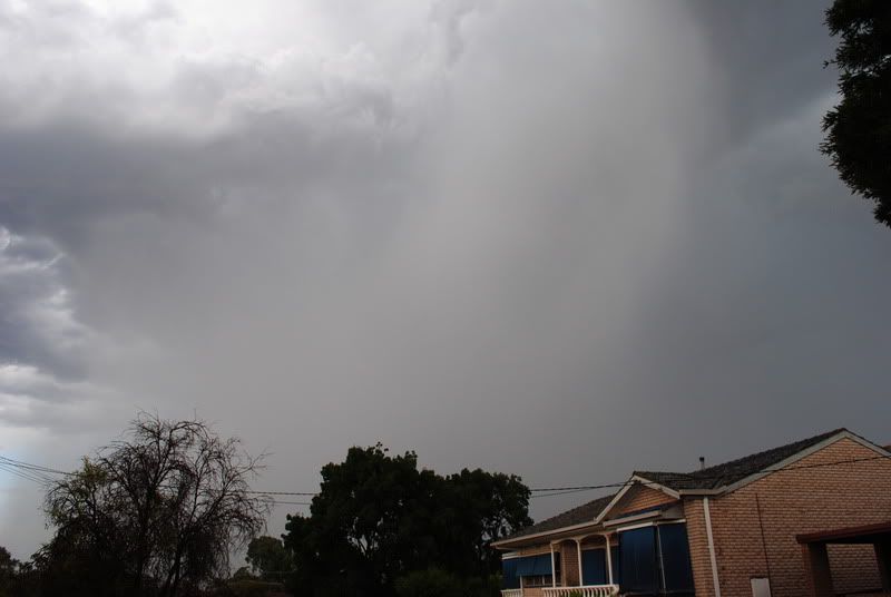
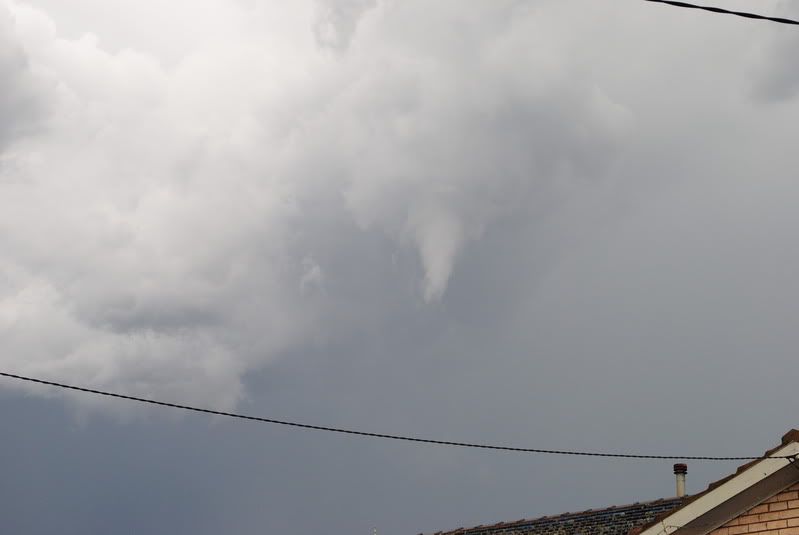
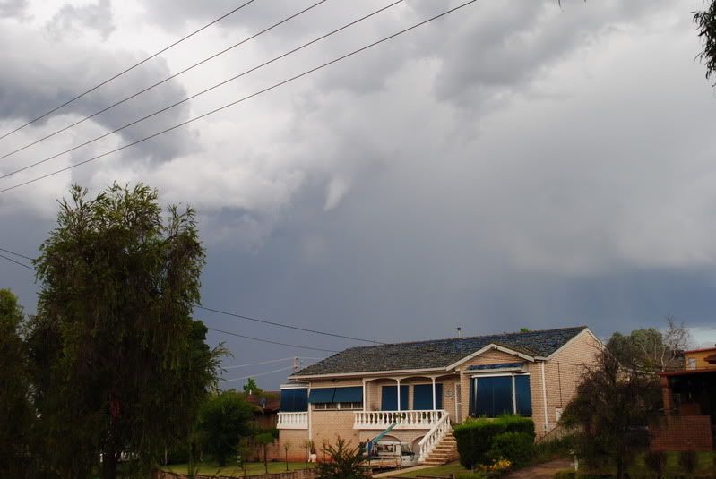
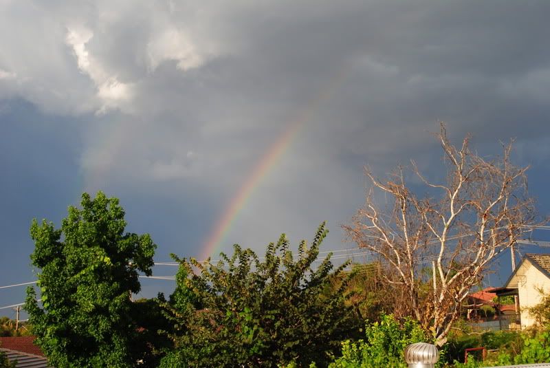
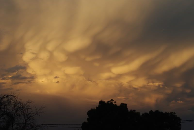
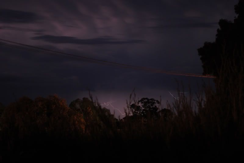
Does anyone have any thoughts on the 2nd and 3rd images? This funnel-shaped feature was at the back of the storm after it had passed. I couldn't see any wall cloud though so maybe it isn't.


Nathan Morris
2013 Rainfall
Jan - 3.8mm
Feb - 27.0mm
Mar - 0.0mm
YTD - 30.8mm
2013 Rainfall
Jan - 3.8mm
Feb - 27.0mm
Mar - 0.0mm
YTD - 30.8mm
- Vortex
- Cumulus
- Reactions:
- Posts: 46
- Joined: Tue Aug 31, 2010 9:24 am
- Location: Gold Coast, Queensland
- Contact:
Re: SE AUS: Increasing storm potential 8/1 to 16/1
Ricky.. your shots never cease to amaze me! 
Check us out on Facebook: 'South Brisbane Storms'
http://www.redbubble.com/people/southbrisstorms" onclick="window.open(this.href);return false;
http://www.redbubble.com/people/southbrisstorms" onclick="window.open(this.href);return false;
Re: SE AUS: Increasing storm potential 8/1 to 16/1
Looks like a funnel to me, albeit a very small one. Funnels/tornadoes and wall clouds will generally occur at the back edge of storms.
Beautiful mamatus and colors in the second last pic!
Beautiful mamatus and colors in the second last pic!
- apocalypse
- Cumulonumbus Calvas
- Reactions:
- Posts: 761
- Joined: Tue Jan 19, 2010 6:17 pm
- Location: Wagga Wagga, NSW 189m asl
Re: SE AUS: Increasing storm potential 8/1 to 16/1
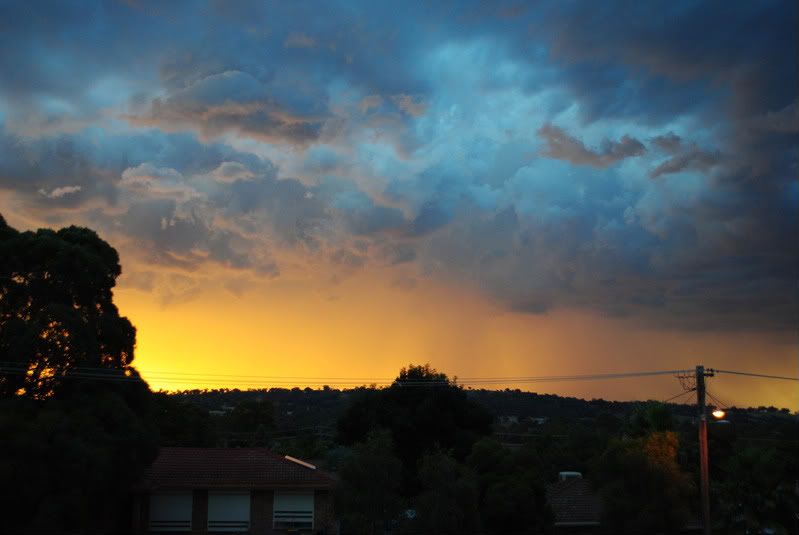
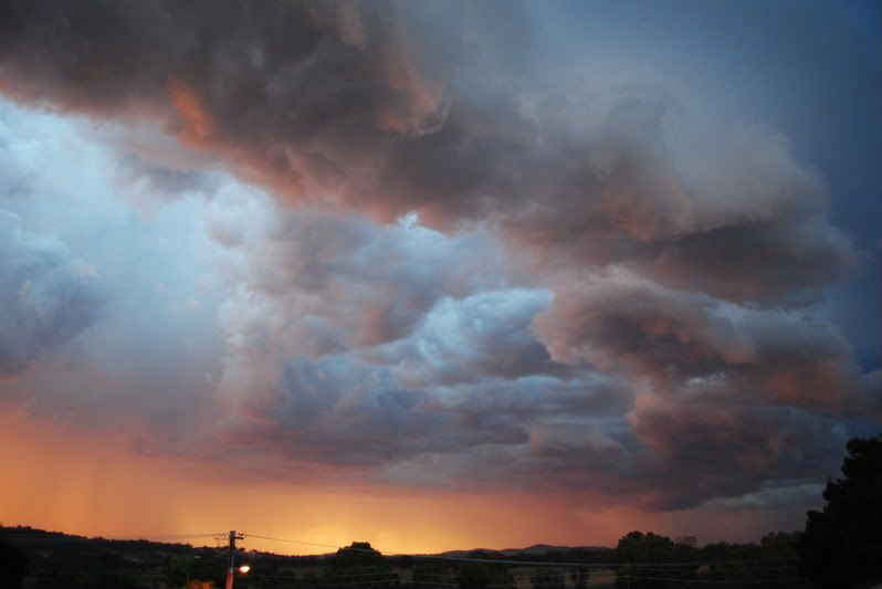
I enjoyed this magical spectacle, once again from my rooftop views, of stunning apricot shades and vivid lemony
essences, in contrast to a dark and ominous guster of gigantic proportions, approaching with might, as these beautiful colours slowly faded, blissfully.
essences, in contrast to a dark and ominous guster of gigantic proportions, approaching with might, as these beautiful colours slowly faded, blissfully.


Nathan Morris
2013 Rainfall
Jan - 3.8mm
Feb - 27.0mm
Mar - 0.0mm
YTD - 30.8mm
2013 Rainfall
Jan - 3.8mm
Feb - 27.0mm
Mar - 0.0mm
YTD - 30.8mm
- Hamlan
- Storm Chaser
- Reactions:
- Posts: 449
- Joined: Tue Dec 22, 2009 11:05 pm
- Location: Northern suburbs
Re: SE AUS: Increasing storm potential 8/1 to 16/1
Hey, no damage survey done Rikki unfortunately but yes we got the whole chase on video, sometimes two videosrikjpool wrote:IBrad those shots are certainly scary! Have you been back to do a damage report to see if anything touched the ground? Any video of it either?


